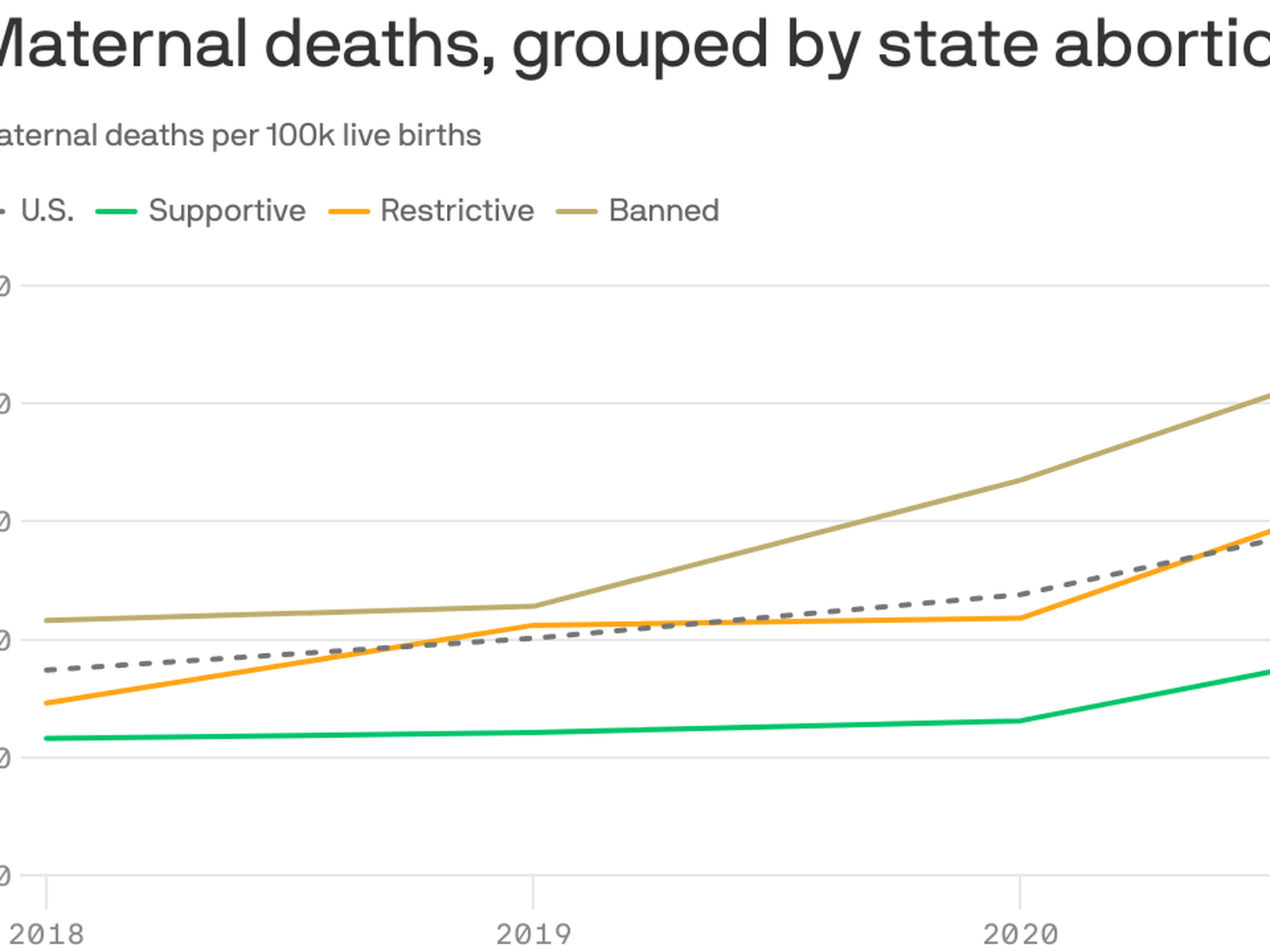
… sure seems restricted to bodily harm to elites.
Hello, I am researching American crimes against humanity. . This space so far has been most strongly for memes, and that's fine.
There's other groups and you are welcome to add to them. USAuthoritarianism Linktree
See Also, my website. USAuthoritarianism.com be advised at time of writing it is basically just a donate link
Cool People: [email protected]
… sure seems restricted to bodily harm to elites.
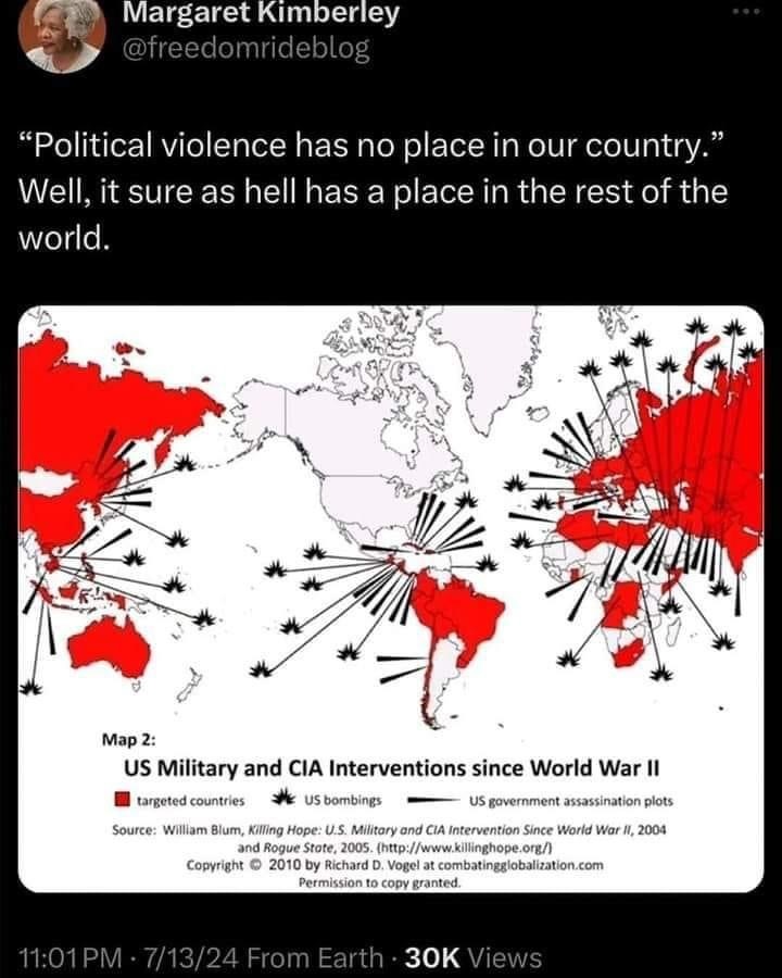
And some examples of domestic political violence off the top of my head:


And there are many, many more (the treatment of Indigenous people, for profit healthcare, school shootings, food deserts, "the war on drugs", the prison industrial complex...).
E: since I'm not sure if the image ID 's are visible, just a quick description of each photo, from the top:
Argentina should be red too. Look up Operation Condor
Ummm... all violence perpetrated by the US police is political in nature.
They were, after all, invented to protect the property of capitalist parasites from the people the capitalist parasites exploited in order to become rich in the first place.
Violence doesn't get more political than that.
Tfw I look up the history of the term Banana Republic
Our country was literally founded on political violence. Explains the 2nd Amendment pretty well.
I don't think US & Canada are coloured right ...
And Mexico. There is no way in hell we haven't done stuff in Mexico.
Does anyone have the source for this image? The websites mentioned in the image seem to be down.
Germany, did they want to assassinate Walter Ulbricht/Erich Honecker or what?
If you count Kent State, you can include the US in that list.
Ew, the america centric map projection, cut eurasia in half, why?
What would the argument be for using a Euro-centric map for displaying data about US military interventions across the world???
It doesn't cut a large populated land in half. It's also the one everybody already know where to find anything.
But anyway, how the fuck the projection isn't symmetrical for the North and South hemispheres? How does one achieve that?
It doesn't cut a large populated land in half.
Why would that matter? This data has nothing to do with population.
It's also the one everybody already know where to find anything.
That's quite a subjective and eurocentric perspective.
But anyway, how the fuck the projection isn't symmetrical for the North and South hemispheres? How does one achieve that?
This appears to be a Mercator projection, or something close to it. The land in the southern hemisphere is generally close to the equator so it appears smaller as part of that distortion. Also it looks a bit weird because Antarctica usually balances that out visually, but is excluded for this map.
There's a lot of different options for displaying different kinds of information. For what this map is trying to convey, it makes sense for it to be centered on the US. The distortion doesn't really matter because distance is not important. Keeping large populated is not important because the map isn't conveying any information related to population. Is this the absolute best projection available? Probably not. But the Mercator projection is still far and away the most common today (and I see this is copy written 2010, so it would be been even more ubiquitous then).
No one ever uses this nonsense