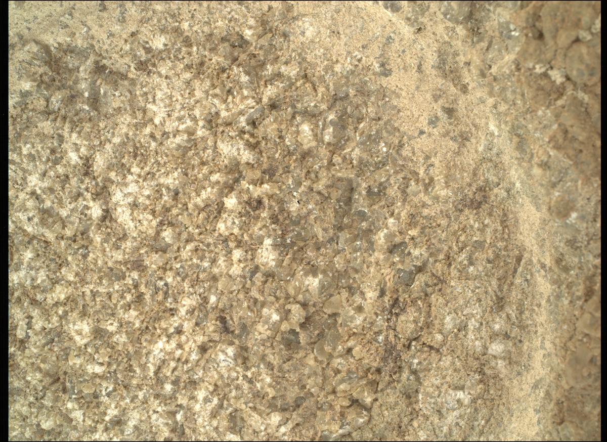
Neat! What are we hoping to learn from the abrasion patches?
NASA's Perseverance Mars Rover
On the plains of Jezero, the secrets of Mars' past await us! Follow for the latest news, updates, pretty pics, and community discussion on NASA and the Jet Propulsion Laboratory's most ambitious mission to Mars!
What are we hoping to learn from the abrasion patches?
A great deal.
- What is the overall elemental chemistry of the rock/target? (identifying iron, carbon, sulfur, magnesium, oxygen etc. etc.)
- How are the elements in the rock put together? (in other words, the minerals formed by those elements)
- Are there organic molecules present? (If so, not necessarily signs of biology, but are always worth learning more about)
- The "texture" of the rock (is it made of loosely bound material like pebbles and sand, or large close-packed solid mineral grains, or something else entirely?)
- What is the rock like inside? (Sometimes different from the outside! Percy has found dissolved salts and mineral veins in some rock interiors, which were not even hinted at from analysis of the outer surface)
The above is not a complete list. The dust and weathering rinds Paul Hammond mentions (the undisturbed outer surface of the rock), in general, prevent you from answering these questions in the same detail, or at all. By answering the first two questions above, you get a good idea of how the rock formed and what it contains (e.g. is this volcanic rock - like from a lava flow - or something laid down in calm water, or something else entirely)?
Generally speaking, if the mission decides to abrade a hole in some rock, it's a sign that the geologists find the stuff interesting, or at least need to identify what's at that spot to make sense of the immediately surrounding landscape.
I'm still working on a series of posts explaining all this in more detail - with neat pictures - but it's going to take a while yet (we've made more than 30 of these holes, and they've shown us quite a few different things from start to finish!) Questions are welcome!
Thanks for the detailed write-up! It's awesome how much we can learn (and have already learned) from the Mars rovers.
The rover abrades rocks using a tool on its robotic arm before drilling them in order to clear away dust and weathering rinds, allowing other instruments to study the rocks and determine if scientists want to grab a sample of them. In this case after studying this patch the team decided not to take a sample at this stage, and have just driven away from the location. This could be because they have a limited supply of empty sample tubes, and they want to check the region thoroughly before deciding which targets to obtain a rock core for sample return.
Thanks! Makes sense that they want to be fairly selective in what samples they store. I hope Mars Sample Return isn't delayed too much further.
I'd love to build a picture frame that shows the path, current location and latest photo taken by Perseverance...
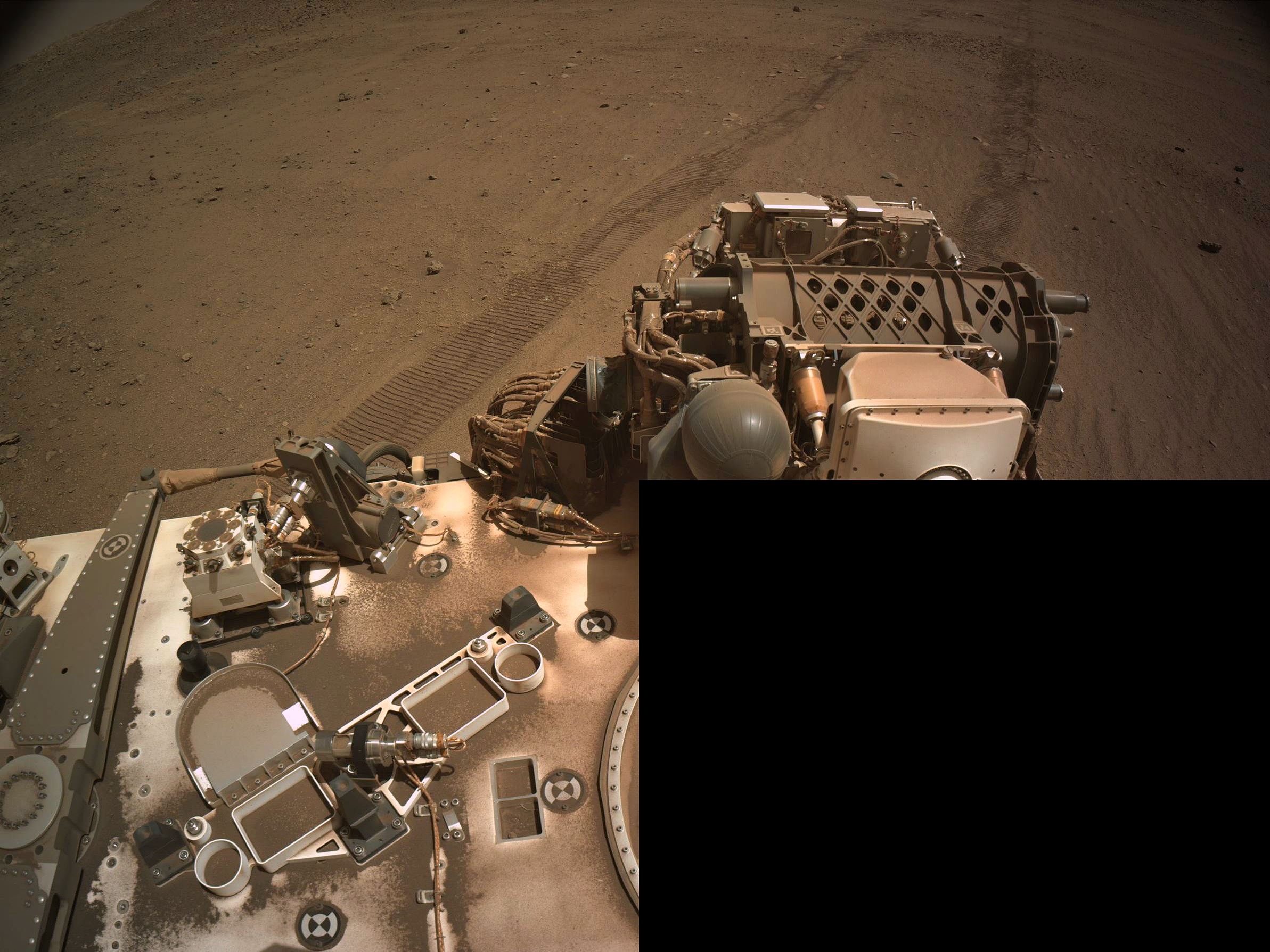
The rover has just completed a drive to a new location on sol 1362 (December 19, 2024)
We have a few post-drive images, but not the full set it normally acquires. Here is one of the partial images (missing one tile) that shows the wheel tracks to the south and the rover looking West-Southwest. There is a projected path the rover is destined to traverse, but the mission is science led, and they often divert off the notional paths that they have published. The next drive should be West towards a science waypoint they have dubbed 'Witch Hazel Hill'. Watch this space in the next day or so and you'll find an updated map showing the rover's location and its latest post-drive photos

Yep. That's Mars. You can tell by the Mars.
