I really admired and miss that guy.
paulhammond5155
joined 2 years ago
Rise and shine!
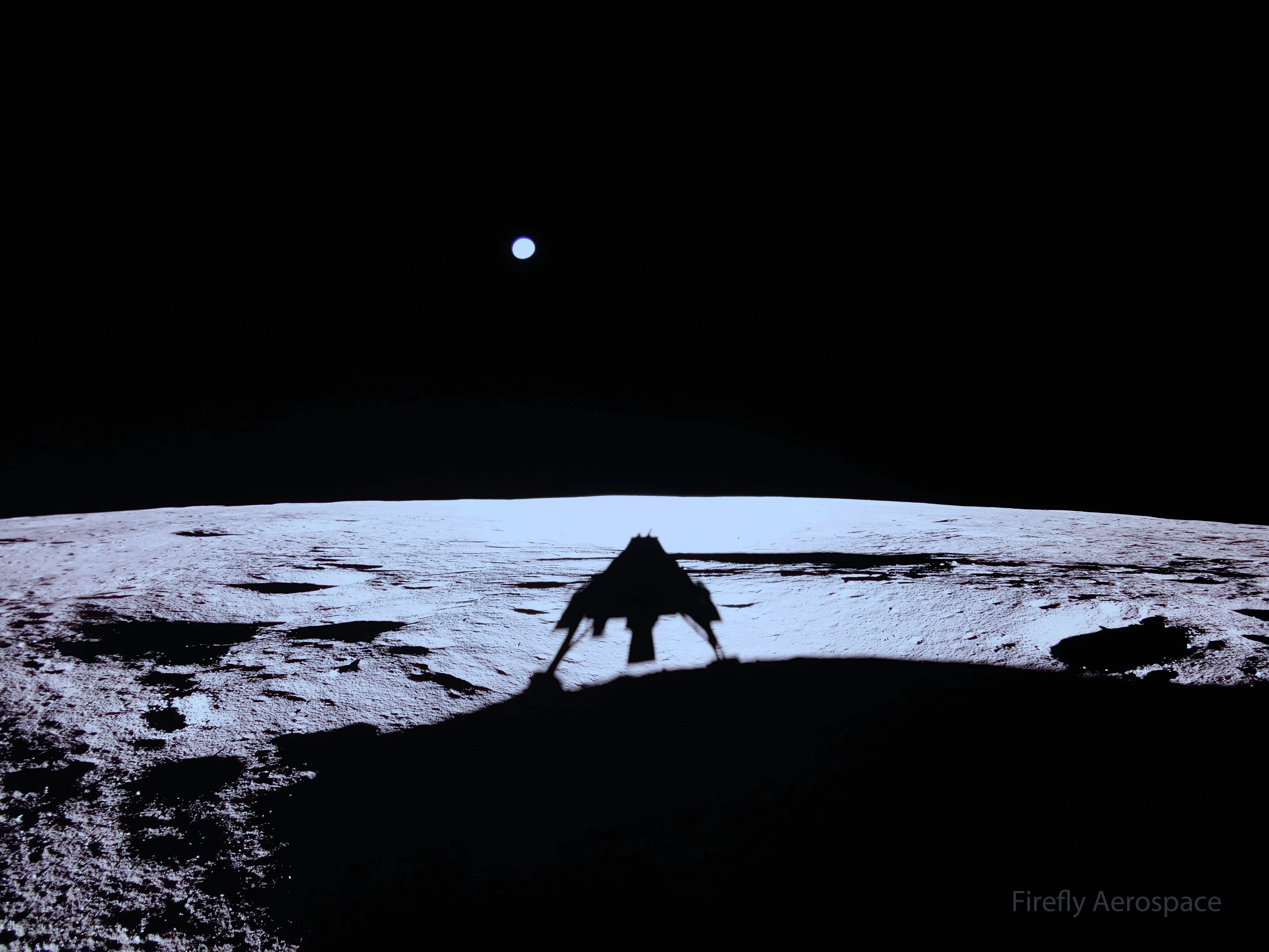
Firefly’s Blue Ghost lander captured its first sunrise on the Moon, marking the beginning of the lunar day and the start of surface operations in its new home. Our Ghost Riders have already begun operating many of the 10 NASA payloads aboard the lander and will continue operations over the next two weeks and into the lunar night.
Credits: Firefly Aerospace
Source: https://www.flickr.com/photos/fireflyspace/54362872324/in/dateposted/
8
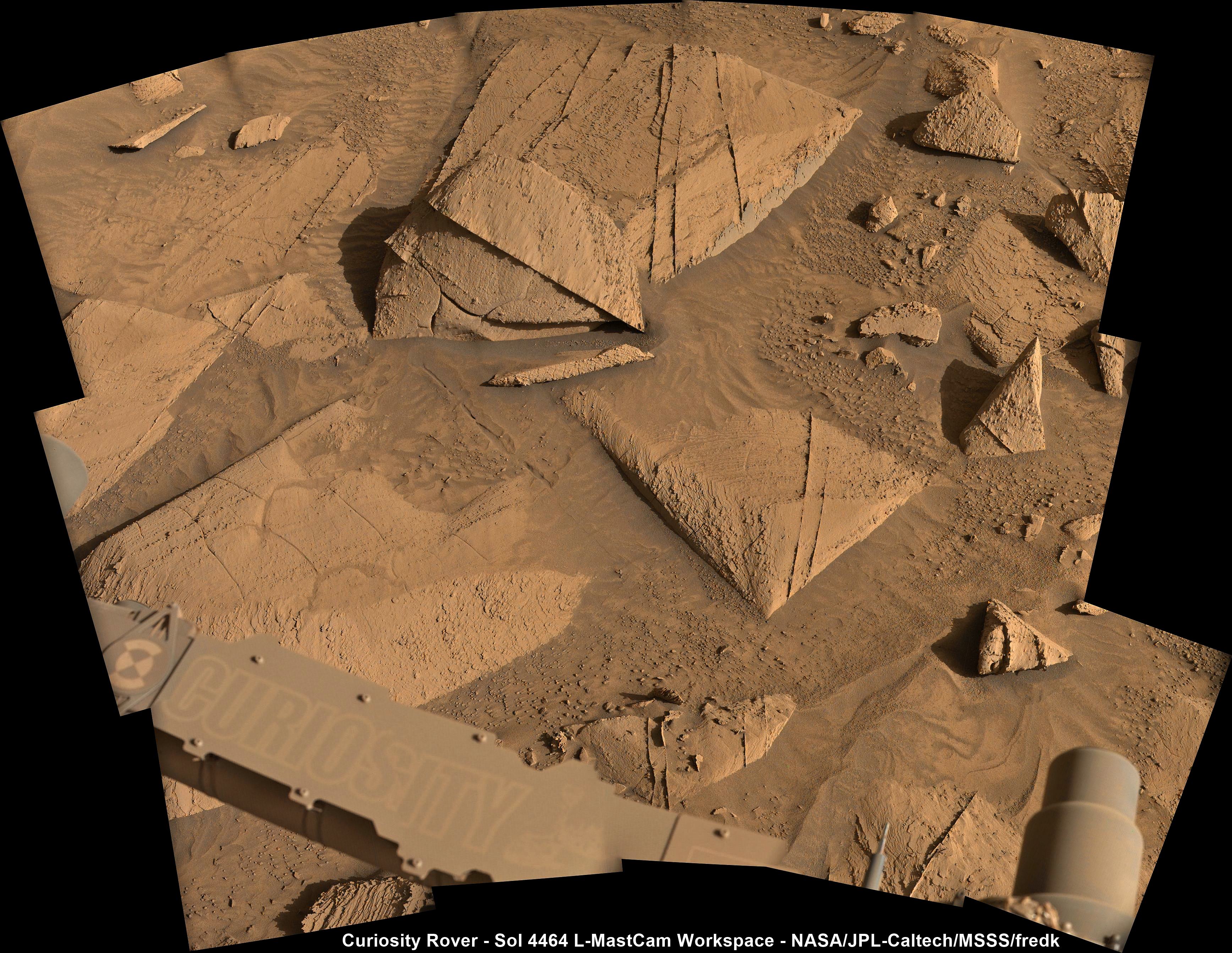
4469 - New workspace after a drive of ~36 m (120 ft) South during Sol 4469. Map and drive data in the body of this post
(lemmy.world)
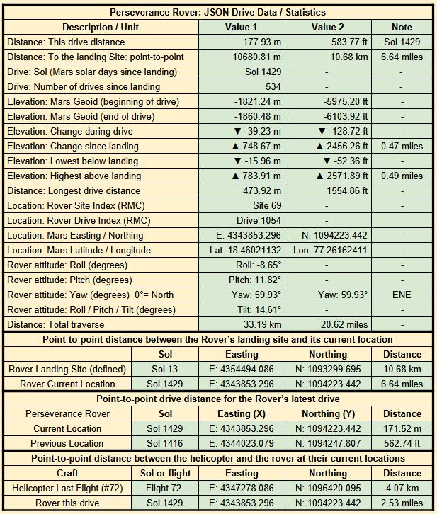
Map -
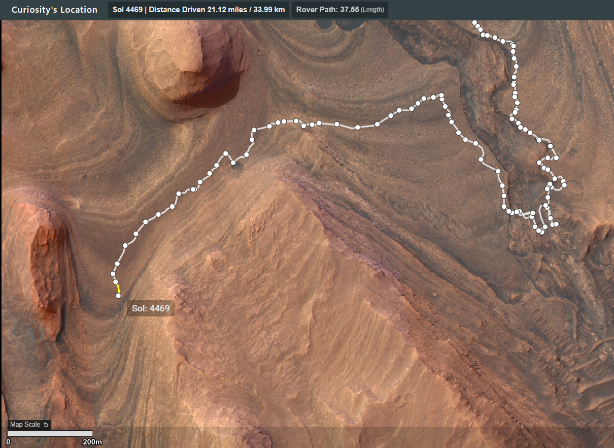
Drive Data -

Astronomy Picture of the Day
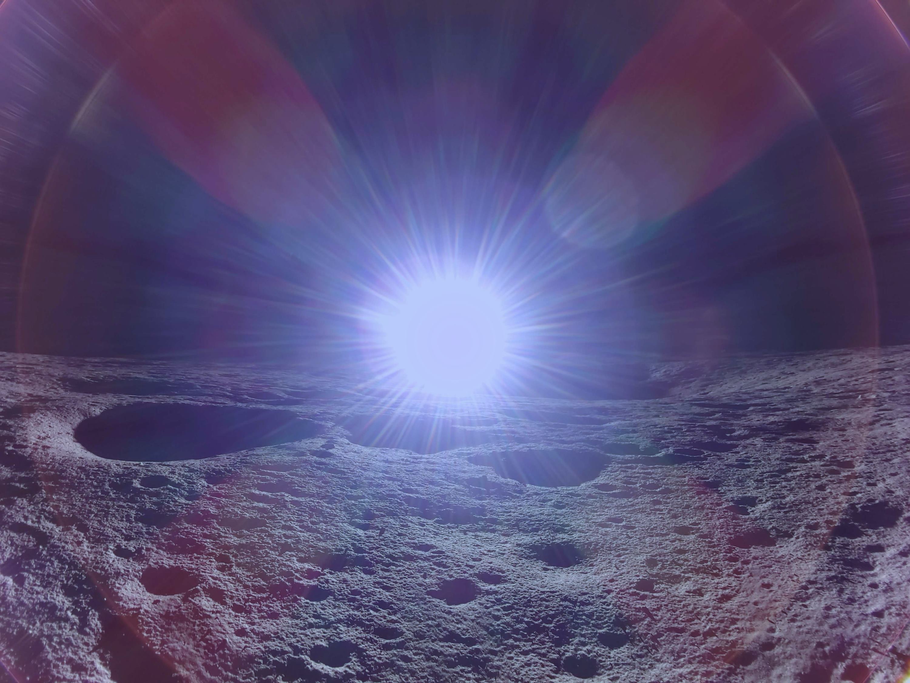
There's a new lander on the Moon. Yesterday Firefly Aerospace's Blue Ghost executed the first-ever successful commercial lunar landing. During its planned 60-day mission, Blue Ghost will deploy several NASA-commissioned scientific instruments, including PlanetVac which captures lunar dust after creating a small whirlwind of gas. Blue Ghost will also host the telescope LEXI that captures X-ray images of the Earth's magnetosphere. LEXI data should enable a better understanding of how Earth's magnetic field protects the Earth from the Sun's wind and flares. Pictured, the shadow of the Blue Ghost lander is visible on the cratered lunar surface, while the glowing orb of the planet Earth hovers just over the horizon. Goals for future robotic Blue Ghost landers include supporting lunar astronauts in NASA's Artemis program, with Artemis III currently scheduled to land humans back on the Moon in 2027.
Full resolution image link
Image Credits: Firefly Aerospace.
I can't see it being funded adequately in the current climate, hope I'm wrong
The sample page link will be updated soon with the details of the 27th sample (they wait until it's sealed to update the list)
It is called "Green Gardens"
Mars will always be tricky, even when your think they have all the bases covered, a new type of curve ball arrives, along with some extra bases. Looking back at the CacheCam images it appears as though they have had 2 or maybe even 3 attempts to seal tube 060, but one may just have been the process of cleaning the neck of the tube at the measuring station. If they don't provide a separate mission update addressing this, then it's a 6 month wait to read the mission managers reports in the PDS. Certainly one for the history books :)
Curiosity continuing its traverse to the southwest.

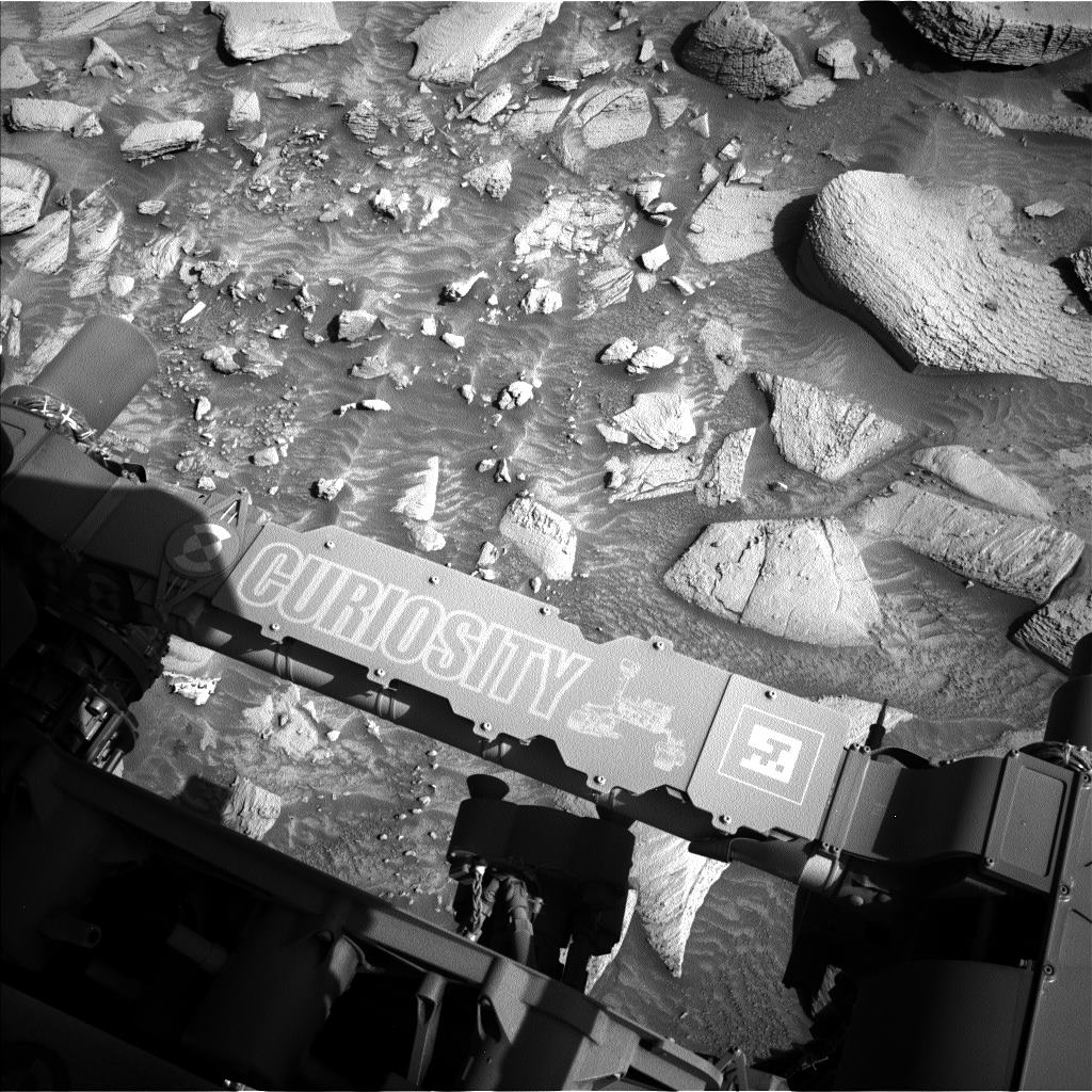
Curiosity Rover - Sol 4464 L-MastCam Workspace Assembled in MS-ICE from 15 overlapping Bayer reconstructed frames Credits: NASA/JPL-Caltech/MSSS/fredk
Here's the drive data, a simple table using the JPL JSON URLs that are updated after every drive
She's aging gracefully :)
Drive was almost directly West downslope by close to 40 meters, the point-to-point is close to 169 meters, but there was a 180 degree turn in place at the end of the drive, so I estimate the total traverse will be over 170 meters.
Screen capture of the updated traverse map shows the continuation of the drive to the SSW
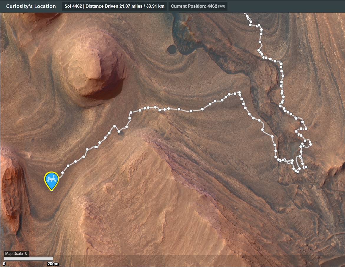
NASA/JPL-Caltech/UofA
Detailed drive data from JPL's JSON feed

A useful guide :)
This will eventually be a full 360 degree panorama
view more: next ›
It would seem bigger, but this is imaged with a wide angle lens. The lander has a lot more cameras, I'm sure we'll get some better shots of Earth and a nice panorama of the lander's surroundings in the coming days It's mission will only last 60 days, so they have a lot to do in a short time.