Map Enthusiasts
2968 readers
119 users here now
For the map enthused!
Rules:
-
post relevant content: interesting, informative, and/or pretty maps
-
be nice
founded 1 year ago
MODERATORS
1

3

5
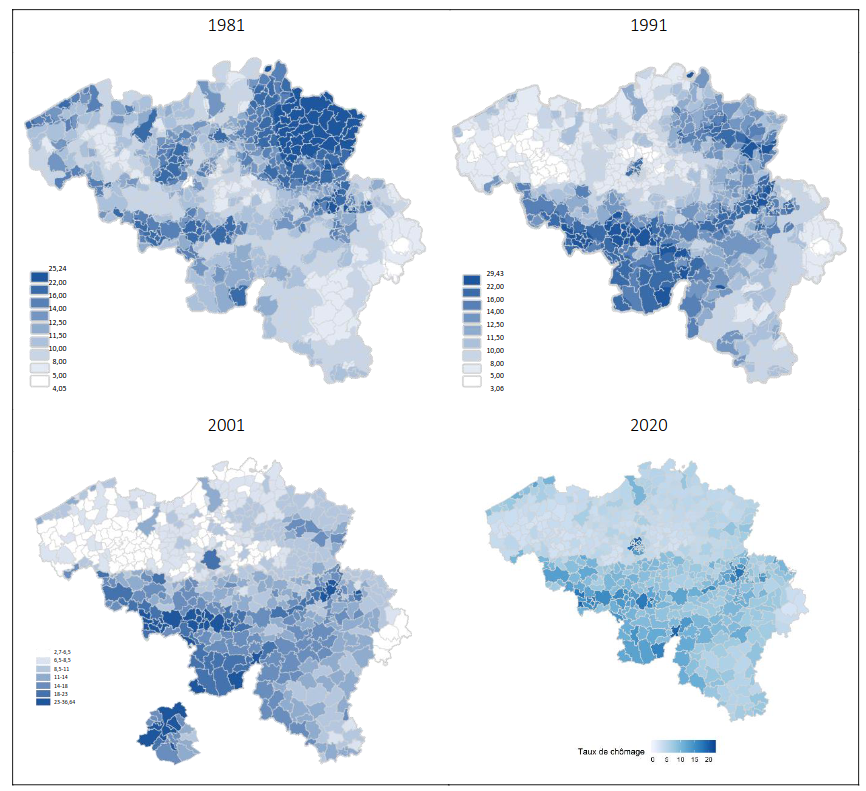
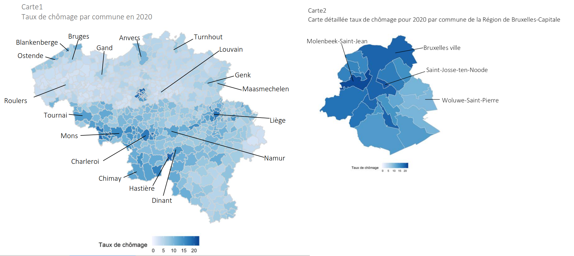
In the map it can be clearly seen that the unemployment is higher in Wallonia than in Flanders. This is largely due to the fact that Wallonia has historically relied on its heavy industry, such as steel and coal, which has moved abroad the last decades. In fact, the Sambre and Meuse valley which was the industrial heartland in Belgium thanks to its coal resources, can be clearly seen on the map.
It is also interesting to see how the distribution of unemployment has changed throughout the years, as seen on these maps:
6


9
(sorry about the colors not matching)

11
Cyan - Congress (13 seats), Green - SSUBT (9), Orange - BJP (9), Pink - NCPSP (8), Yellow - SHS (7), Blue - NCP(AP) (1), Grey - Ind (1)
The shapefile is from the Election Commission of India website.


15
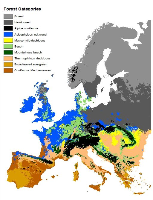
More info about the map and the forest types here. The forest types are described in chapter 6.
The map does not necessarily show what kind of forest actually grows in different places, if any, but rather which forest type you could expect to find there naturally, if it would be forest. But it probably matches reasonably well with what actual forests look like, although most of Europe is of course not covered by forests.
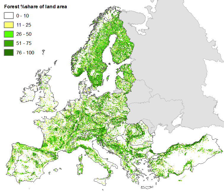
Here's a map over forest cover in Europe:

17


19

20
337
What 16th century Ottomans thought Europe looked like on top of an actual map of Europe
(files.catbox.moe)


22

24
108
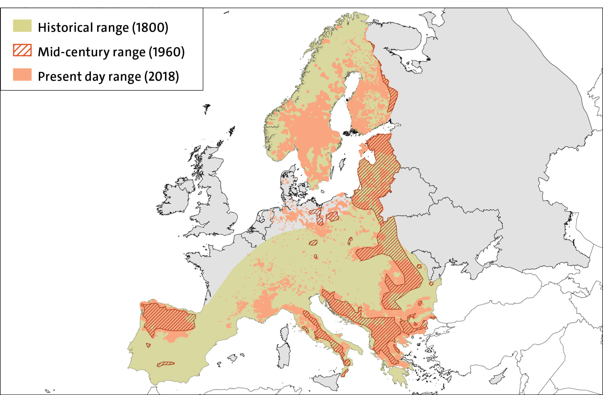
The decline and recovery of the European wolf population from 1800 to 2018 (no data for Russia and Belarus).
(rewildingeurope.com)
Map is a bit confusing since it has no data for Russia and Belarus, but there are wolves there. Here is another map with population numbers as well:

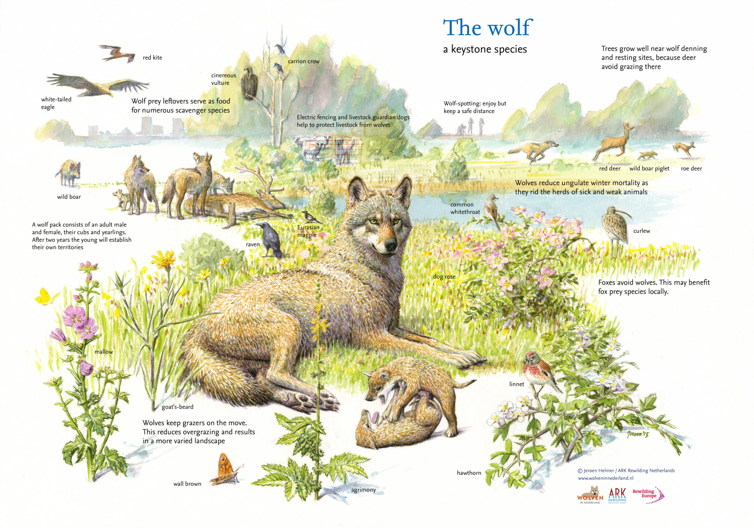
Also, pretty infographic about wolves from the same source:


view more: next ›