SpecialSetOfSieves

joined 10 months ago
[–] SpecialSetOfSieves 4 points 17 hours ago (1 children)

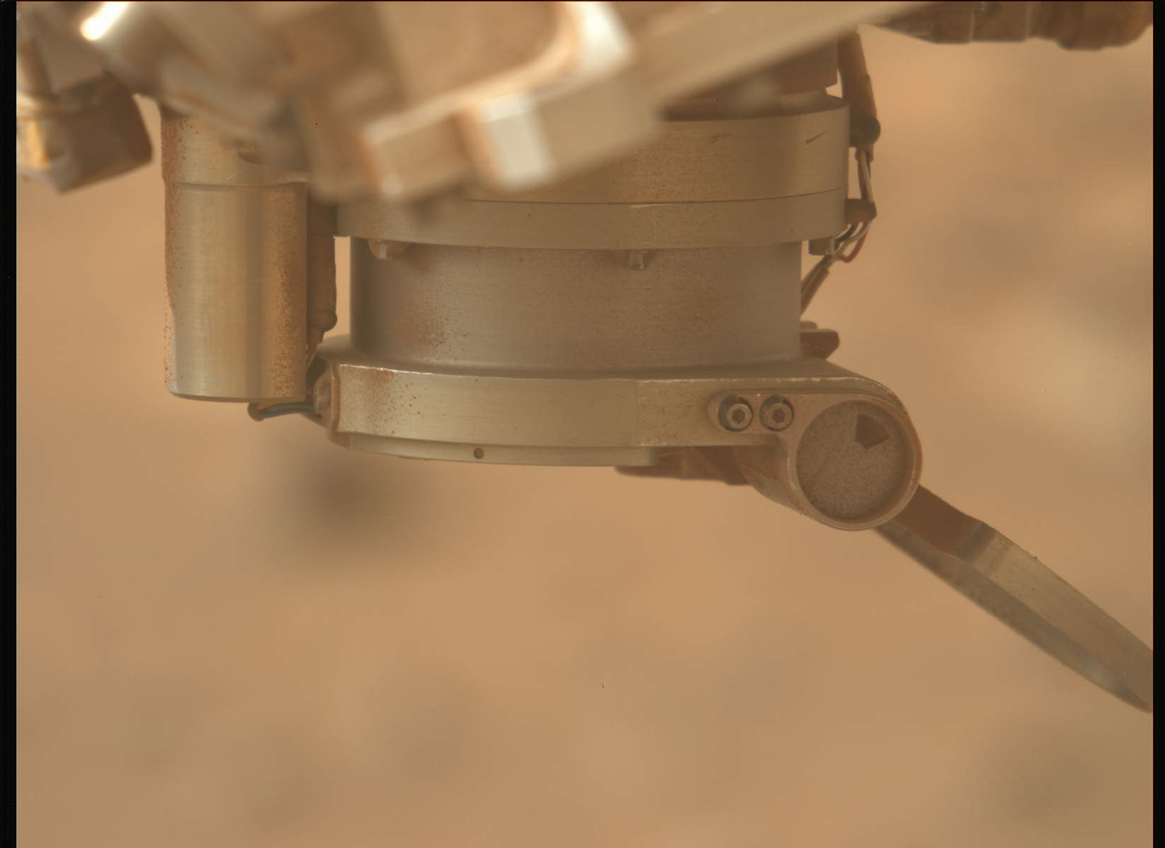
After 8 years of ascending the mountain, this is what it's come to. As this episode documents very nicely, the rover's brush tool has been working perfectly all this time... until now. After stumbling over all that raw sulfur and being forced to backtrack over all this rocky terrain - he's faulty, malfunctioning. Kept babbling on about his mission.

To quote Mars Guy:

that post, spinning at a few hundred RPM, appears to have been jammed into the rock, which was soft enough to result in a shallow hole. Now the remaining question is, after hundreds of uses without jamming the post - what went wrong this time?

These astro-droids are getting quite out of hand. Even I can't understand their logic at times.


Don't try to tell me that there isn't at least one skier, boarder or sledder among the rover drivers.

Bonus points for the white powder they made with the abrasion tool (left of center, where the tracks meet the rocks). Pico Turquino may not be good enough for certain geologists, but some people know how to have fun on powder that no one has carved in 3 billion years.

[–] SpecialSetOfSieves 3 points 3 days ago* (last edited 3 days ago) (1 children)

I have only anecdotal evidence to support this, but:

Looking at images like this from the same time last Martian year, when we were on the crater floor, it seemed pretty dusty then, as well.

We've known for quite some time, however, that this general time of year (northern hemisphere winter) is dusty, and we're not very far into spring as yet. I think there would be a lot of science value in observing dust devil and wind gust activity from a significant elevation like this, and I long to see the kind of views you're talking about as well. Unfortunately, dust devils are more of a summer thing, and the mission seems determined to get Percy up and over the summit ASAP. I personally learned to look at Mars differently after seeing the colour images from Ingenuity's later flights, and the perspective on this canyon and delta region from the summit could be significant, not to mention inspiring... provided we could actually see what the view really has to offer.

I've complained about the nosebleeds enough already, so I'm going to refrain from commenting on Ken Farley's driving habits.

[–] SpecialSetOfSieves 3 points 3 days ago (3 children)

There's going to be a lot of this for the next little while. From the photos returned over recent sols, it would seem the only nearby target of interest is... the rover itself, or rather, the rover's tracks. (There is definitely worthwhile science to be had from observing the tracks, but the study won't be photogenic in the meanwhile).

To be fair, there isn't much but sand and fine gravel around the rover at the moment and for a distance ahead, but the "Crater Rim" part of the campaign is going to look a bit strange in retrospect. Only two abrasion holes and no cores until we reach the summit? I'm looking forward to hearing the latest update from the rover team, because they seem to be sure of what they're doing.

[–] SpecialSetOfSieves 5 points 1 week ago (1 children)

Moderators, would it be possible to add a pinned post or two, with some resources to give people an overview of what Percy has done so far? The mission website outlines things to an extent, but I'd be happy to add some explanatory material. I'm thinking, to give one example, of a post that shows all the abrasion patches Percy has made to date. IRL I get a lot of blank reactions when I try to show people photos of geological materials on a screen, or comments like, "It's just a rock. So what?" Seeing all of the holes/patches in a montage would be very illuminating, however.

If a pinned post isn't the best way, I'll go ahead with making a new post each time we get suitable images from a new patch, but it might be difficult to find in a search. I look forward to your feedback.

[–] SpecialSetOfSieves 2 points 1 week ago* (last edited 1 week ago) (1 children)

Thanks! They're being thorough with SuperCam and the UV imager again, even if (I suspect) they don't expect fluorescent minerals up here. I imagine this site will get the "full treatment", as Mars Guy puts it.

This latest abrasion hole, with the fair-sized mineral grains it exposes, really makes me wonder about the dark massive rocks capping the hill, which Prof. Ruff tentatively identified as ignimbrites. Everyone came into this mission jazzed about sedimentary geology, but the volanic/igneous history of this place is proving to be pretty interesting, even mysterious.

EDITED an erroneous adjective.

[–] SpecialSetOfSieves 1 points 1 week ago

Someone like you, who comes into a calm, science-oriented community with F-bombs and complete cluelessness, should be able to understand this:

I didn't study geology or science for years to answer questions from the likes of you. You want a guide? F*** you, pay me.

No one owes you and your s***ty attitude a damned thing. Don't presume that your talk about "getting interested in science" is fooling anybody or represents anyone else, nor does it make up for your entitlement. Paul Hammond and other volunteers here are doing an amazing job. You want better, do it yourself.

[–] SpecialSetOfSieves 4 points 1 week ago (1 children)

I don't think we need users like Linktank around here.

Aside from the entitlement and total lack of self-awareness on display here, there are plenty of science-aware people who avoid social media precisely because of this kind of cretinous toxicity. I am inclined to increase my "engagement" here, and I've actually increased my scrutiny of this mission because of respectful and genuine questions I've seen online... but when I encounter aggressive BS like this, it doesn't feel worthwhile.

The mission website and associated media can answer basic, er, "questions" like those above, but I actually do think there's more of a need to connect the dots for those who want to actually get a feel for the seriously amazing work this mission is doing. To me Lemmy doesn't seem to be the kind of place where a more detailed guide should be hosted, but I'm open to ideas for how it could be done. I've actually been working for a while on a few posts for this instance myself, but it's a time-consuming process!

Your username works very well here 😁

[–] SpecialSetOfSieves 2 points 1 week ago (4 children)

They've already done an abrasion patch at the 1333 site, and given the mission's emphasis on Pico Turquino, one would assume that they're going to core here as well, but the rover team has been surprising me lately. I must say that the exposed interior we're seeing on 1334 isn't what I expected, but I'd like to see the night-time LED images before getting too caught up here.

[–] SpecialSetOfSieves 2 points 3 weeks ago (1 children)

Interesting! CacheCam isn't used very often. Would dust on the lens impact operations significantly?


This episode would be a good one for introducing all those non-Martians in your life to Percy's journey, with the combination of sweeping visuals and the callback to Ingenuity's fledgling flights. Especially if you want to spend more time in the tropics.

[–] SpecialSetOfSieves 4 points 3 weeks ago

With all the apparent lithologic diversity and patches of flattish bedrock as we've gone higher and higher up the rim, I'd be more surprised if they hadn't thought about coring. They've been shooting a lot more close-ups lately, that's for sure, and not just on the "white rocks". I assumed they were going to wait until reaching some accessible, heavy and stable boulder at Pico Turquino, and I still think they will. Nonetheless, it would be hard to miss the pretty distinct geologic units as we've sidled up to that hill, and erosion clearly has some interesting tales to tell around here. I definitely haven't been able to complain about the rover climbing too fast and blowing past interesting stuff lately.


... because the overhangs, and all the holes among these many boulders, would make me nervous if I was roving the slopes of this giant crater rim. We know that Percy is a very determined astro-droid, but there are too many places for tech scavengers to hide around here. Although I guess they would have to be pretty small jawas...

Link to full Mastcam-Z frame

[–] SpecialSetOfSieves 5 points 1 month ago (1 children)

ZOMG

We're actually backtracking?!?! What have they done with Ken Farley - has he been kidnapped?? He'd never stand for actually going back and deviating from the Mission Plan...

[–] SpecialSetOfSieves 2 points 1 month ago* (last edited 1 month ago)

One pill makes you larger

and one pill makes you small

and the ones that Mother gives you

Don't do anything at all


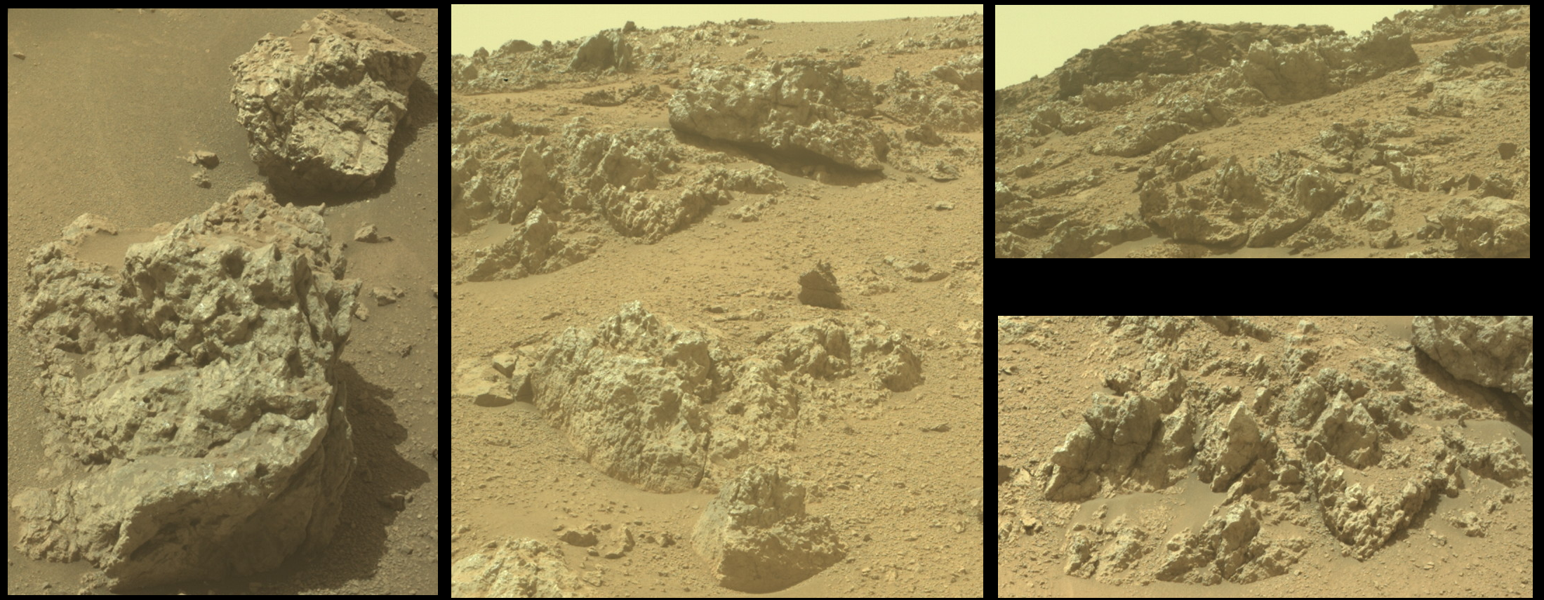
All of the above vignettes were cropped from Front Hazcam images taken on Sol 1308, at about 1 PM local time.

Given that the sun was roughly behind the camera and rover when these images were captured, the complex, light-toned surfaces of these rocks stands out, with glinting reflective patches evident, especially toward the top of the hill. I'd be intrigued to view these rocks in the late afternoon, when shadows are longer and the dusty skies of late winter aren't layering that soft sheen over everything. Given the aggressive driving schedule that the rover team has adopted for climbing the Jezero rim, though, I'm not sure that Percy will stop here for very long...


This shot was taken by the arm-mounted WATSON camera at 10:46 PM local time, illuminated by the LED (see also shots lit from the left and right, for perspective). The boulder Percy is analyzing (see here for a daylight view) isn't as reflective as some near the rover, but then again, this part of the Jezero rim seems to have more than enough funky rock coatings for anyone!


I can't find any evidence that the triangular-prismatic rock at the top centre of this image even existed before Sol 1292 (apparently visible on the left hump on the horizon in this image)... are the Martians watching us???

(To be clear, I am joking here. I just think it's really neat to see how many of these cobble and boulder-studded slopes on the Jezero rim produce these angular and seemingly resistant forms. Martian hills and mountains are pretty rounded in general - I'd hardly expect to find the Matterhorn in these ancient landscapes - but erosion has a way of surprising you in this place...


Warning: the video features an undignified view of the rover from about 2:10-2:30. Don't say we didn't warn you.


The science team thinks that this rock has a texture unlike any seen in Jezero Crater before, and perhaps all of Mars. Our knowledge of its chemical composition is limited, but early interpretations are that igneous and/or metamorphic processes could have created its stripes. Since Freya Castle is a loose stone that is clearly different from the underlying bedrock, it has likely arrived here from someplace else, perhaps having rolled downhill from a source higher up. This possibility has us excited, and we hope that as we continue to drive uphill, Perseverance will encounter an outcrop of this new rock type so that more detailed measurements can be acquired.


No, I'm not calling this a "potential biosignature" 😆

Mars Guy has documented some of the rover team's prior work on coated rocks, although I don't remember seeing any examples this visually striking.

The coated rocks which have been documented prior to this one - none of which were nearly so patchy as this one, if I recall correctly - have been interpreted as a relatively thick dust coating formed by the action of water vapor, i.e. humidity. Mars should have had some fairly recent episodes of higher atmospheric moisture caused by the tilting of Mars' axis, which would expose the polar caps to more sunlight and temporarily humidify the atmosphere while the ice is being redistributed to the new polar latitudes.

We've never had any mission climb the rim of a crater as large as Jezero before... not on Mars, or even on Luna... I'd say it's been pretty fun so far!


I have seen thousands upon thousands of still frames from the MER, MSL and Mars 2020 missions, but very few that take the perspective seen above. I find it practical and useful for the following reasons:

  • Seeing exactly which clasts and sand ripples have been in contact with the rover (notice the pebbles and cobbles that have been pushed into sand, exposing darker material). The rover's tracks aren't always evident, and this helps.
  • We can easily see the state of the wheels
  • We get instant perspective on the size of surface features
  • We can observe sedimentation on the rover (how much sand/dust is coating it) through time

However...

Shots like this are just really cool. People already anthropomorphize rovers (and Ingenuity), because we like seeing ourselves on other worlds by proxy. People also like monster trucks, mudbogging, ATVs, and just plain getting dirty. Mars is known for being cold and arid, but the truth is, barring any possible toxins in the soil or dust, it's really a place for big kids! Geologists aren't the only ones who like to play in the rocks. There's a whole culture out there that likes to put metal to dirt or hard stone, and I don't feel like we reach them enough. More of these, please!


After reporting a while back that the SHERLOC instrument was inoperable due to a stuck, half-open dust cover, it seems that we're back in business, based on the latest images from Sol 1076 (29 Feb 2024).

I'm not sure if the engineering team will decide to leave the dust cover open, but I do know that the science team could really, really use SHERLOC, which can (and has) identified organic molecules in the rocks, including the samples we've collected. With Ingenuity losing its "wings", we can all use good news from Jezero!


Comparing recently downlinked images from Sol 1069 (22 Feb 2024), the partially closed (and apparently stuck) dust cover for SHERLOC seems to have opened by a few more degrees.

SHERLOC is one of the mission's primary instruments, used to detect organic molecules and identify minerals. Losing the full use of this instrument would be a problem.

The following sequence of images, taken several minutes apart, will show the dust cover's motion:

https://mars.nasa.gov/mars2020-raw-images/pub/ods/surface/sol/01069/ids/edr/browse/zcam/ZL0_1069_0761842926_818ECM_N0501618ZCAM05177_110085J01.png

https://mars.nasa.gov/mars2020-raw-images/pub/ods/surface/sol/01069/ids/edr/browse/zcam/ZL0_1069_0761844394_678ECM_N0501618ZCAM05177_110085J01.png

https://mars.nasa.gov/mars2020-raw-images/pub/ods/surface/sol/01069/ids/edr/browse/zcam/ZL0_1069_0761845258_706ECM_N0501618ZCAM05177_110085J01.png

view more: next ›