this post was submitted on 02 Apr 2024
407 points (96.4% liked)
Comic Strips
14210 readers
3218 users here now
Comic Strips is a community for those who love comic stories.
The rules are simple:
- The post can be a single image, an image gallery, or a link to a specific comic hosted on another site (the author's website, for instance).
- The comic must be a complete story.
- If it is an external link, it must be to a specific story, not to the root of the site.
- You may post comics from others or your own.
- If you are posting a comic of your own, a maximum of one per week is allowed (I know, your comics are great, but this rule helps avoid spam).
- The comic can be in any language, but if it's not in English, OP must include an English translation in the post's 'body' field (note: you don't need to select a specific language when posting a comic).
- Politeness.
- Adult content is not allowed. This community aims to be fun for people of all ages.
Web of links
- [email protected]: "I use Arch btw"
- [email protected]: memes (you don't say!)
founded 2 years ago
MODERATORS
you are viewing a single comment's thread
view the rest of the comments
view the rest of the comments

I'm dumb AF please explain
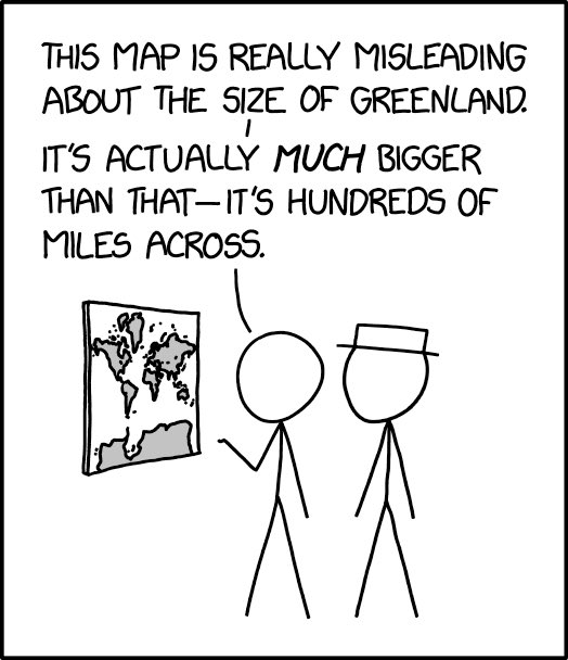
The Earth is a sphere, which means there’s no easy way to project it onto a flat surface. One of the methods used to project the Earth’s surface on the map results in certain places (such as Greenland) to be stretched to huge sizes, sometimes appearing as big as Africa (look up “Mercator map”). The joke here is that while we expect him to make a comment about the map’s projection, he instead comments on how Greenland on the physical map is only a few inches, as opposed to its actual size.
So yeah, subverted expectations, peak Dad joke
I thought it was funny also that Antarctica is blown up across the entire width of the map
The map is not the same size as actual Greenland