Cartography Anarchy
A community for Cartographers with nothing left to lose.
Rules:
Don't be awful Lemmy Guidelines Still Apply.
No direct upload images This is hosted on Lemm.ee- to post images, you must use an image upload service like Imgur to post maps.
We are agents of chaos I've created this to be the alternative to the community I used to manage on the website that shalt not be named "mapporncirclejerk"
Live and let die Meme trends happen, so please don't message mods asking to take down maps that are repetitive to a bit.
Reposts Vs. Covers Not all reposts are evil- if someone posts something that has been done years ago, it serves to bring old memes to the new users. I call these meme covers. However it can be done in excess which makes it a repost and spam. Mods will determine if a post is a cover or a repost.
No impersonating mods I can't believe I had to make this rule.
No harassing mods on an appeal We can talk it out, and we will be acting in good faith when making decisions. If you disagree with a removal, you are free to message for clarification or to appeal by giving some added context.
Bans Bans will be set to a maximum of 365 days for humans, and a minimum of 365 years for bots. I believe people can change, so if you are banned for good reason, do know that it is not permanent, it is just a way to say "take time to grow and come back when you are ready".
view the rest of the comments

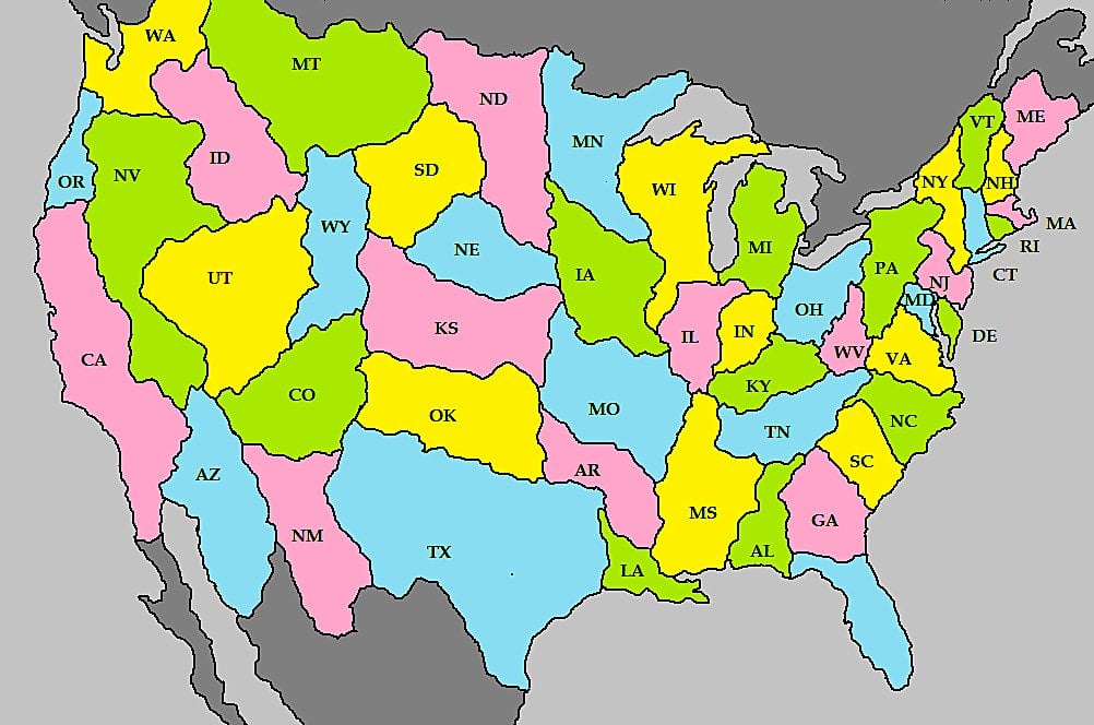
As someone of the earth sciences it is my opinion that whoever drew this has exactly zero understanding of "natural geographic borders".
Right???? This map changes borders that are already based on rivers and natural geographical features.
Can you draw us a better map then?
Nobody got time for that. But yeah this map seems to be more or less randomly generated, it messes with a lot of borders that are already geographically defined. Seems like they just made everything into an irregular shape and assumed people wouldn't look too closely.
US states were in large part created to reflect natural geographic divisions already. They were frequently drawn up on maps before having any significant population centers, so geographical boundaries were the primary focus. A secondary focus being equality, so not making any state too big or small relative to its neighbors.
Maps! Bring us the maps!
I know a couple of guys that can help.
Thank you, this makes me happy
The fact that the Mississippi River isn’t being used as a border anymore in some states bother me. But I’d love to see your take.
100% agree. As an Oregonian, that border on the Willamette made me wanna cry. Literally no consideration of nature or people with that boundary, and yet it’s called a “natural border”.
Looking at Long Island, I find it interesting that they chose the Hudson River as a natural boundary but apparently Long Island Sound is no big deal
I can’t figure out what Rhode Island’s border is meant to be but it apparently doesn’t include Rhode Island
New Jersey is glaringly bad