Cartography Anarchy
A community for Cartographers with nothing left to lose.
Rules:
Don't be awful Lemmy Guidelines Still Apply.
No direct upload images This is hosted on Lemm.ee- to post images, you must use an image upload service like Imgur to post maps.
We are agents of chaos I've created this to be the alternative to the community I used to manage on the website that shalt not be named "mapporncirclejerk"
Live and let die Meme trends happen, so please don't message mods asking to take down maps that are repetitive to a bit.
Reposts Vs. Covers Not all reposts are evil- if someone posts something that has been done years ago, it serves to bring old memes to the new users. I call these meme covers. However it can be done in excess which makes it a repost and spam. Mods will determine if a post is a cover or a repost.
No impersonating mods I can't believe I had to make this rule.
No harassing mods on an appeal We can talk it out, and we will be acting in good faith when making decisions. If you disagree with a removal, you are free to message for clarification or to appeal by giving some added context.
Bans Bans will be set to a maximum of 365 days for humans, and a minimum of 365 years for bots. I believe people can change, so if you are banned for good reason, do know that it is not permanent, it is just a way to say "take time to grow and come back when you are ready".
view the rest of the comments

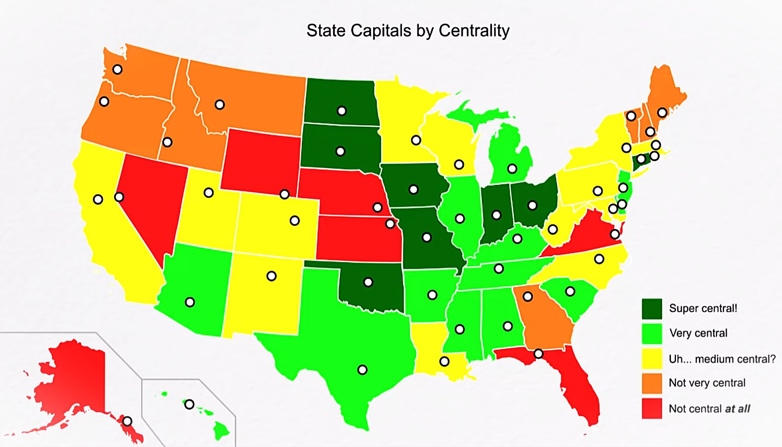
Wyoming: capital is in the small area of useful farmland, as opposed to non-arable mountains. Also close to Colorado, which has a lot more useful farmland and general economic activity.
Nebraska and Kansas: capital is close to the Missouri River, where a lot of trade occurs.
Virginia: capital is ~~close to DC.~~ not where this map indicates.
Florida: ??? I guess it's just generally closer to the mainland.
Alaska: Capital is far south for the relatively tropical climate.
I'm trying to understand where OP thinks Richmond is located. Potshot, but that looks like it would be near dhalgren VA which is nowhere near the capital.
I'd also argue it's close ish to the capital. More central ish while still being near one of our major rivers source: I live in Virginia.
Yeah, looked it up and OP looks more like Norfolk or Williamsburg.
Also DC is further north than I thought 🤐
It's weird how many people have no idea where richmond is. I live in virginia and haven't met anyone who thinks it's where this map shows, but I have met multiple people who insist it's in northern virginia by fairfax until you show them a map. And to make matters worse they all actually live fairly close to richmond but just don't know they do
I find this so hard to believe. Like how does anyone live in Virginia and not know where Richmond is? I-95 literally runs through the city cutting it in half. If you can find the interstate you will find Richmond. Source: born and bred Richmonder.
I genuinely have no idea, one of them actually got in an argument with another one of my friends about it and started claiming that the map must be mislabeled because richmond couldn't possibly be south of where we were
I don't know why this amuses me as much as it does. It's deliciously ridiculous.
I think it is because people know that a ton of fighting happened between Washington and Virginia during the Civil War, and the area became infamous for the chaotic fighting between both cities. The map seems to have Richmond located on Williamsburg, which isn't right, but Richmond isn't very far from there
The ports of Pensecola and St Augustine served as the capitals of East and West Florida territories in the years before Florida became a unified state. The delegations trying to unify Florida got tired traveling all the way to and from each capital so they met in the middle at the site of a destroyed Apalachee settlement (courtesy of Andrew Jackson a few years earlier) and threw up a crude government building
If you overlay a population density map of alligators and sneks, Florida’s capital placement will probably make more sense.