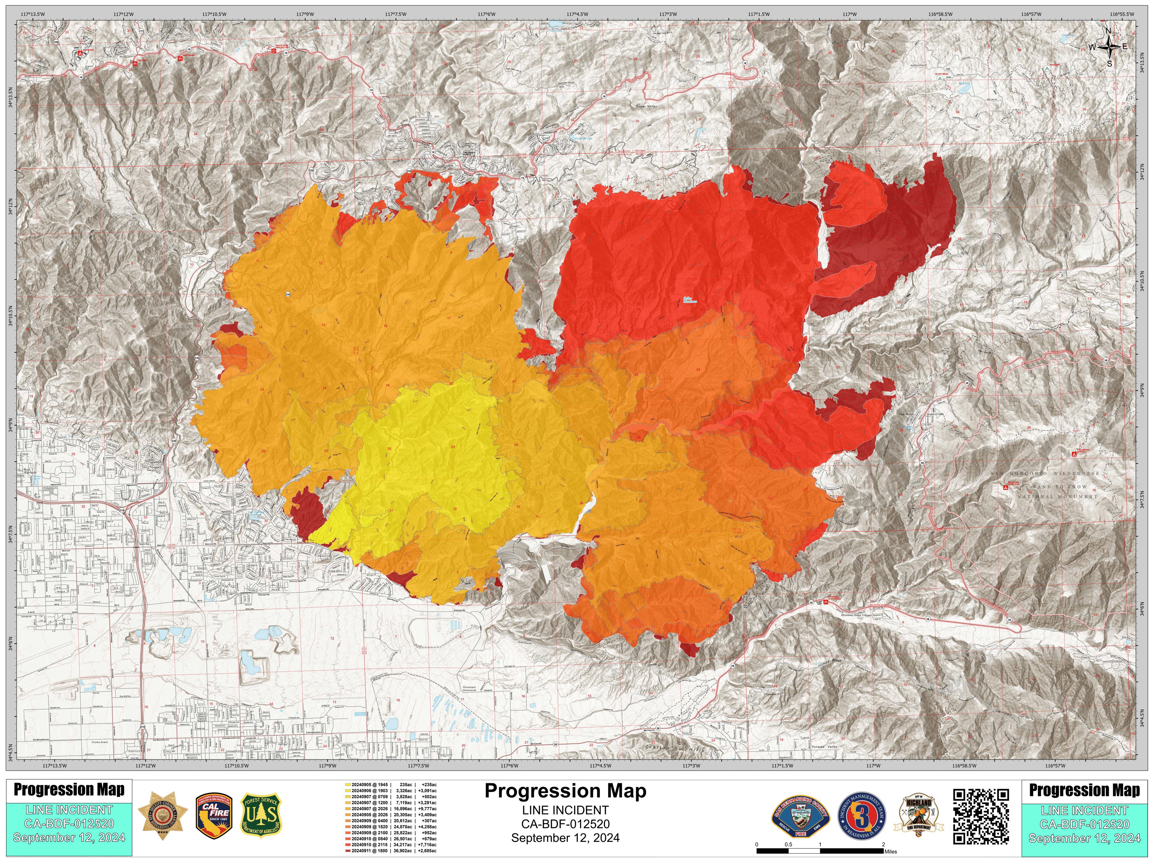
I actually dug this map out of a dropbox archive, I haven't seen it posted anywhere... seems quite detailed! This is from today.
Here is the video report from Cal Fire earlier today, with the link starting the video right when he goes into detail about the current situation on the Big Bear front: https://youtu.be/DEeE4YRbDWI?feature=shared&t=268
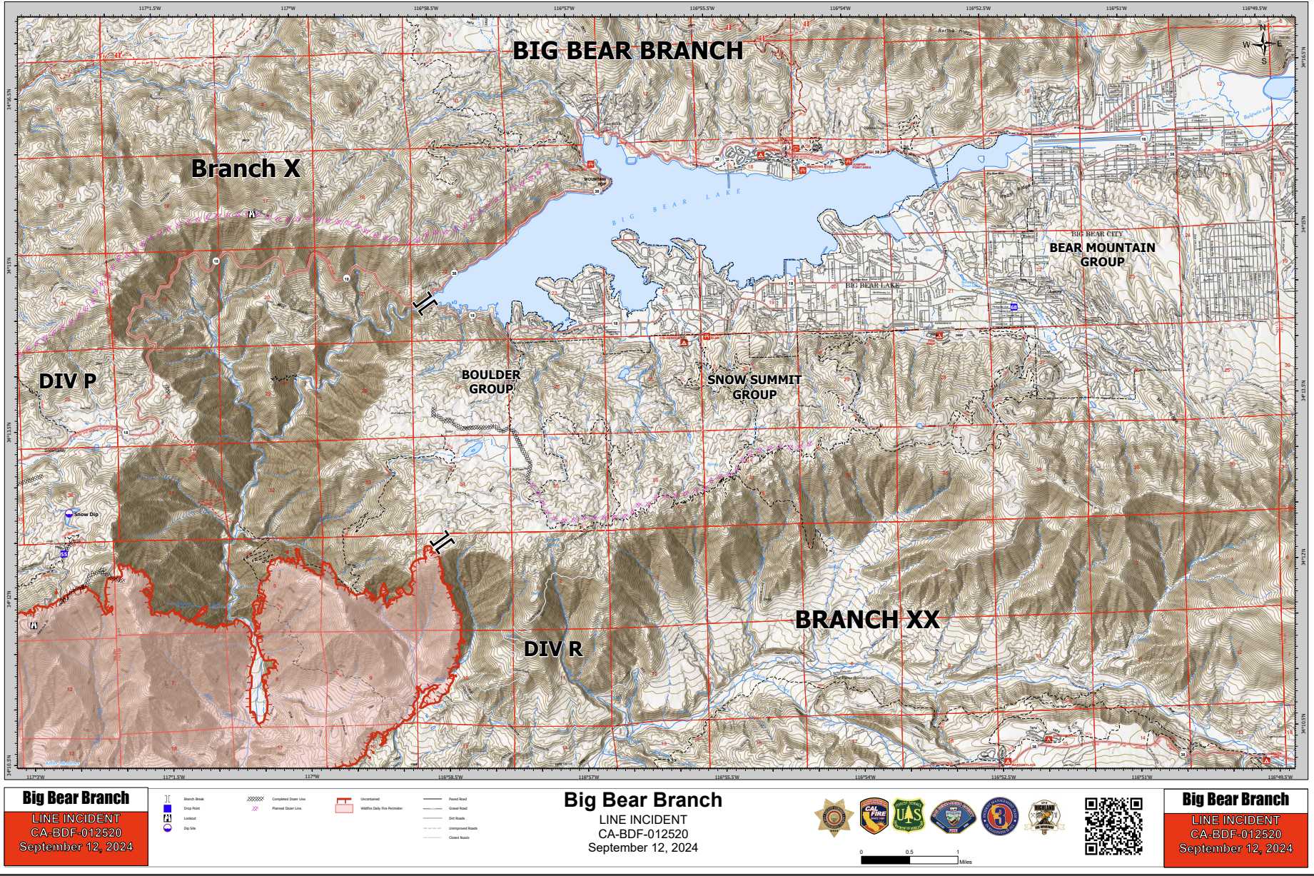
Here's an annotated transcription of the Big Bear Portion of the update, which is extremely positive for us:
And then we get into our Big Bear area, and that Big Bear area looks really good. We had the fire come up that slope yesterday. We had about 800 acres burned in that area, [and] it hit what we call the plateau, or the very rim where that vegetation Management program has been put in by the forest service
We had Crews up there waiting and as it hit that Rim, and they attacked it with aircraft, they attacked it with bulldozers, and they're carrying the dozers to the west and then to the north and trying to tie it into the Big Bear Dam Area at the 18 intersection right there. So they'll be doing that today - nursing it along that entire Plateau. As that fire crests that Plateau, [they are] very confident in that operation due to a lot of factors:
- There's some Dozer lines up there
- That vegetation management work that's been done up there and
- The crew's plan worked yesterday, [so] it's going to work again today
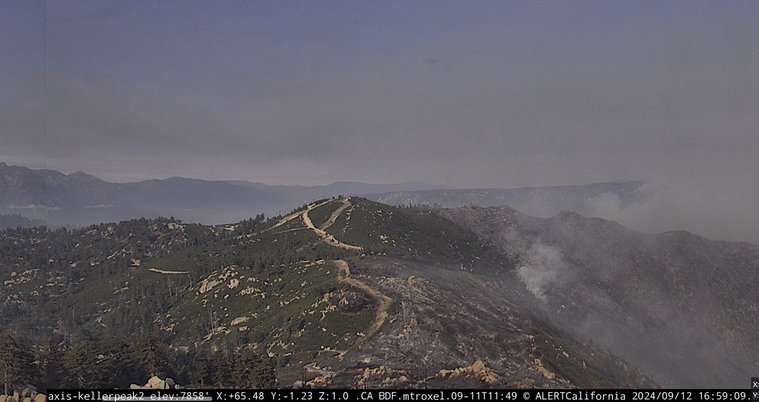
I think we're looking at a visual of a successful border where they stopped the fire. This is looking towards Big Bear from Keller Peak at 4:59 PM PDT. It certainly seems promising! Live Cam: https://ops.alertcalifornia.org/cam-console/2045
I doubt this is new news, I just didn't notice it until now and figured it was a positive update to share.
So, I haven't seen an update all day with regards to the maps... This is very abnormal compared to the last week, but not necessarily bad news.
In the good news category, this is the cleanest air day I've seen so far all week. The PM 2.5 count was over 800 for most of last night, up until about 1AM when I noticed the stars were visible. Today has been really nice, though... 50-100 at the start, and it's down to 15-20 right now.
There's a distinct lack of wind here, and (judging by the wind map on MyRadar) over the fire right now. This seems like great news when paired with this being the coldest day since the fire started.
Aha! Three people now, it's officially a party. I think this page is being lurked by more than that based on the Reddit updoots, but it's pretty hard to tell haha. Let me know if I can improve anything in the top post!
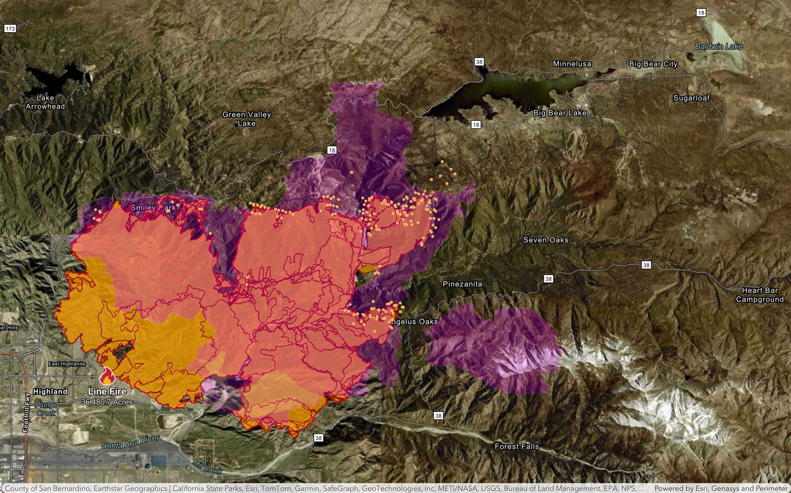
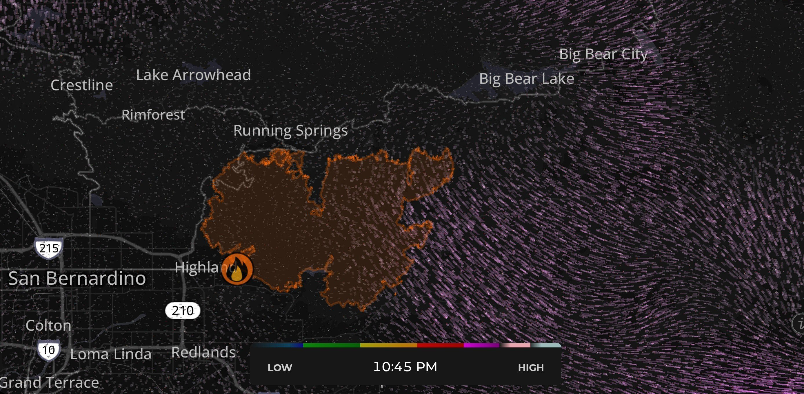
Not the best news today first thing with this map, but hopefully the firefighters are able to tackle those hot spots near Bluff Lake. Update as of 10:45PM PDT (but those hot spots crawling north were from at least an hour earlier).

Do note that this may not be the case tomorrow morning/afternoon. The wind often changes direction at night. The air quality is improving here right now, though! I have a meter outside reporting the PM2.5 at 92. It was over 800 just a few hours ago, which was quite alarming.
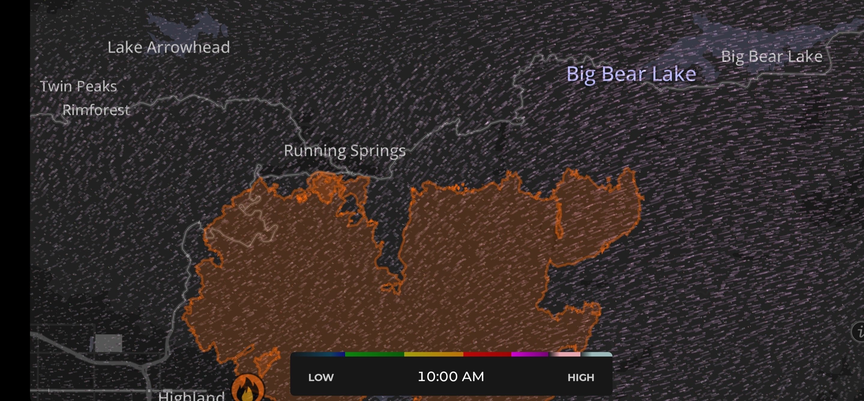
A quick update showing the wind blowing the fire away from Big Bear after a fairly brutal few days of rapid and notable winds towards us.
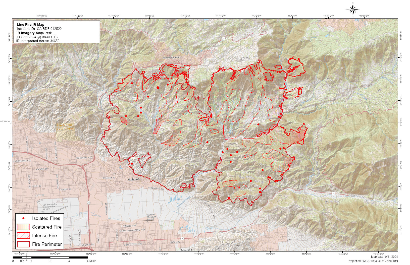
This helpful resource came from the socaloumtains forum. I appreciate that it maps out the intensity of different areas.
Added it to the list! I'm new in town, so I've definitely never heard of that website. It's great to see it! I came here because I wasn't sure where to go, and figured I'd just draw in people from Reddit.
Interesting - I suppose that makes a lot of sense why they'd let it get to the ridge, then! I was assuming they simply couldn't do a thing about it until that point due to the terrain. I see some hot spots jumping in a bit as of the last update, it'll be interesting to see where they draw a line.
All of this information is more than I've heard, so it's really fascinating to hear it! I appreciate you sharing here. And man, the smoke is actually becoming a problem where I live. I have three top notch HEPA air filters that are currently failing to keep the PM2.5 count below 90 on a totally sealed home. I may need to evacuate if doesn't improve. Typically by the late evening/early morning it gets better. I saw stars last night in the AM, and blue sky this morning... so here's to hoping this trend comes back around!
New fire map for this morning as of 10:16 PM PDT.
This features one with the historic fire data in purple from 1970 (similar fire size and location), and one without.
Both maps combine the Cal Fire map with the Satellite hotspot map from NOAA.
EXPAND TO FULL SCREEN
EXPAND TO FULL SCREEN