I wanted to put together a hub of resources for the Line Fire here on Lemmy. I hope this helps anyone who might find it!
⚠
Sort by NEW to see the latest maps/updates!
🗞
Line Fire Updates:
https://www.fire.ca.gov/incidents/2024/9/5/line-fire/updates
The latest updates from the county and state are funneled through here multiple times a day.
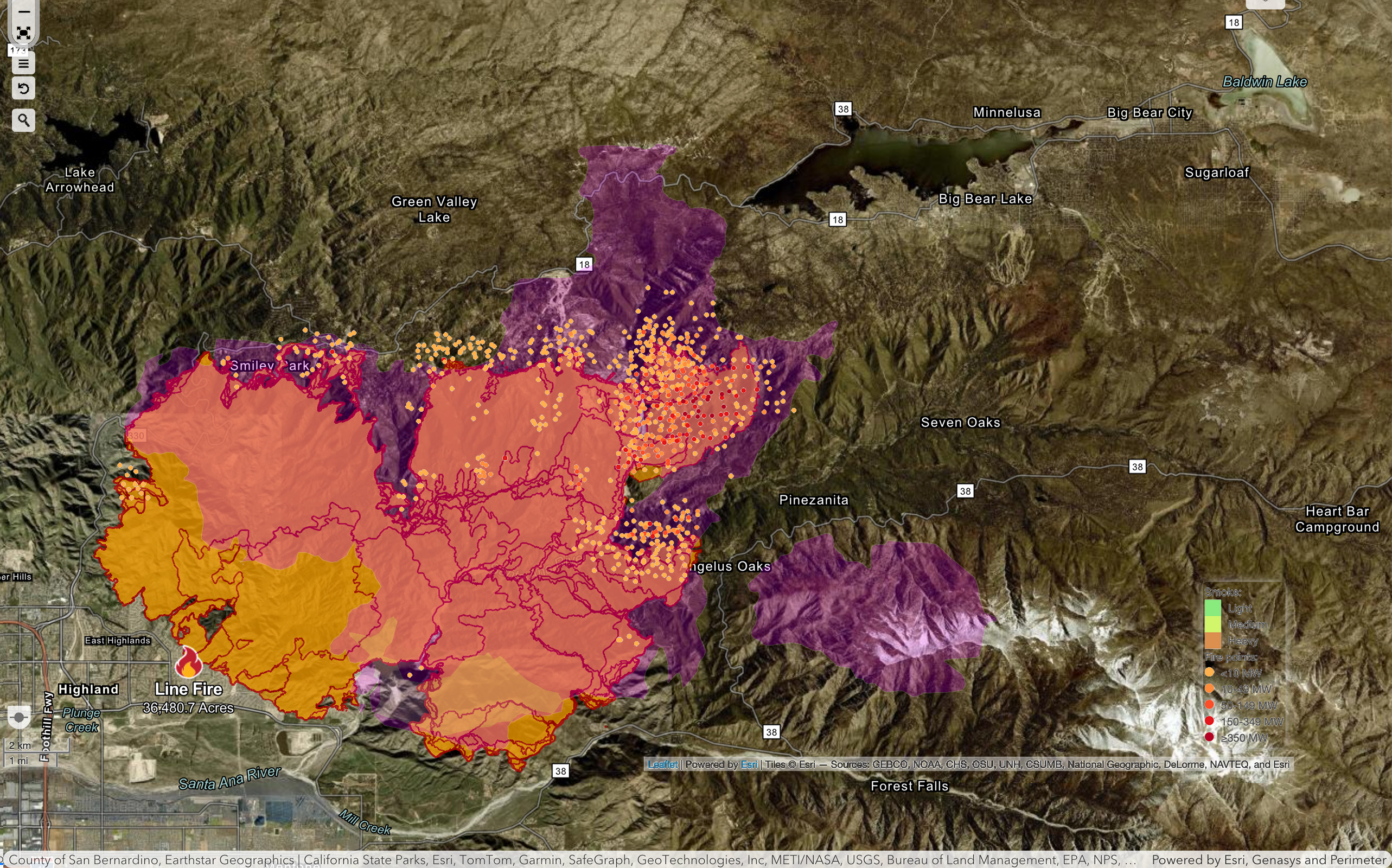
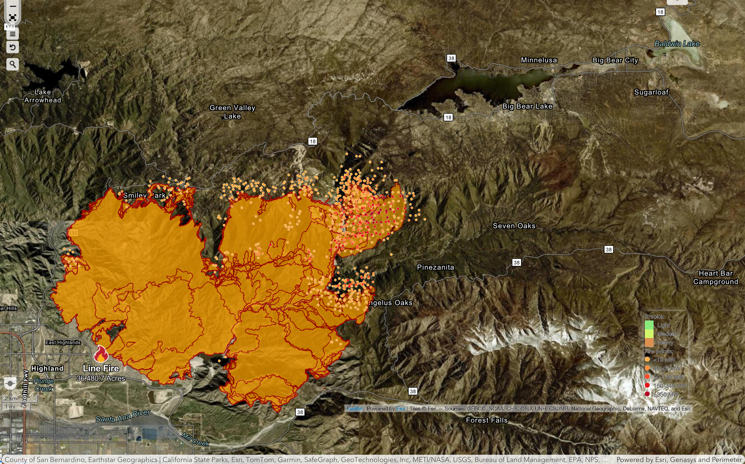
🗺
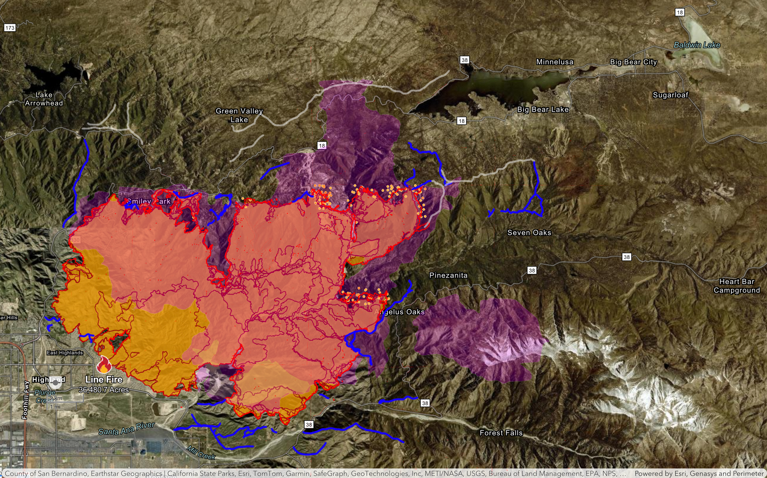
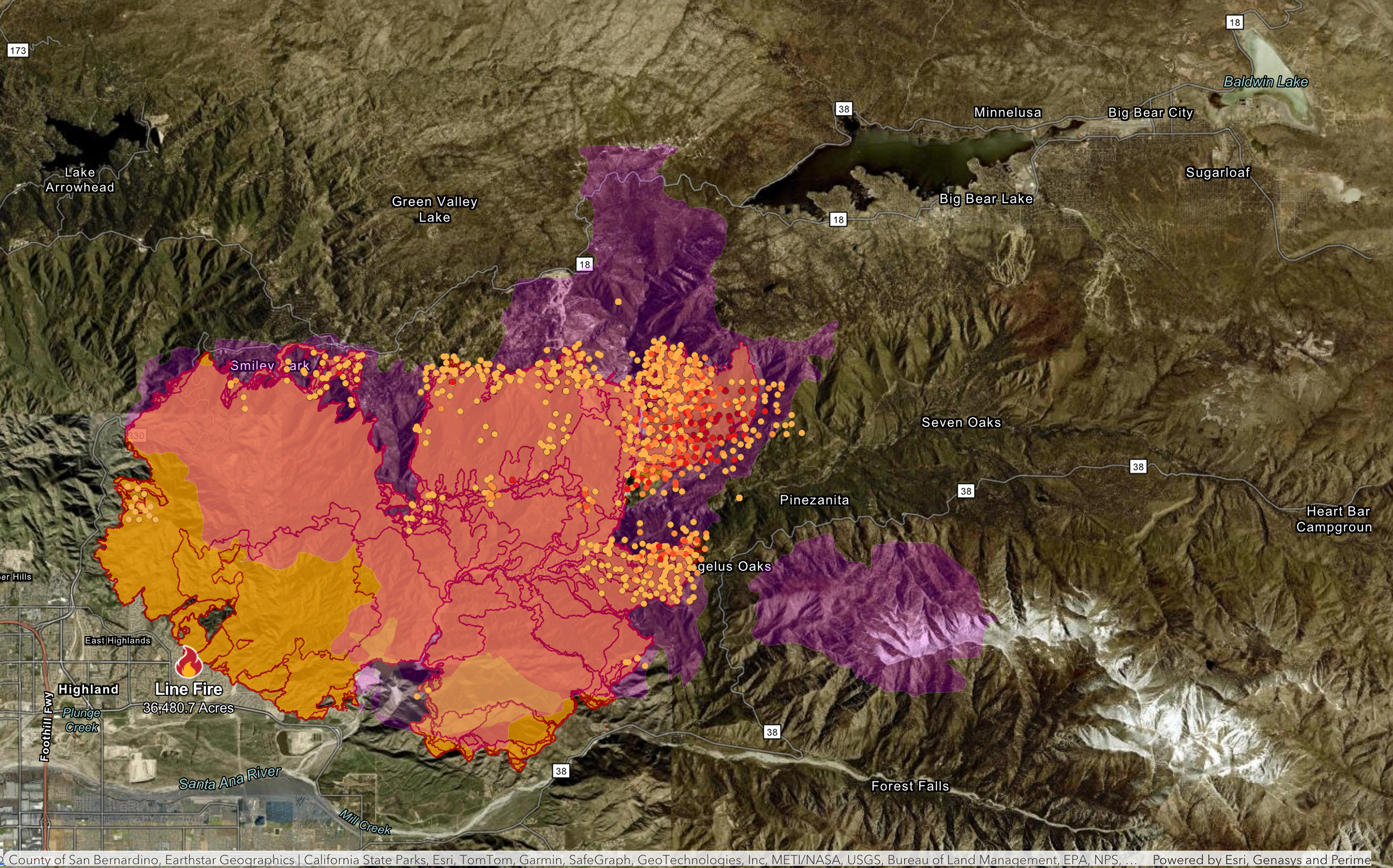
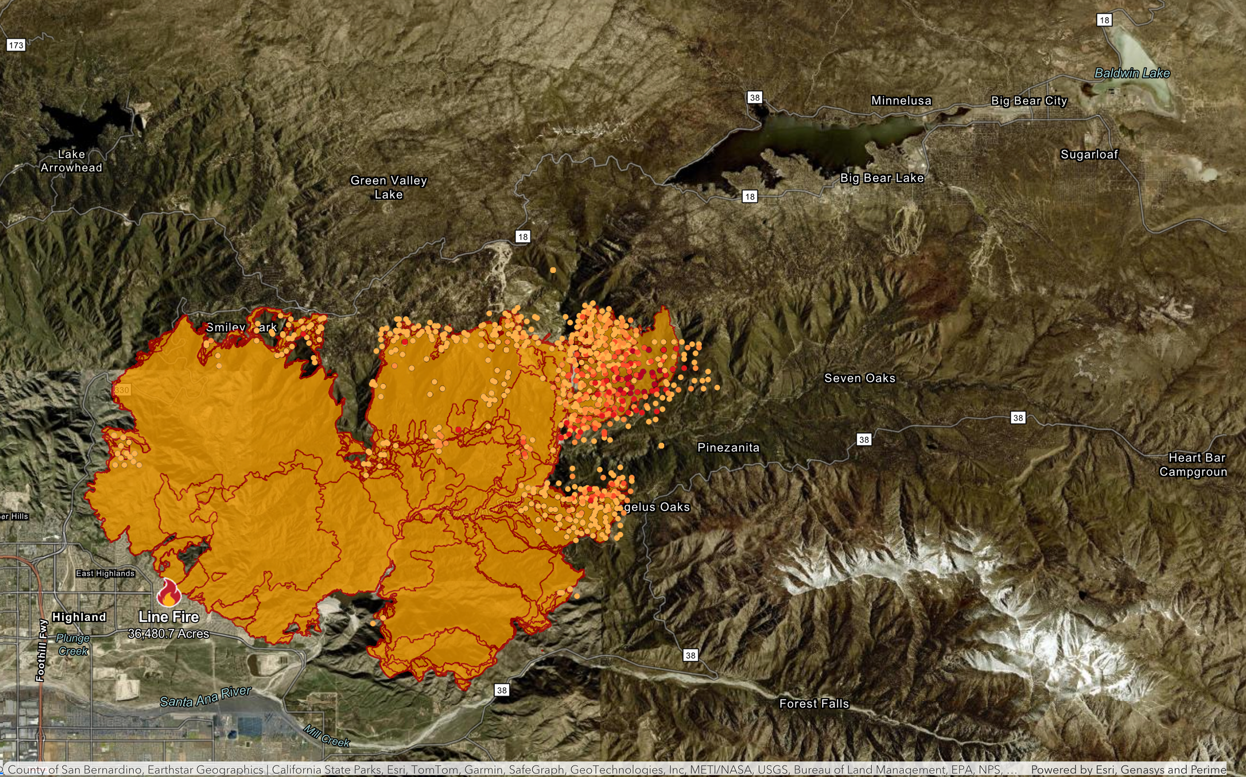
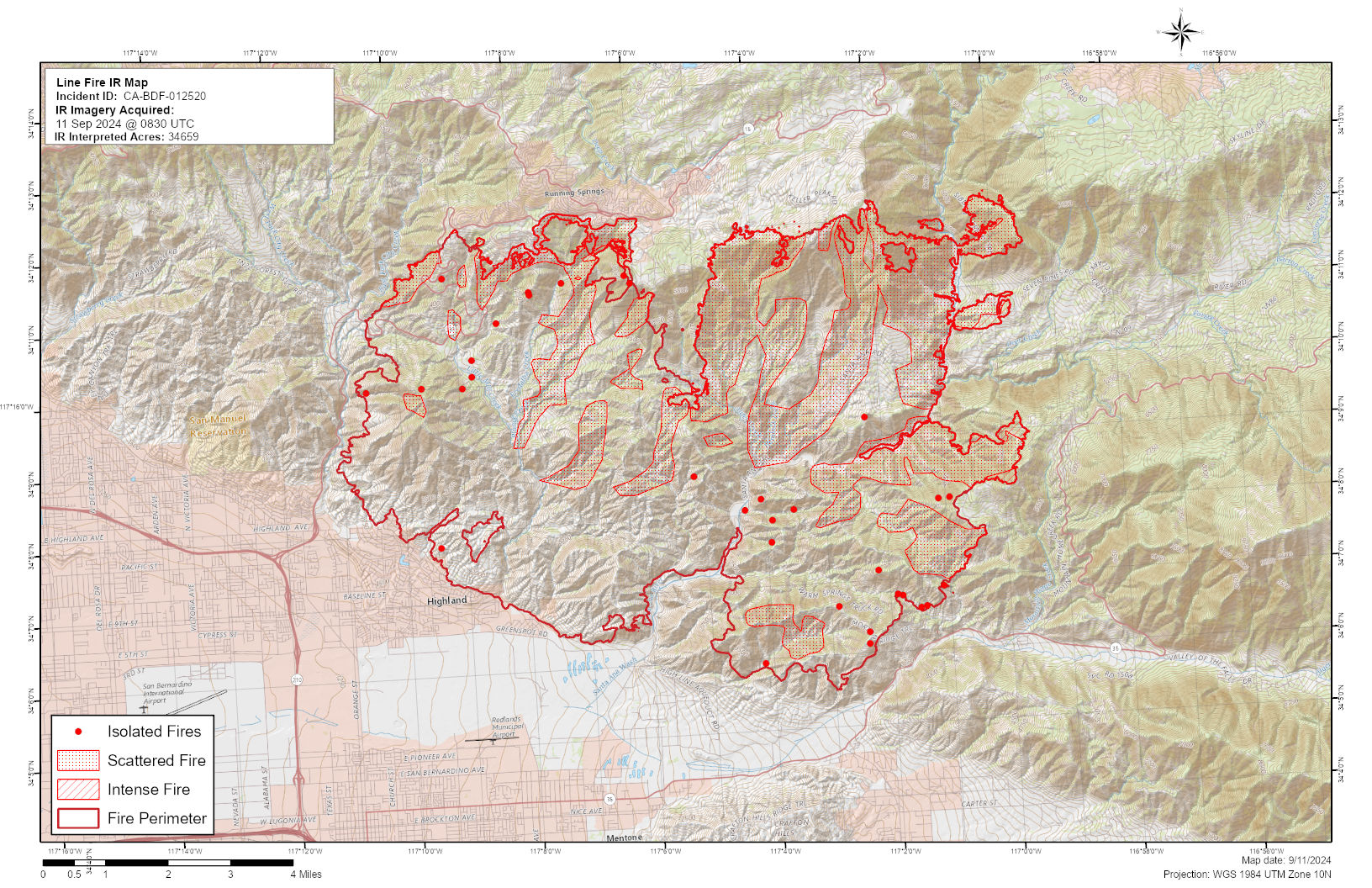
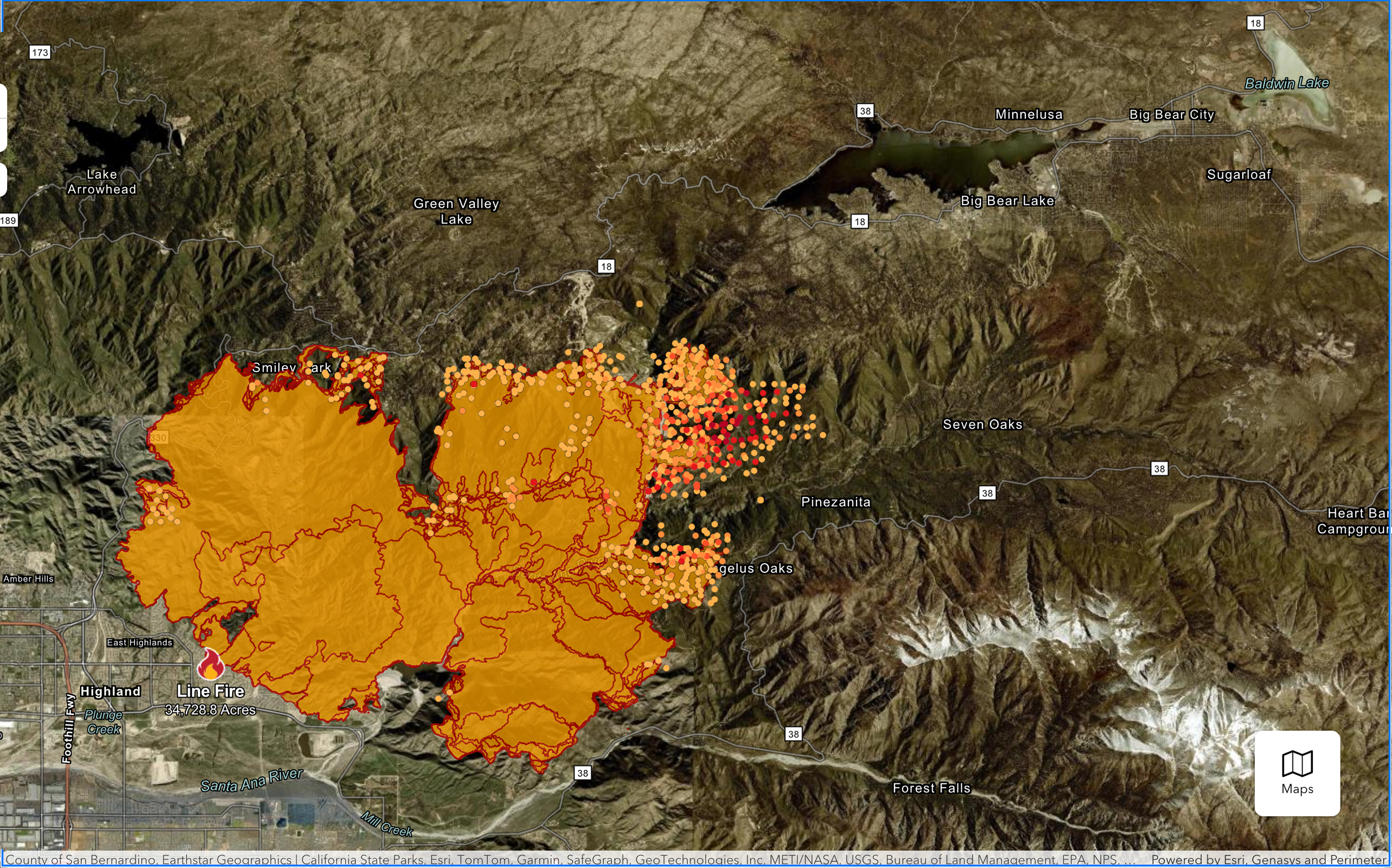
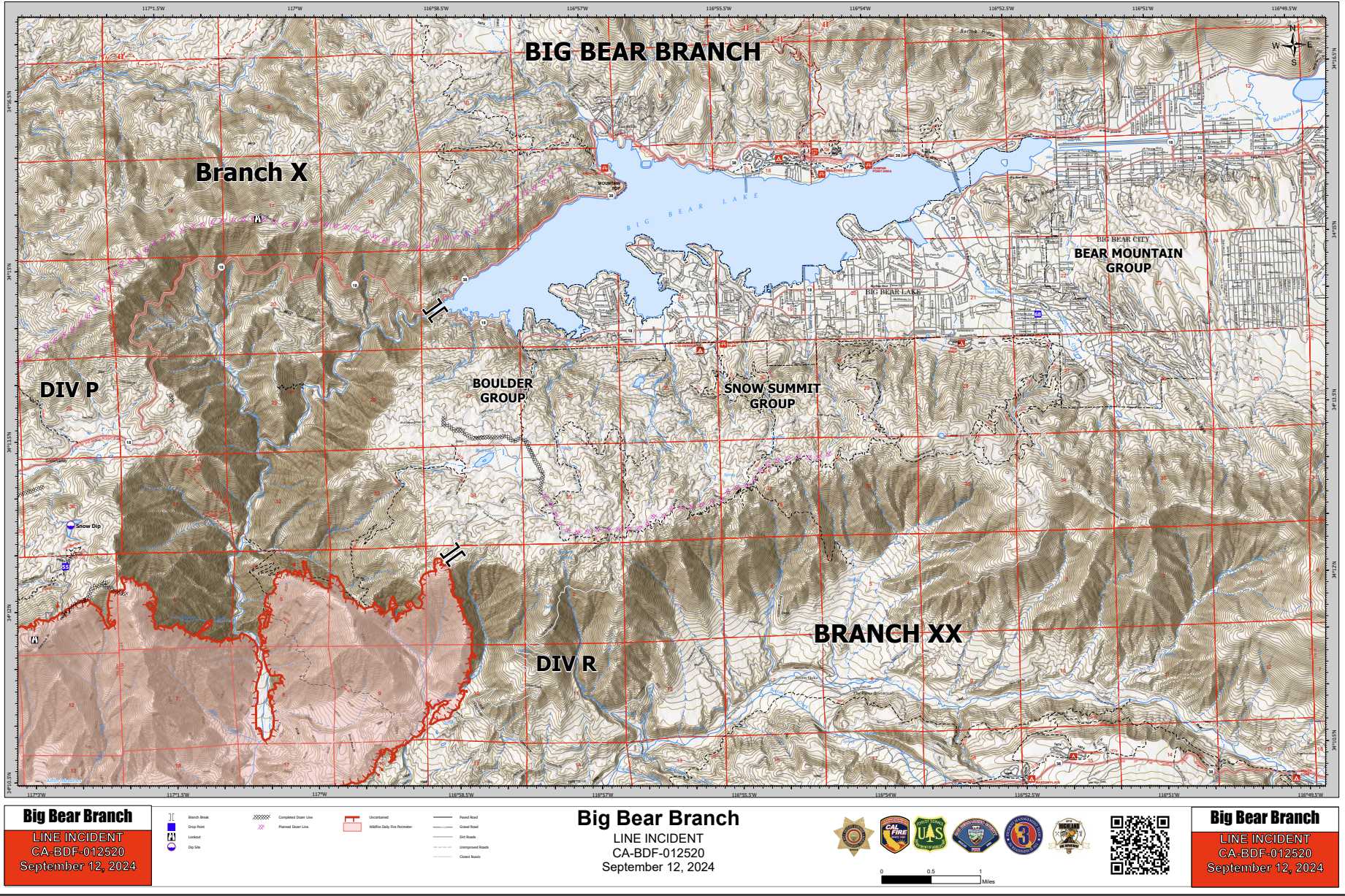
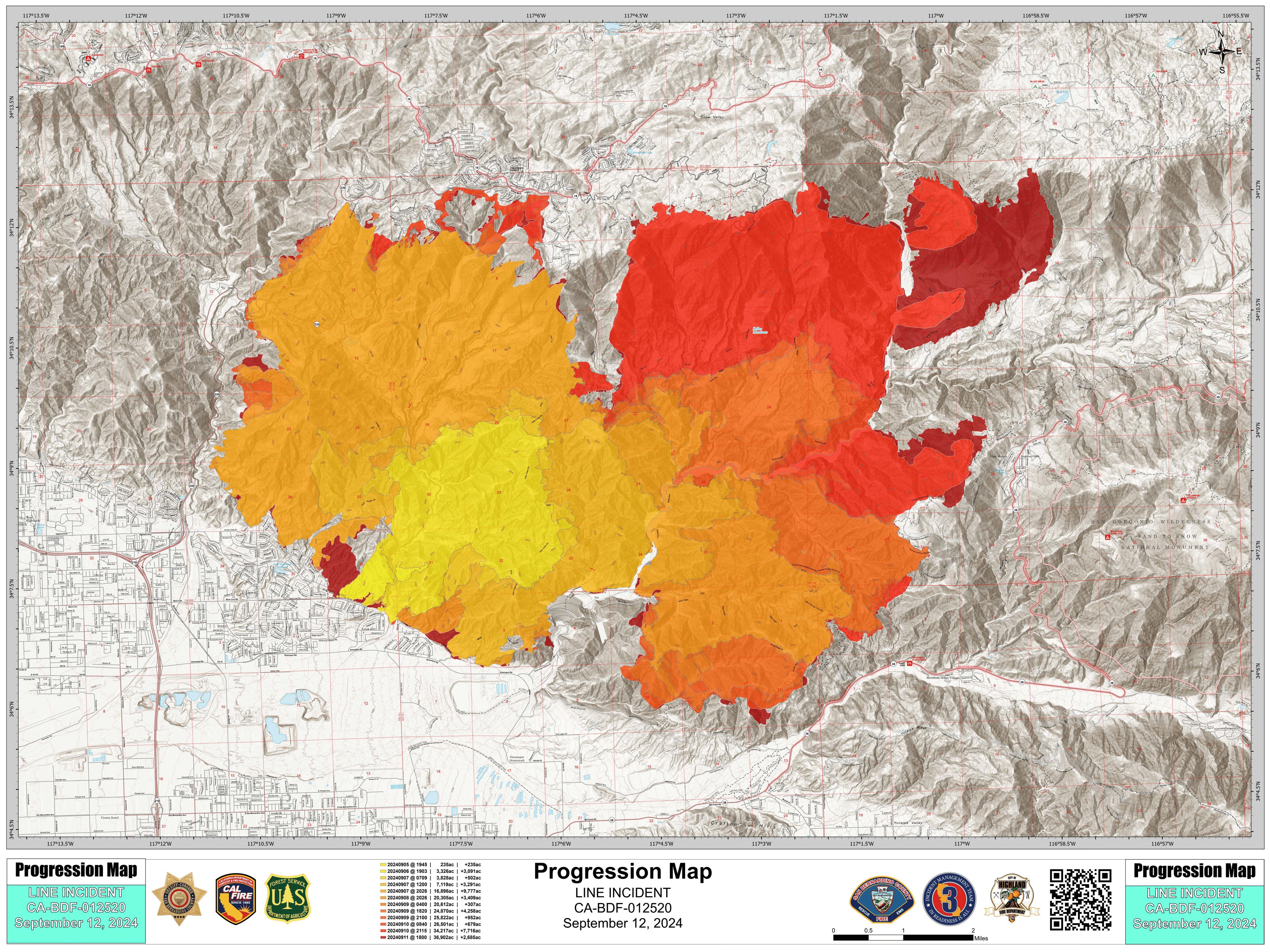
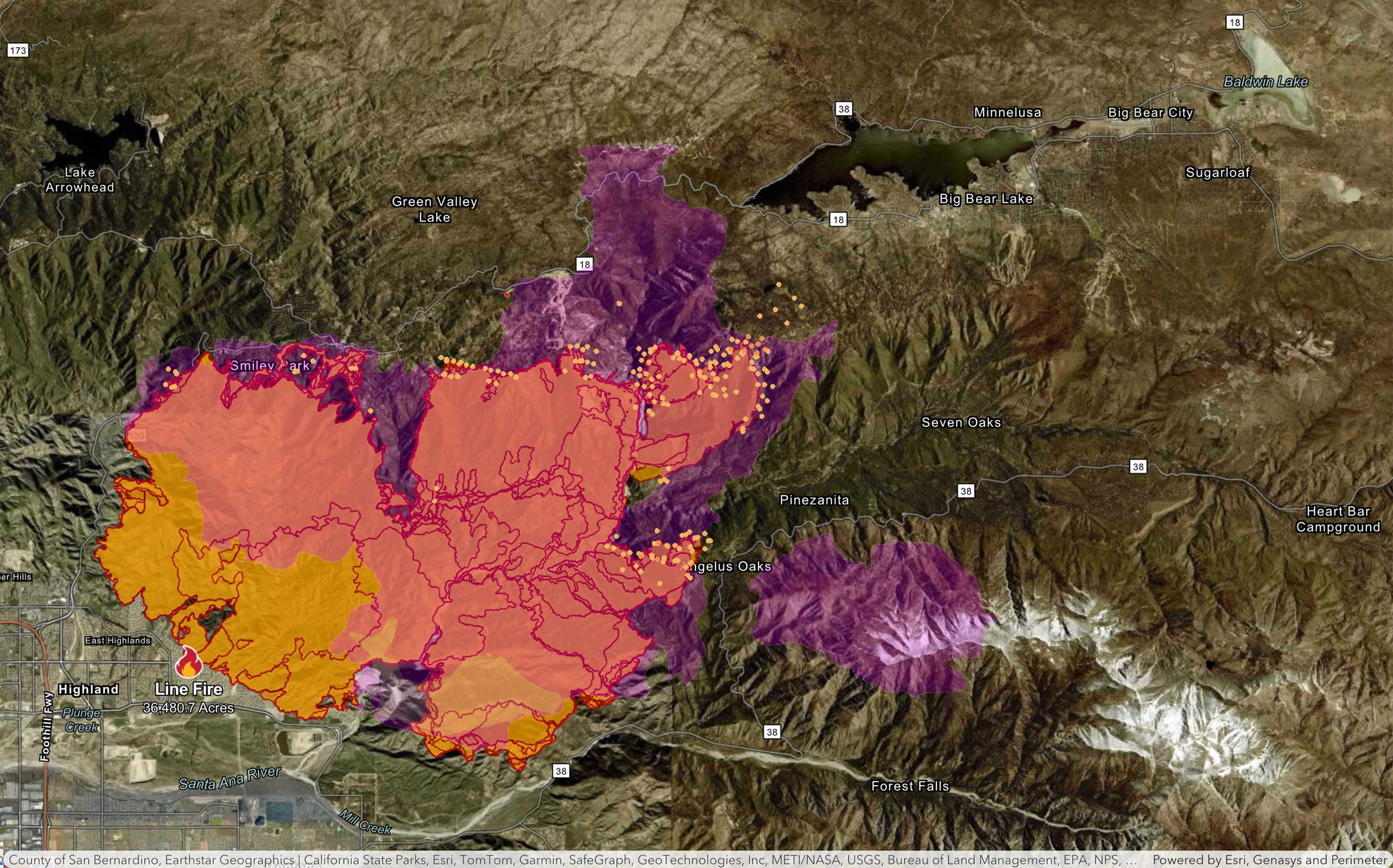
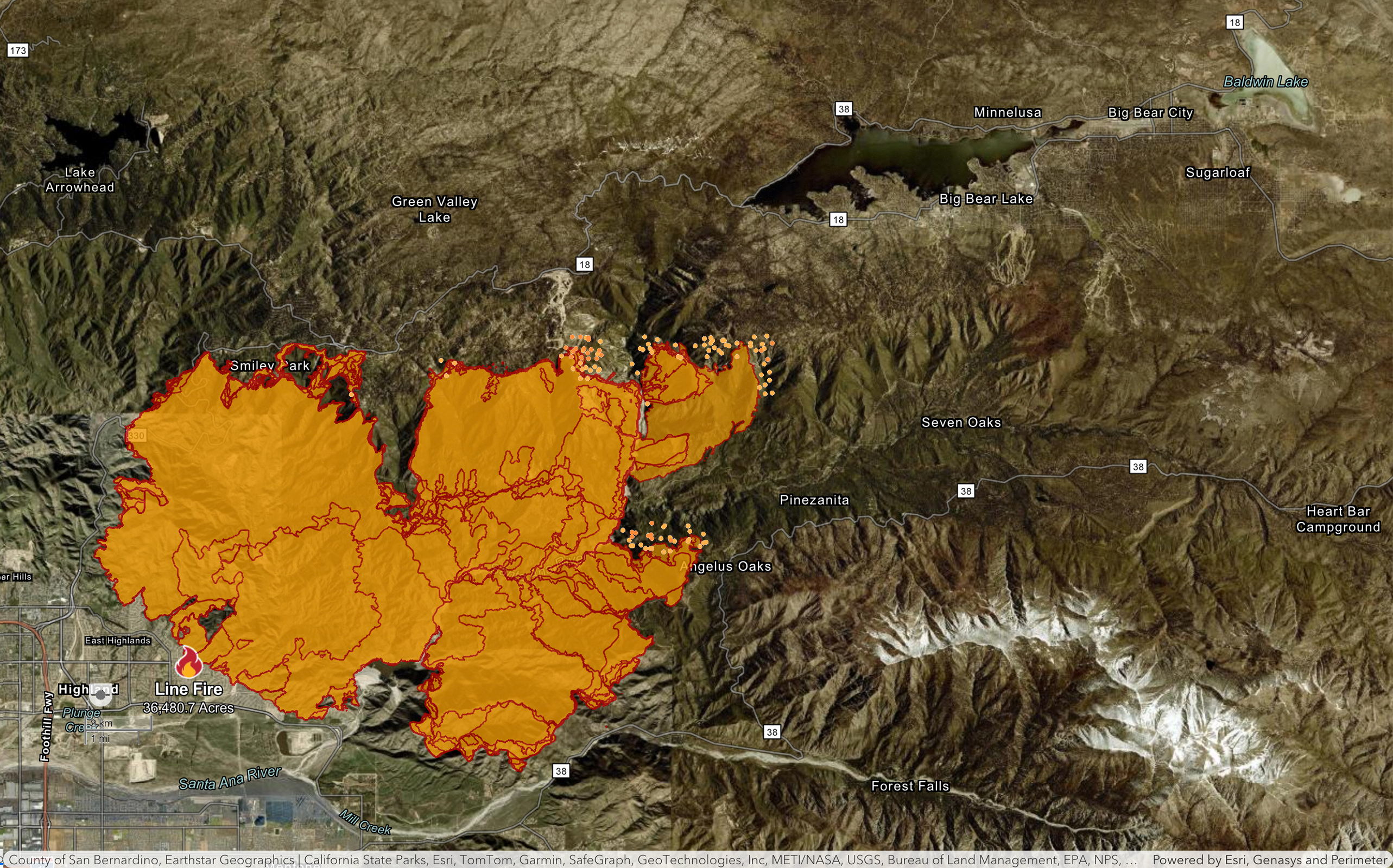
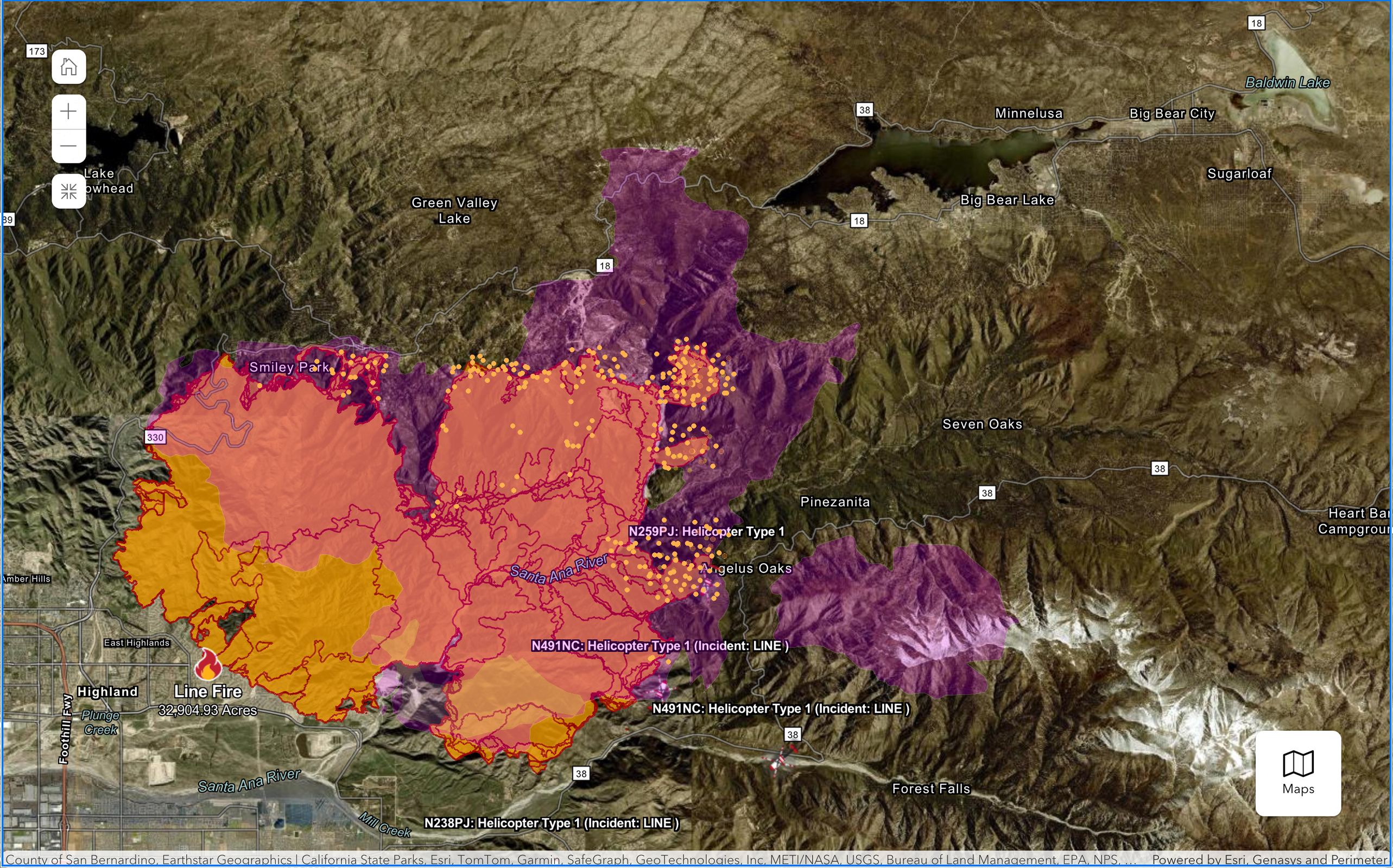
Line Fire Maps:
The latest maps are being curated in the comments below multiple times a day, but the most up-to-date maps should always be the direct sources listed right here:
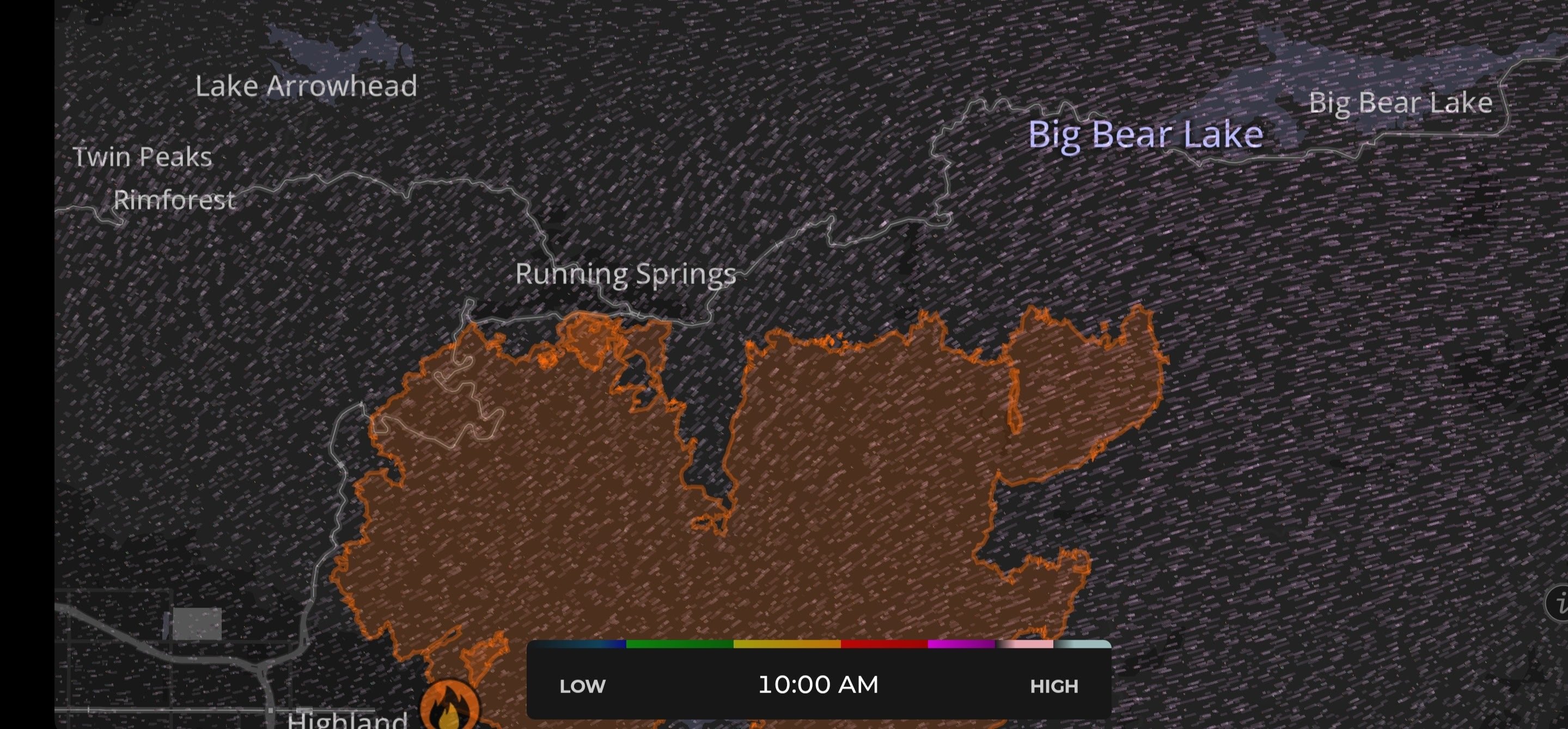
NOAA fire Map:
https://www.ospo.noaa.gov/products/land/hms.html#maps
The most reliable and frequently updated map that shows satellite readings of fire spread. This includes hotspots outside the perimeter, and a comprehensive smoke plume map.
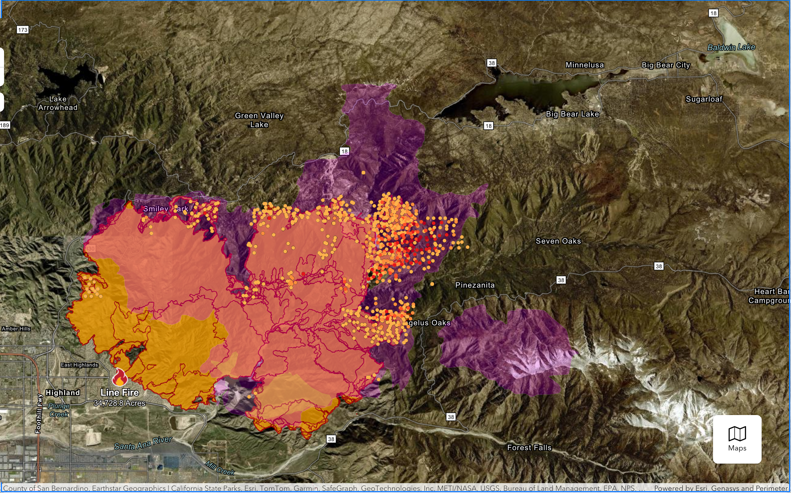
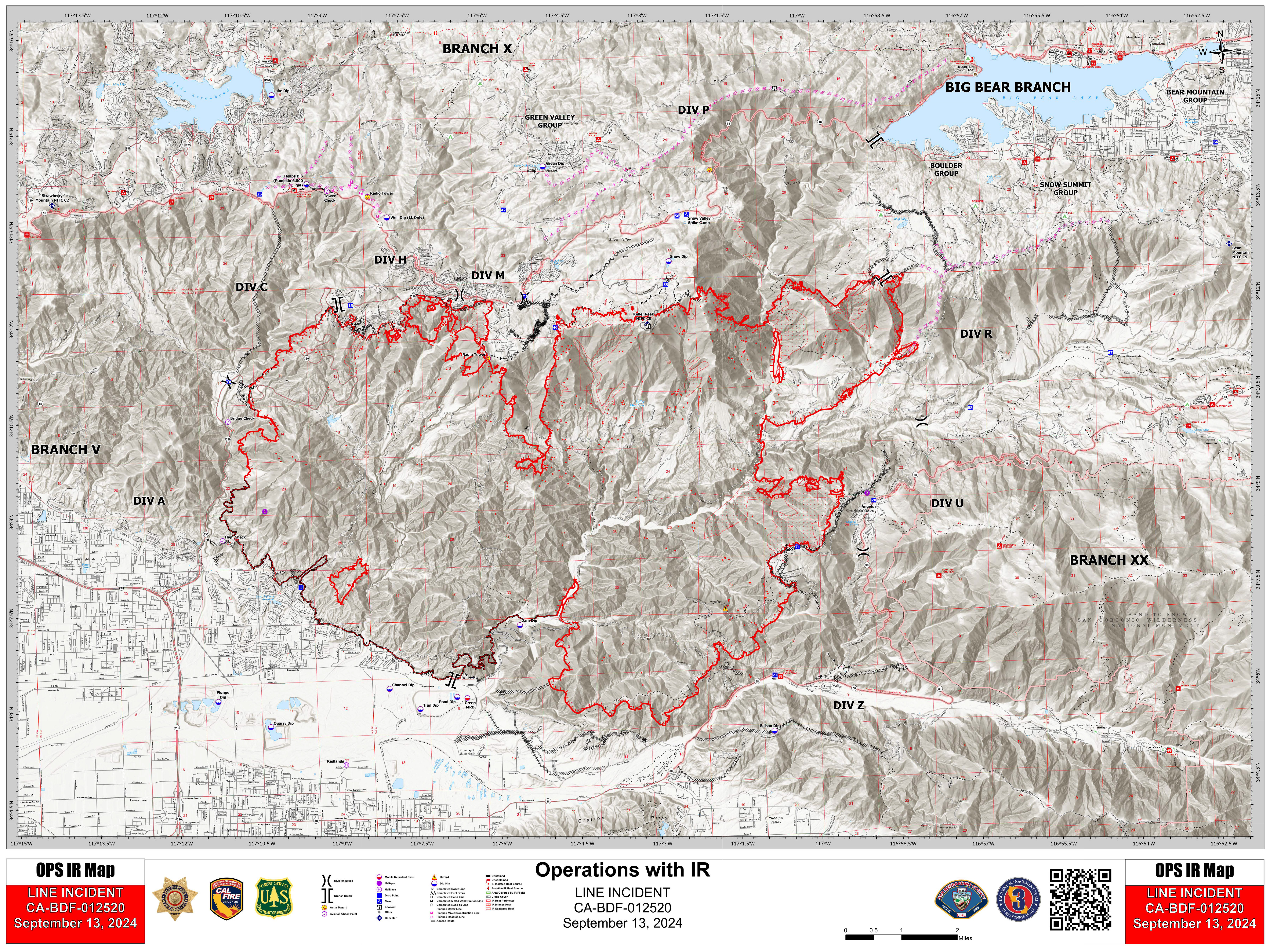
Official Cal Fire Map:
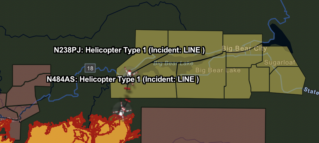
https://www.fire.ca.gov/incidents/2024/9/5/line-fire
Shows live aircraft positions, and is updated a few times a day. Very reliable and helpful to review evacuation warnings/orders
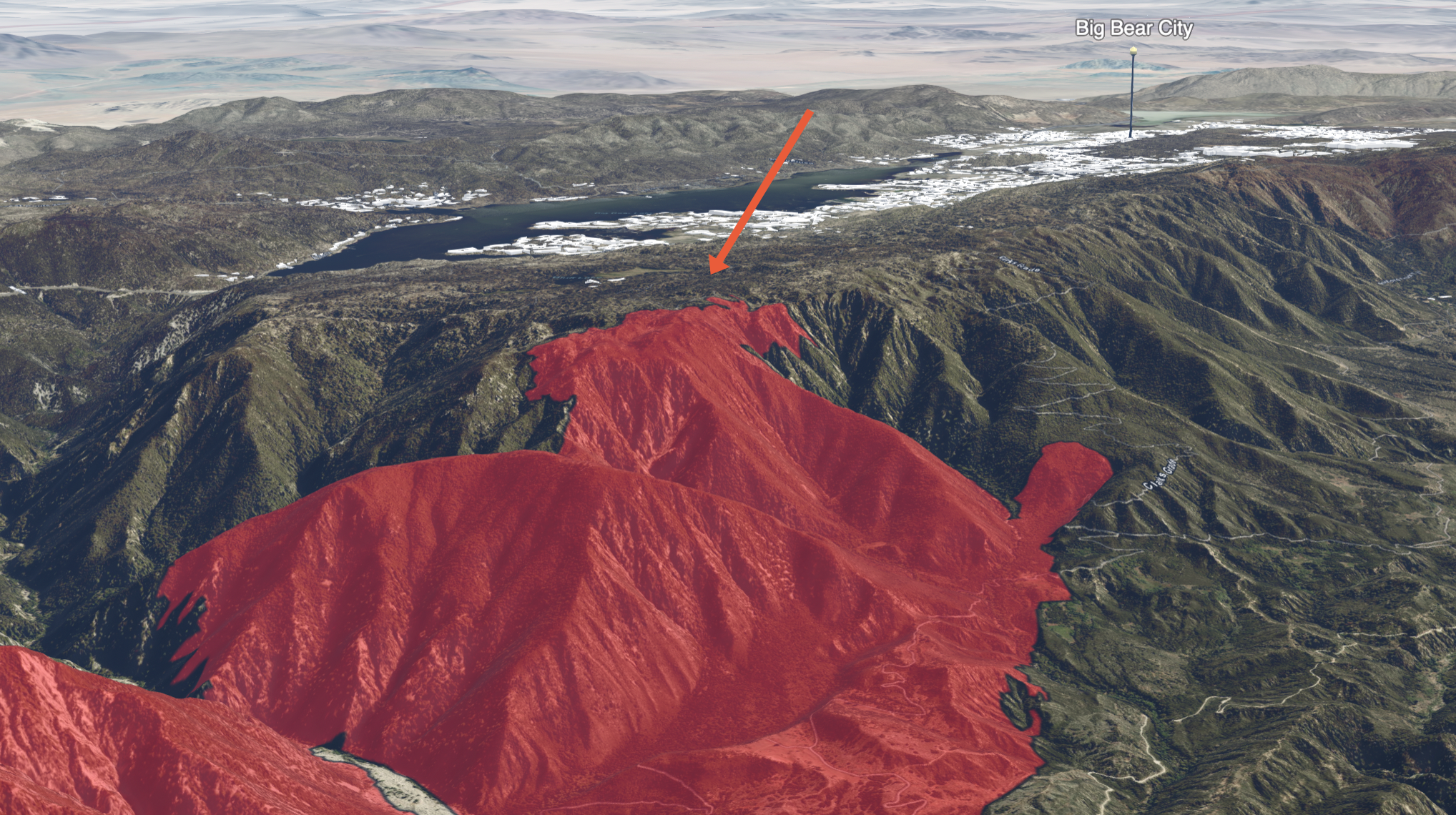
3D Fire Map by Cal Fire
https://calfire-forestry.maps.arcgis.com/home/webscene/viewer.html?webscene=52683f25df174b0eb124dfb9a6831a98
Not updated more than once or twice a day, but a very cool map to inspect.
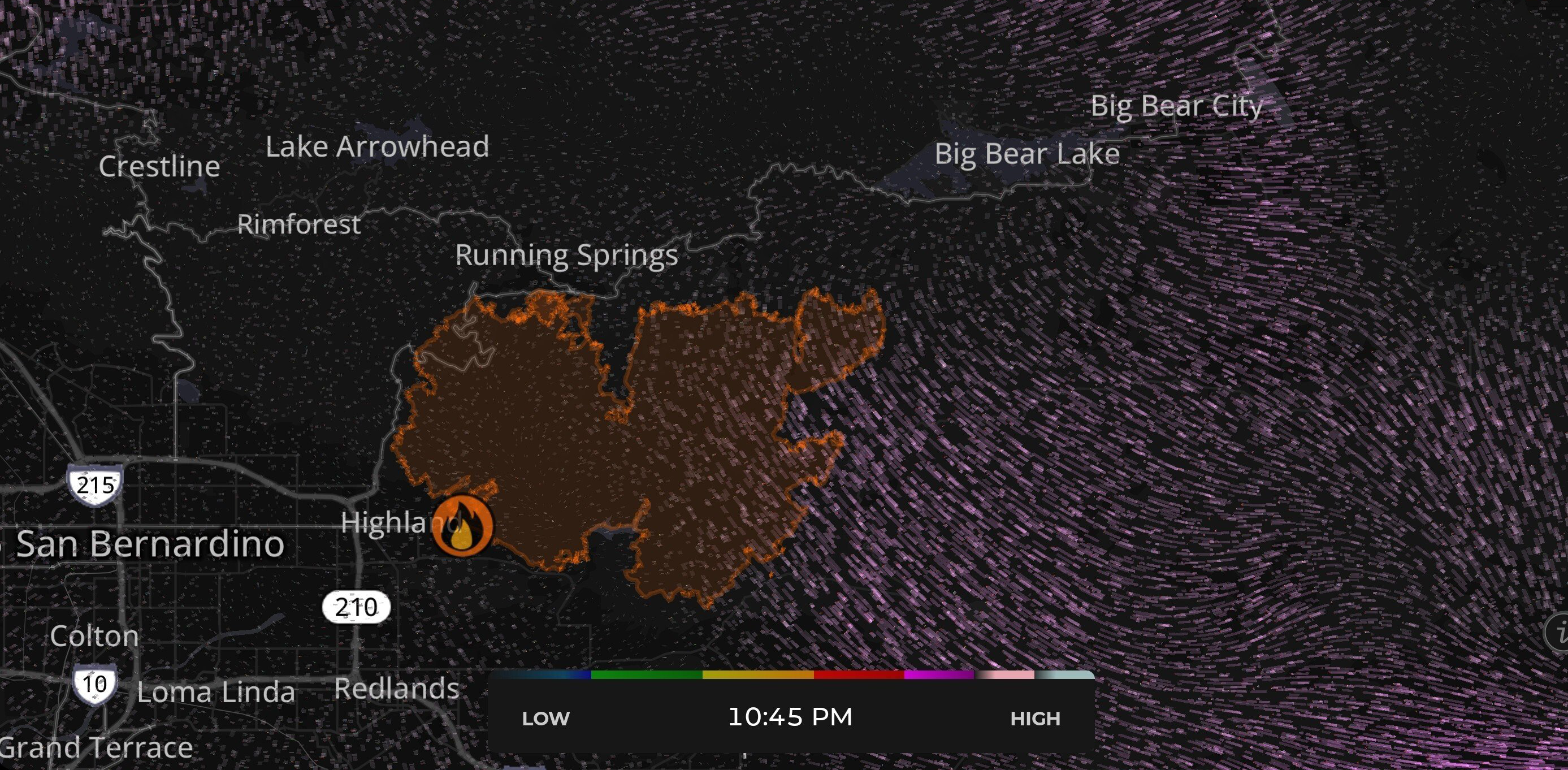
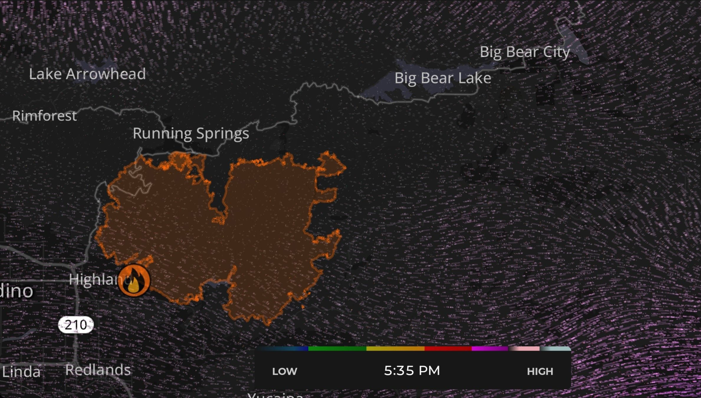
CleanAir Fire & Smoke Map
https://fire.airnow.gov/#10.64/34.2049/-116.9408
Updated more often than the Cal Fire map, and shows real-time air quality readings
Historical map of the Big Bear area
https://projects.capradio.org/california-fire-history/#10.76/34.1852/-116.9961/0/1
This is an extremely helpful tool for obtaining visual data of previous wildfire events. The linked map is centered on Big Bear and Arrowhead lake.
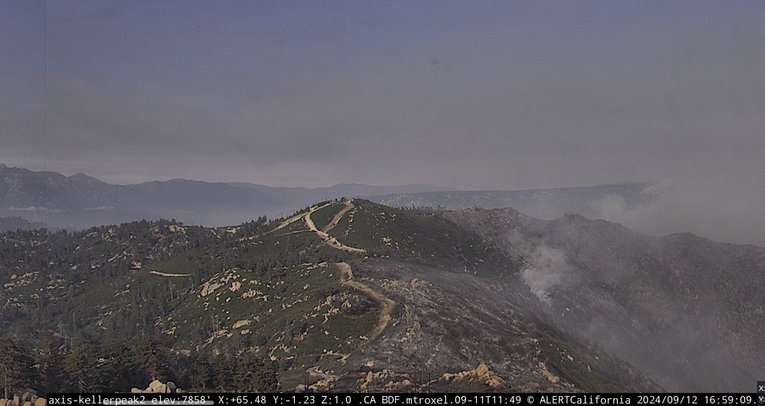
📹
Line Fire Webcams
https://ops.alertcalifornia.org/cameras
This network of cameras can be used to easily and intuitively view the fire from multiple angles.
📻
Line Fire Radio
https://scancalifornia.com/live/goldmine/
This covers radio chatter from firefighters tackling the Line Fire.
💬
Community Resources
https://socalmountains.com/e107_plugins/forum/forum.php
A forum for locals that's been around since 2003
Local Images
https://www.flickr.com/photos/calfire/albums/72177720320272950/with/53989492937
Big Bear City trash pickup was halted on Tuesday, Wednesday and Thursday of this week. Water and Sewer services are all continuing without disruption. (and I haven't personally experienced any power disruptions yet.)