cross-posted from: https://lemmy.world/post/14126220
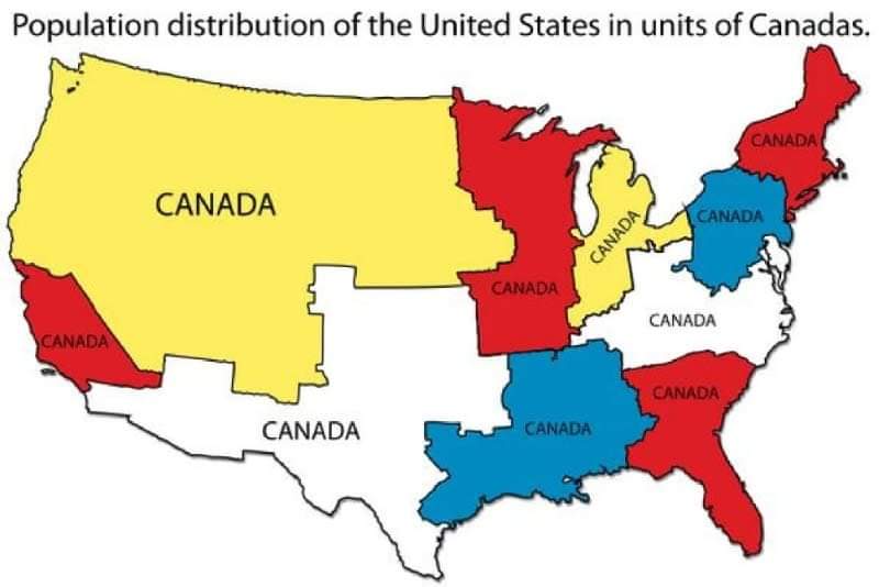
Distribution of the United States in Units of Canadas
Discover Cartographic Marvels and Navigate New Worlds!
Rules
cross-posted from: https://lemmy.world/post/14126220
Distribution of the United States in Units of Canadas
Pretty sure this is outdated. It shows 10 Canadas-worth of population, but Canada's population has been growing proportionally faster than the US. Canada recently was estimated to have crossed the line of 40 million and the US has 330 million, so it should be fewer than 10 Canadas-worth. It's still weird to me because most of my life I was taught Canada had a population of about 33 million.
I'm not sure I understand. Are these shapes Canadian provinces?
No, it's just dividing up the US into slices of equal population.
Equal geographic US population areas equivalent to Canada’s total population.
Anyone else find it weird there's 4 red canadas and only 2 each white/blue/yellow? Why not a couple green canadas instead of the extra reds?
Can't answer why they chose the colors they did at the frequency they did, but this is why only four colors: https://en.wikipedia.org/wiki/Four_color_theorem