this post was submitted on 23 Jan 2025
27 points (100.0% liked)
NASA's Perseverance Mars Rover
1537 readers
114 users here now
On the plains of Jezero, the secrets of Mars' past await us! Follow for the latest news, updates, pretty pics, and community discussion on NASA and the Jet Propulsion Laboratory's most ambitious mission to Mars!
founded 2 years ago
MODERATORS
you are viewing a single comment's thread
view the rest of the comments
view the rest of the comments

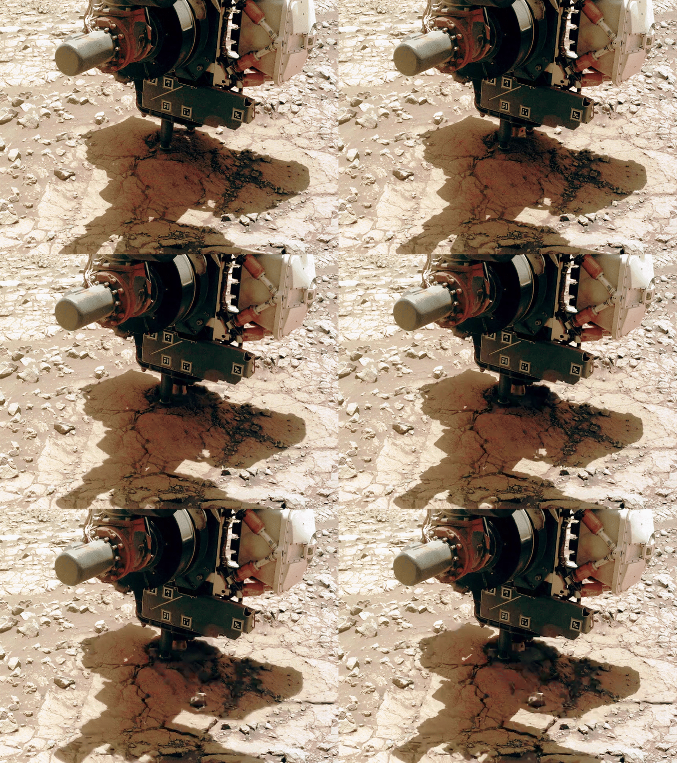
Are the "melting" rocks to the right, the result of heavy compression or did they use an LLM to generate missing image areas?
It is still great to see the in action (on Mars).
As Paul Hammond mentions, the "melting" is due to material sliding downhill. During the abrasion, which works partly by percussion, you can actually see a pebble sliding downhill (between this frame and this frame, which were taken only one minute apart), to the bottom right of the abrasion bit itself (near the centre of the image).
It's not always apparent from the images, but the rover is currently on a fairly steep slope; we're still parked on the exterior/outboard side of the Jezero Crater rim. I wonder how difficult it would be to make the 3D images I used to see from earlier rover missions...
The folk at MSSS MastCam-Z team create and share 3D models featuring some of the sample sites and other points of interest, these are posted on SketchFab. So far they have posted 221 models, here's the link to the MastCam-Z channel https://sketchfab.com/Mastcam-Z/models
Thank you! I've seen some of these before when looking at 3D models of the abrasion patches, but those shape models are quite useful in general.
I was thinking specifically of the "anaglyph" images we used to get from the MER PanCams and NavCams (such as the "Legacy Pan" from Opportunity). Even individual 3D frames could be quite mind-blowing in demonstrating the true ruggedness of those landscapes. The environments in and around Jezero, let alone Mt. Sharp, can't be any less rugged than those were.
We used to get get occasional post drive red/cyan 3D anaglyphs from JPL for MSL, but it looks like they got dropped when they redesigned their web pages as I can't find them now.
As far as M2020 goes, converting the wide angle lenses of the NavCams will likely be hard? But in the next weeks I'll have a go. In the past folk don't appreciate the red/cyan anaglyphs, but that was in the days of Reddit, so if I can make any we'll see how they go down :)
Hahaha I hear you, Paul. In the end, I'm just going to have to bite the bullet and learn how to work with images myself. I didn't mean to put everything off onto you 😄
As for people not appreciating the images, or the general stream of information from the rover(s), I'm proceeding on the theory that it's hard to appreciate what these missions do without the context being readily available. Even in sifting through aaaall the images I needed to assemble my overview of the abrasion patches, I could see that I needed to rapidly compare and contrast several different abrasion sites to get a quick visual feel for the differences between them. And if someone like me feels this way, I can only imagine how difficult it might be for the casual social media user to see how exciting "another red rock" might be. Geologists aren't always the best at outreach, but I believe the attempt is worth it in my case.
I can't help with the 3D images just yet, but I'll see what I can do after I post my overview.