26
10
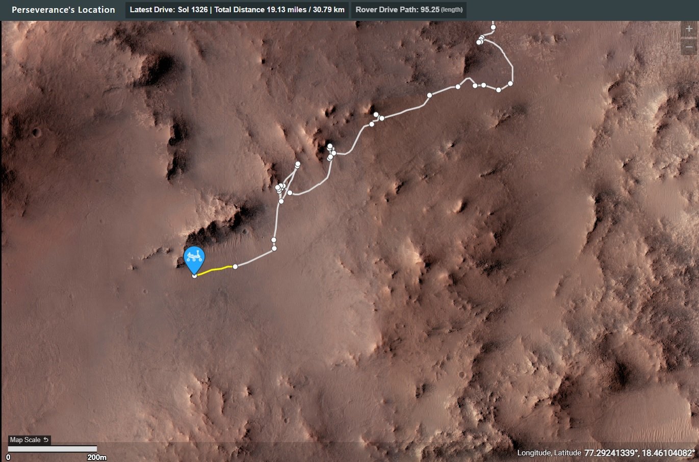
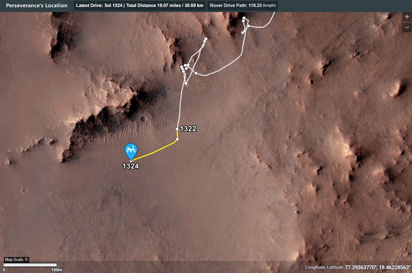
1326 - Traverse map. Looks perfectly placed to check the western edge of Pico Turquino
(lemmy.world)
Screen capture of the online mission map
On the plains of Jezero, the secrets of Mars' past await us! Follow for the latest news, updates, pretty pics, and community discussion on NASA and the Jet Propulsion Laboratory's most ambitious mission to Mars!
Screen capture of the online mission map
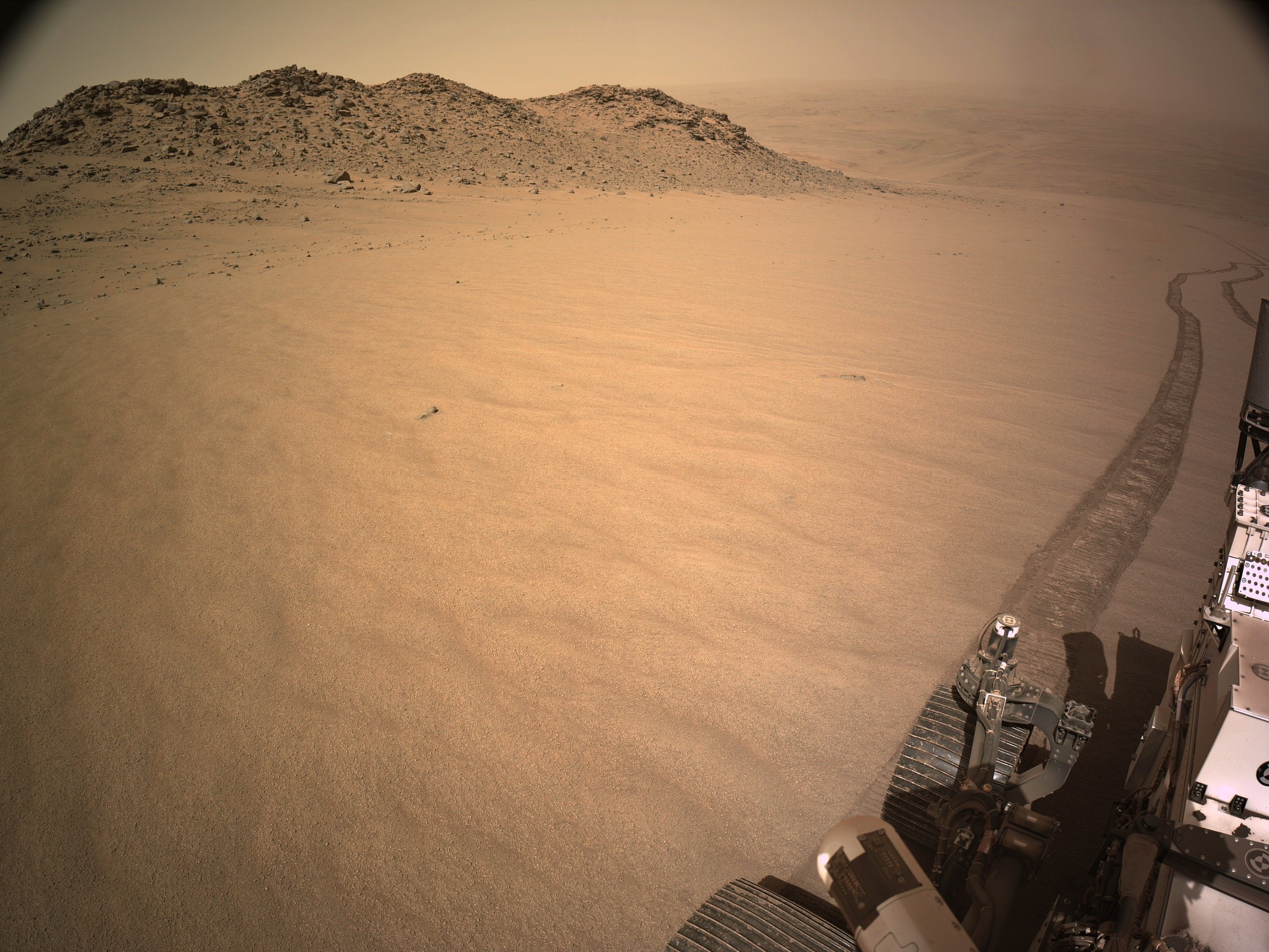
post drive 4-tile L-NavCam. Now at site 62.0. Details and map for the drive/climb are not yet available, will share ASAP
Image credits: NASA/JPL-Caltech
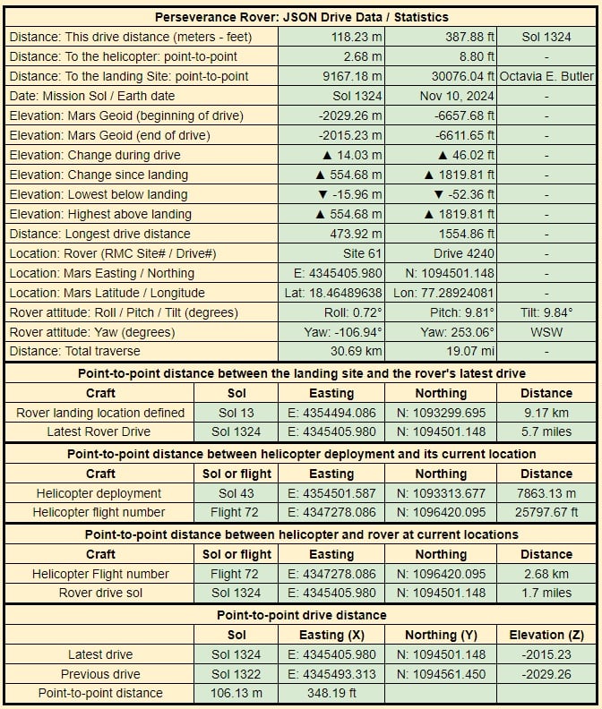
Data taken from JPL's JSON feeds.
The JSON details are updated by JPL shortly after each drive
End-of-drive NavCam from site 61.4240. Map and drive details will follow once JL release the formal data. NASA/JPL-Caltech
EDIT: Corrected an error in the estimated elevation change
NASA/JPL-Caltech
Credits: NASA/JPL-Caltech/ASU/MSSS

And the full version:

The zoomed in version has better typesetting, since the full was made by editing the older versions. The next one will be better.

... because the overhangs, and all the holes among these many boulders, would make me nervous if I was roving the slopes of this giant crater rim. We know that Percy is a very determined astro-droid, but there are too many places for tech scavengers to hide around here. Although I guess they would have to be pretty small jawas...
Link to full Mastcam-Z frame

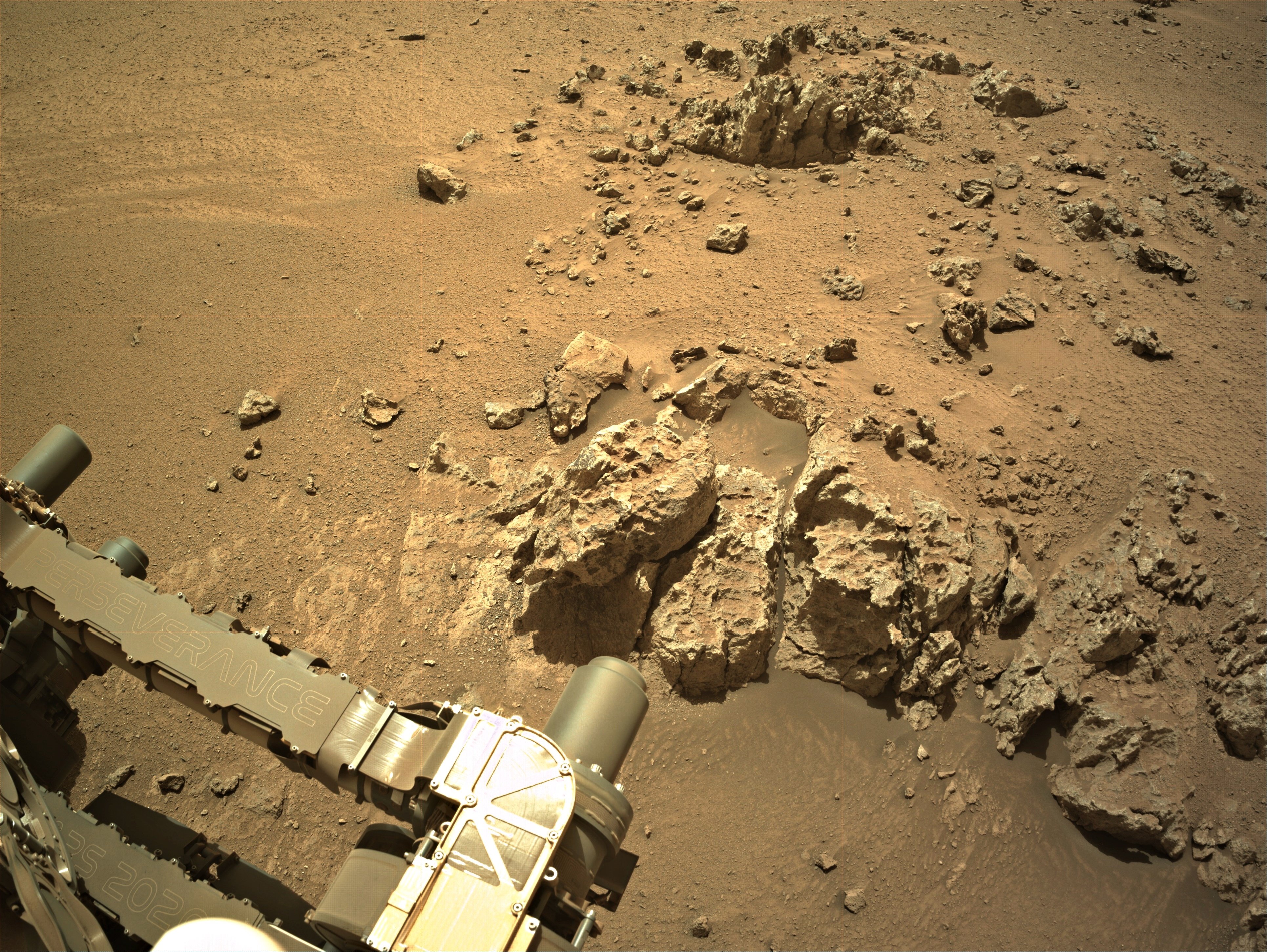
Pick a rock, any rock 😜
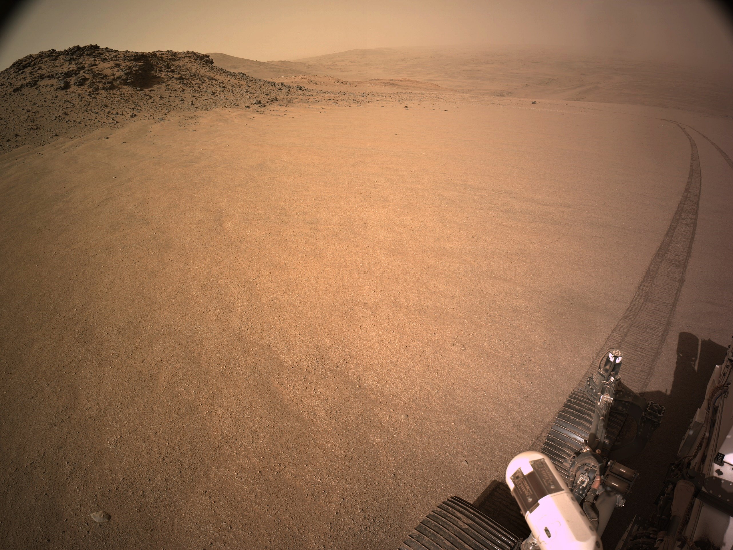
9-tile end-of-drive R-NavCam.
Site 61.2782
No details of the official distance yet, but it's just a few meters, I'll post the drive details and updated map asap
NASA/JPL-Caltech
Data is extracted from JPL's JSON files that are updated after each drive

The drive on 1320 is highlighted with a yellow path.
The small white circles are waypoints

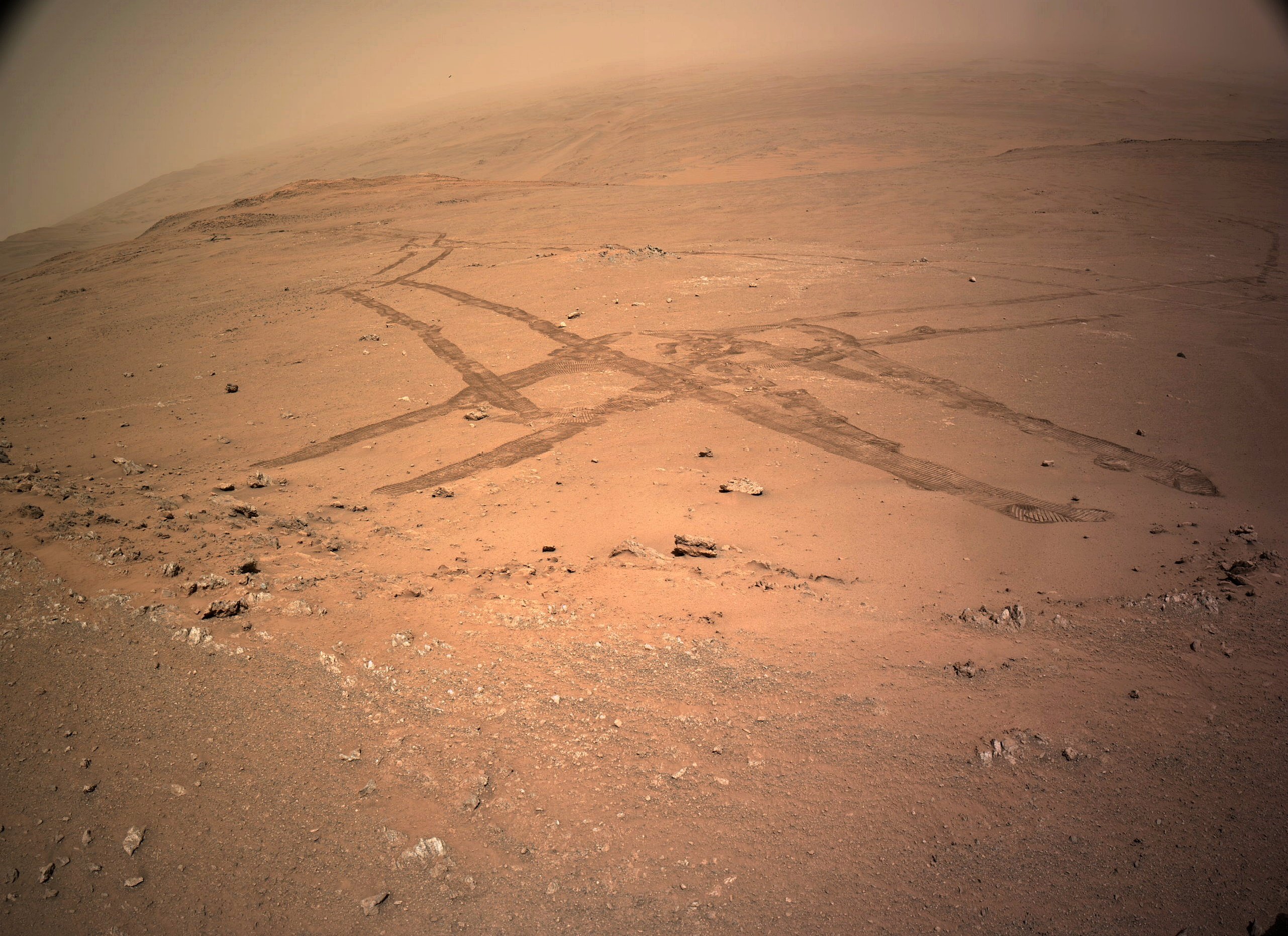
The rover's tracks in this image show us its complex journey exploring this section of its climb out of the crater. This end-of-drive post-drive tiled NavCam was acquired after a drive on November 6, 2024 (Sol 1320) of ~29 meters / ~95 ft to the north, arriving on the oposite side of a small ridge the rover explored several sols ago. Credits: NASA/JPL-Caltech
Next stop Pico Turquino?
Pico Turquino: Is the next science waypoint identified by the team. IIRC it is believed to contain fractured rocks that were once possibly altered by hot springs

Raw data supplied by JPL after every drive on their JSON pages

End-of-drive L-NavCam looking West towards Pico Turquino (image center)

Data extracted from JPL's JSON pages. The data is updated by JPL shortly after each drive


