NASA's Perseverance Mars Rover

1450 readers
72 users here now

On the plains of Jezero, the secrets of Mars' past await us! Follow for the latest news, updates, pretty pics, and community discussion on NASA and the Jet Propulsion Laboratory's most ambitious mission to Mars!

founded 1 year ago
MODERATORS
26


And the full version:

The zoomed in version has better typesetting, since the full was made by editing the older versions. The next one will be better.

27


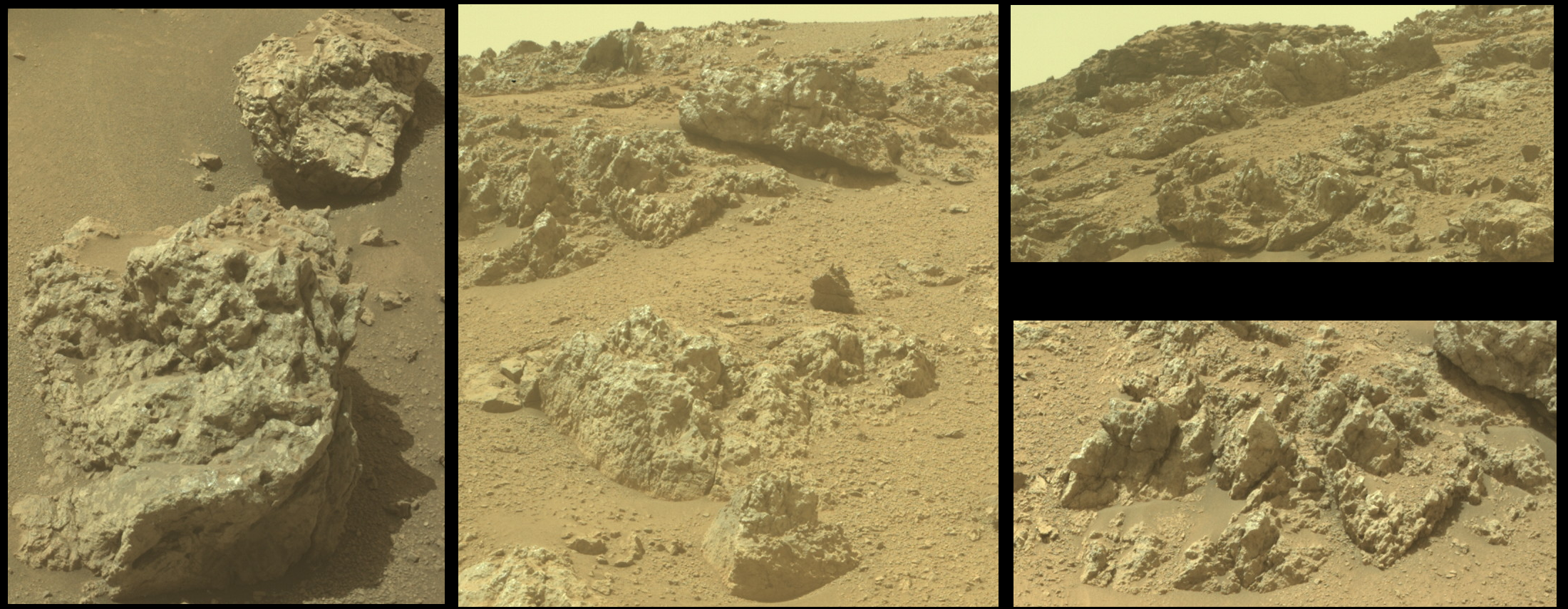
... because the overhangs, and all the holes among these many boulders, would make me nervous if I was roving the slopes of this giant crater rim. We know that Percy is a very determined astro-droid, but there are too many places for tech scavengers to hide around here. Although I guess they would have to be pretty small jawas...

Link to full Mastcam-Z frame

28


Pick a rock, any rock 😜

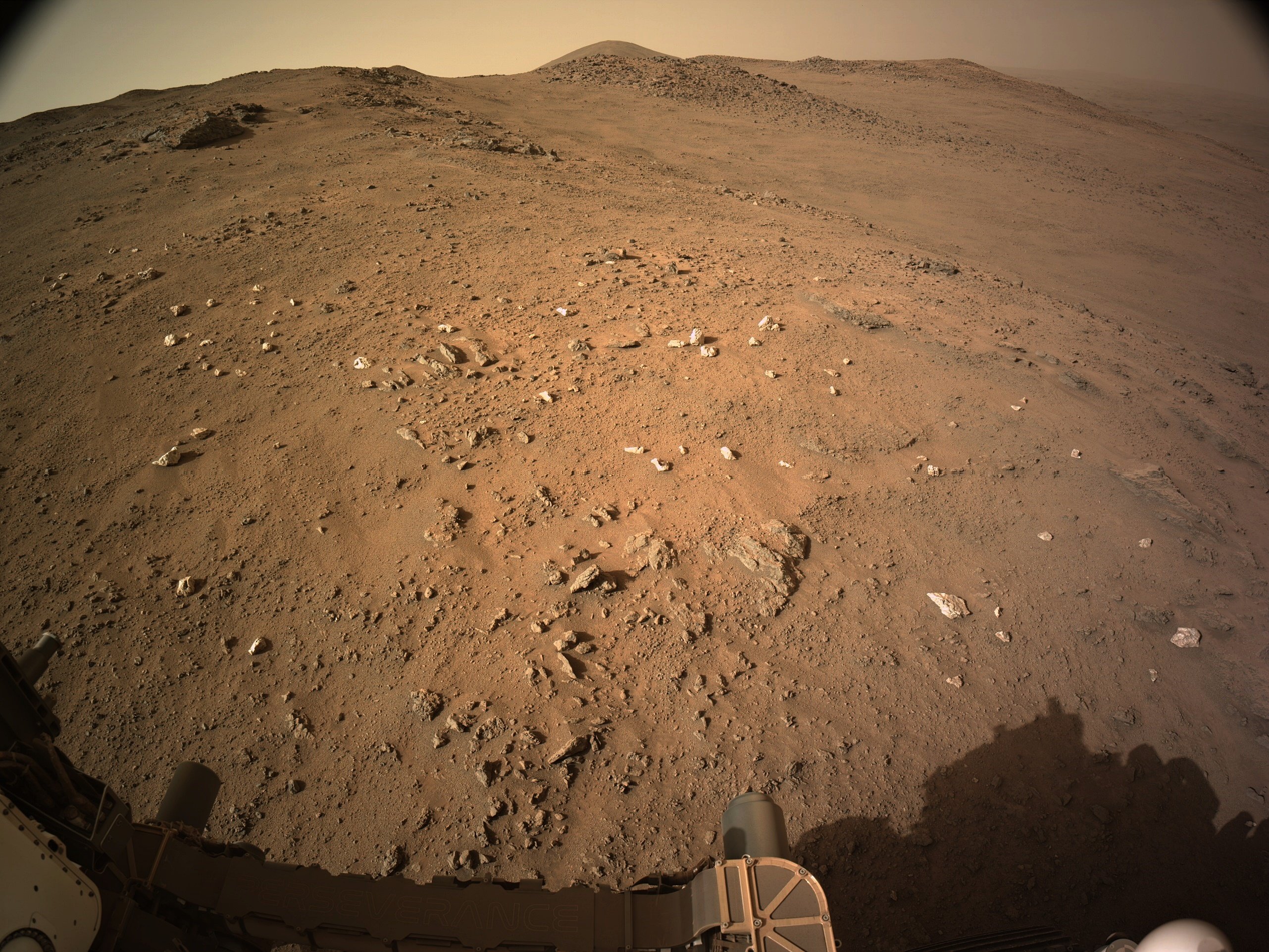
9-tile end-of-drive R-NavCam.

Site 61.2782

No details of the official distance yet, but it's just a few meters, I'll post the drive details and updated map asap

NASA/JPL-Caltech

29


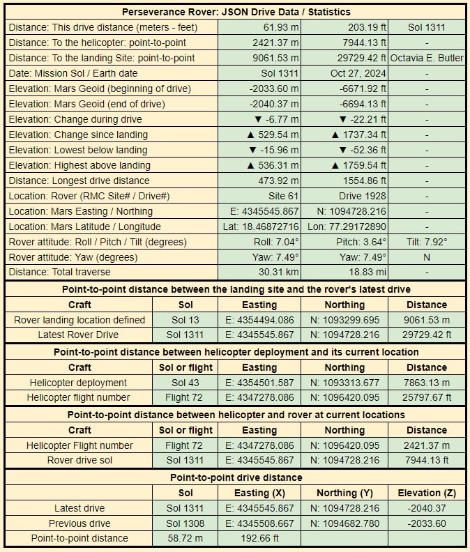
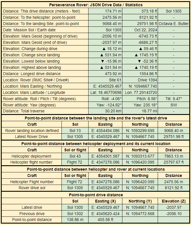
Data is extracted from JPL's JSON files that are updated after each drive

30


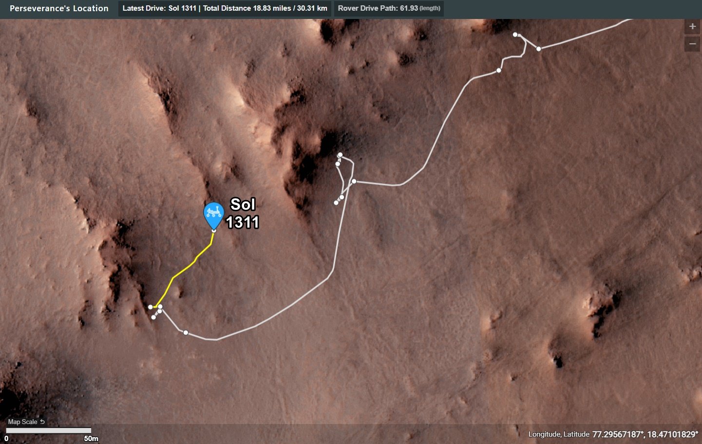
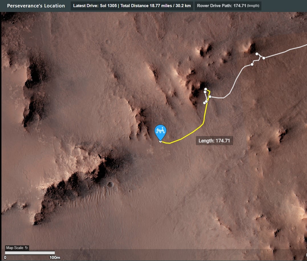
The drive on 1320 is highlighted with a yellow path.

The small white circles are waypoints

31


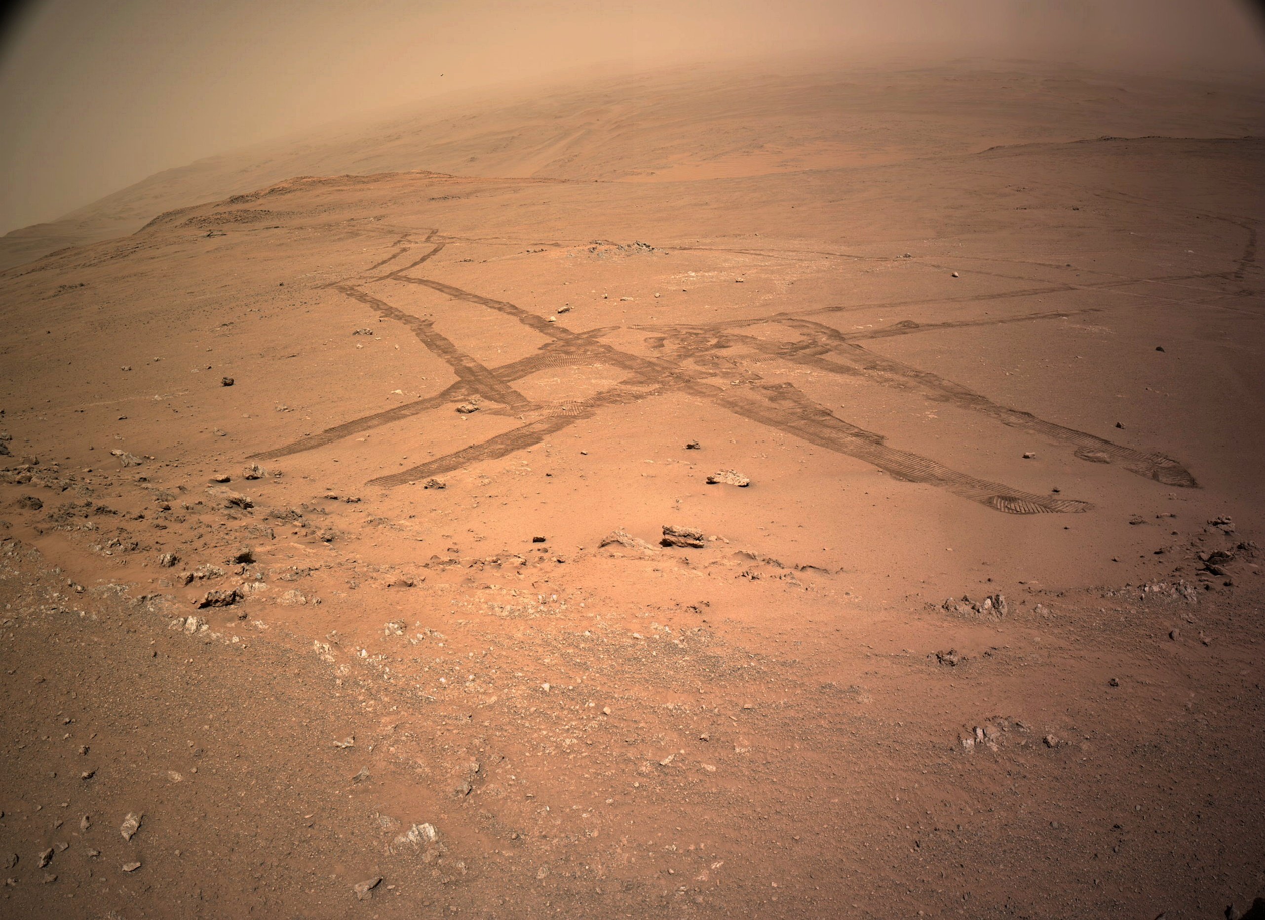
The rover's tracks in this image show us its complex journey exploring this section of its climb out of the crater. This end-of-drive post-drive tiled NavCam was acquired after a drive on November 6, 2024 (Sol 1320) of ~29 meters / ~95 ft to the north, arriving on the oposite side of a small ridge the rover explored several sols ago. Credits: NASA/JPL-Caltech

32


Next stop Pico Turquino?

Pico Turquino: Is the next science waypoint identified by the team. IIRC it is believed to contain fractured rocks that were once possibly altered by hot springs

33


Raw data supplied by JPL after every drive on their JSON pages

34


End-of-drive L-NavCam looking West towards Pico Turquino (image center)

35


White rocks are a familiar sight on Earth, often composed of the common mineral quartz. But white rocks on Mars are rare and quartz has never been observed by any rover. Now Perseverance may have found some.

36


Blog - October 30, 2024

37


Data extracted from JPL's JSON pages. The data is updated by JPL shortly after each drive

38


2-tile NavCam - NASA/JPL-Caltech

39
40


This animated orbital-map view shows the route NASA’s Perseverance Mars rover has taken since its February 2021 landing at Jezero Crater to July 2024, when it took its “Cheyava Falls” sample. As of October 2024, the rover has driven over 30 kilometers (18.65 miles), and has collected 24 samples of rock and regolith as well as one air sample.

41
 
 
42
 
 
43
27
submitted 3 weeks ago* (last edited 3 weeks ago) by paulhammond5155 to c/perseverancerover


Sol 1131 - end-of-drive 4-tile processed NavCam at site 91-1928 (October 27, 2024

Still waiting for the official data, but it looks to be close to 50 meters Northeast of its position on sol 1308

44


For more than three and a half years, Perseverance has been exploring the interior of a large impact crater on Mars, which is unrecognizable from the ground. But now, exploration of the rim is showing possible signs of its violent origin.

45


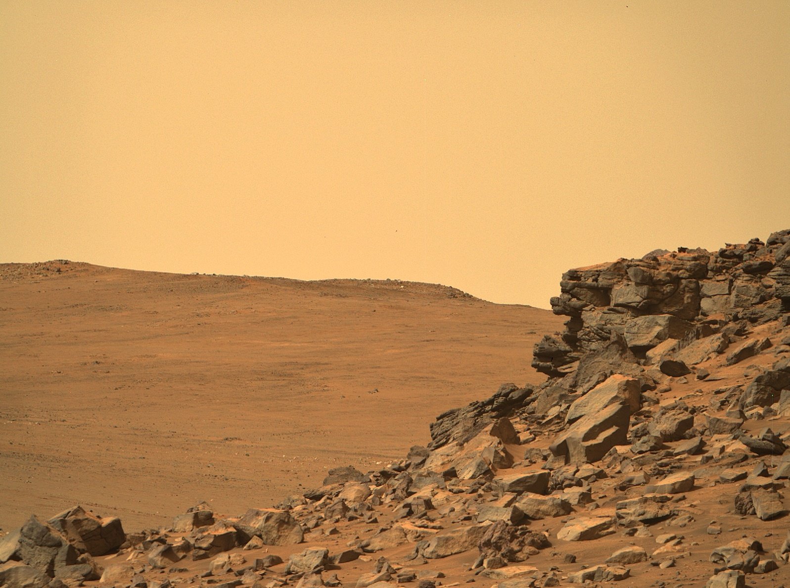
R-MastCam-Z at full zoom (110mm) images a craggy rock face of Pico Turquino

The distance the rock face from the rover is approximately to 130 meters / 427 feet

Pico Turquino is one of the science waypoints on the notional path to the summit of the crater rim.

The rim was of Jezero crater is seen in the background (approximately 1.4 km / 0.87 miles from the rover.

The difference between the current elevation of the rover and the crater rim at that location is approximately 250 meters / 820 feet

The upper part of the Pico Turquino butte stands about 25 meters / 82 feet above the base of its scree slope

Perseverance rover acquired this image using its Right Mastcam-Z camera. Mastcam-Z is a pair of cameras located high on the rover's mast.

This image was acquired on October 25, 2024 (Sol 1309) at the local mean solar time of 09:33:48.

Processed using PhotoScape

Image Credit: NASA/JPL-Caltech/ASU/MSSS

46


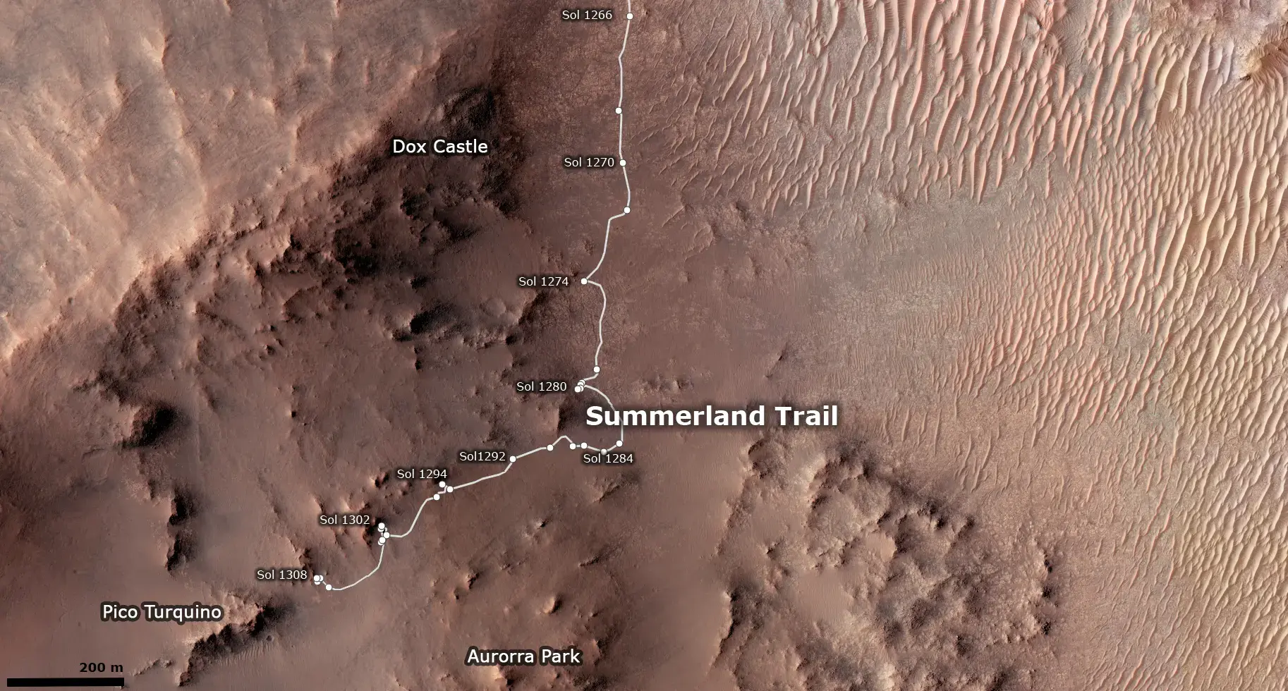
Updated the Map. Didn't find any new place names, so it was mostly just a quick Photoshop work, and a added Sol Number, but it is how it is. Glad I can now update things easily without redoing it completely.

47


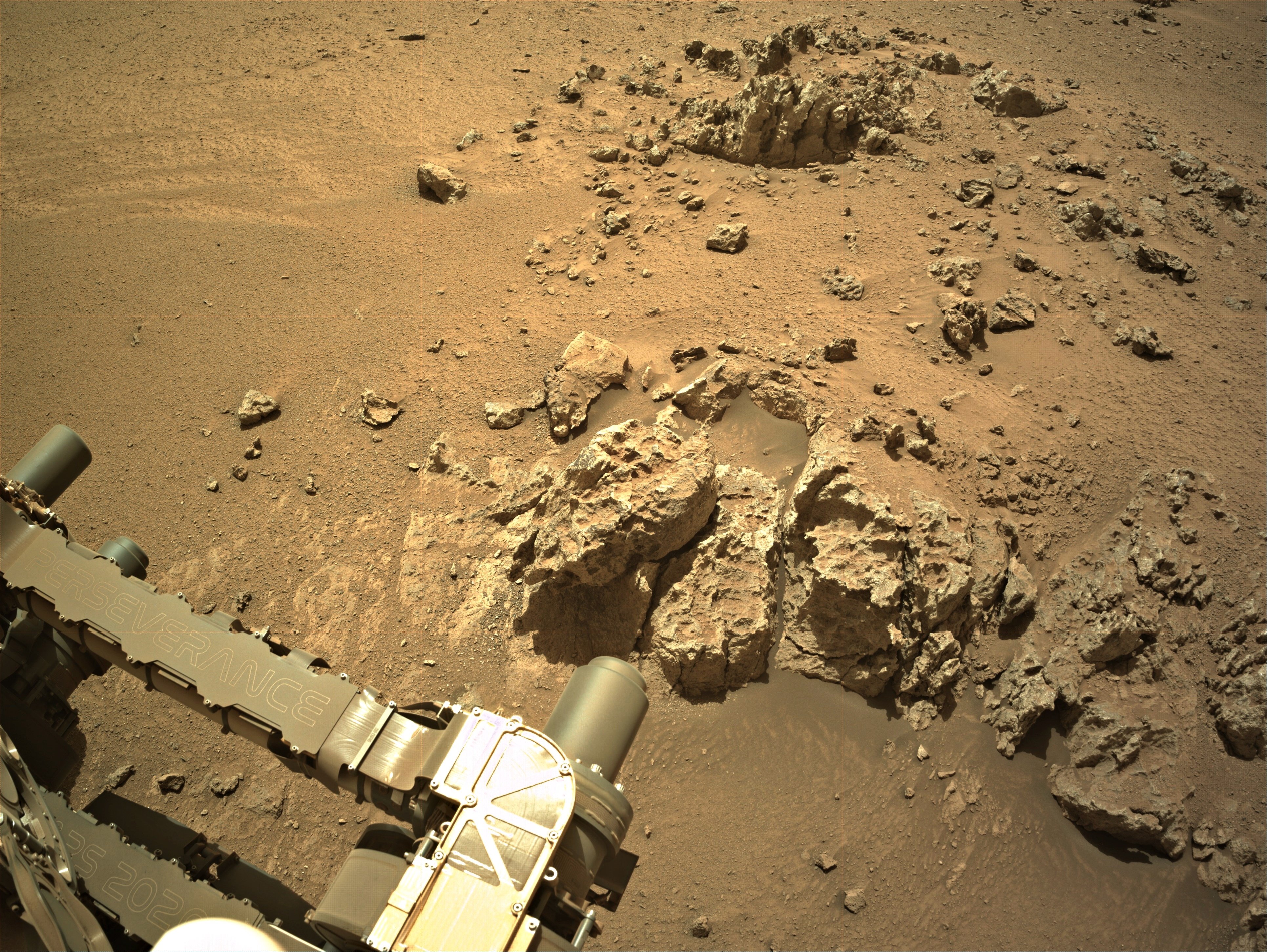
All of the above vignettes were cropped from Front Hazcam images taken on Sol 1308, at about 1 PM local time.

Given that the sun was roughly behind the camera and rover when these images were captured, the complex, light-toned surfaces of these rocks stands out, with glinting reflective patches evident, especially toward the top of the hill. I'd be intrigued to view these rocks in the late afternoon, when shadows are longer and the dusty skies of late winter aren't layering that soft sheen over everything. Given the aggressive driving schedule that the rover team has adopted for climbing the Jezero rim, though, I'm not sure that Percy will stop here for very long...

48


'Pico Torquino' is ~200 meters WSW, it's one of the science waypoints identified by JPL in the crater rim campaign.

Image credits: HRSC: ESA/DLR/FU-BERLIN, CC BY-SA 3.0 IGO CTX: NASA/JPL-Caltech/MSSS HiRISE: NASA/JPL/University of Arizona

49


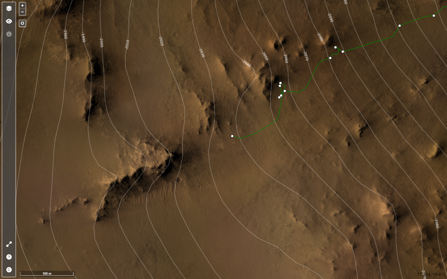
Screen capture from JPL's online map

https://mars.nasa.gov/maps/location/?mission=M20

50


Data from JPL's JSON feeds

view more: ‹ prev next ›