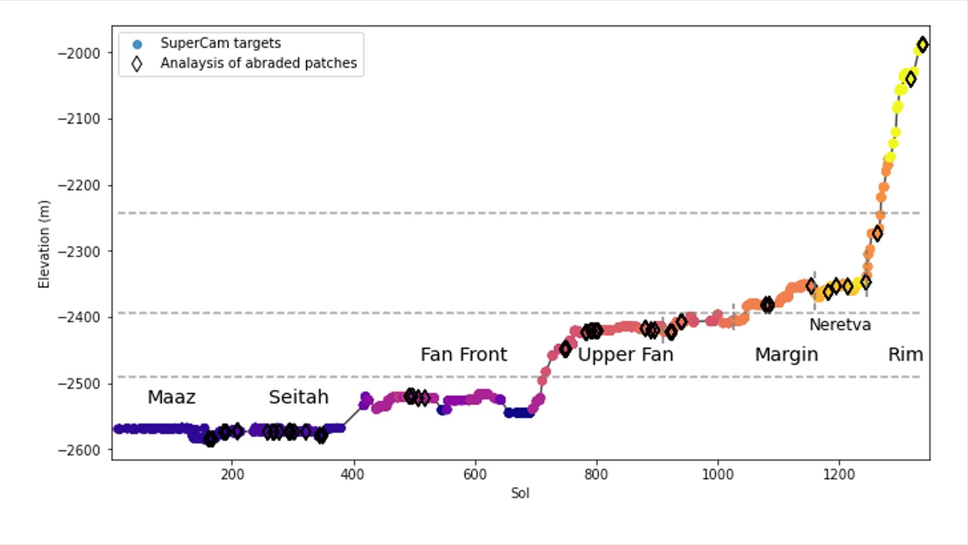
This graph shows the relative elevation of various sampling sites visited by NASA's Perseverance Mars rover. Colored dots along the line represent targets where data was collected by the rover's SuperCam laser instrument; the colors correspond to different regions within Jezero Crater, which are labeled. The black diamonds represent locations where the rover's abrasion tool was used to collect data on rock composition. The x-axis indicates the sol, or day, of the rover's mission, and the y-axis shows elevation in meters. Jezero Crater sits about 8,530 feet (2,600 meters) below reference level (the equivalent for "sea level" on Mars, which does not have any oceans), which is why the numbers appear to be decreasing as Perseverance is gaining elevation.
The dotted horizontal lines represent estimated levels of ancient, now-dry lakes. Jezero Crater was filled by water for much of its history; this lake environment could have preserved signs of microbial life, if any formed here billions of years ago.
At the far right of the graph, the line suddenly jumps, indicating a sharp elevation gain, showing how quickly the rover has ascended toward the crater rim.
NASA/JPL-Caltech/LANL/CNES/IRAP/DLR/PIA26476
