Wilderness Backpacking

45 readers
1 users here now

For all your backpacking trips into the wilderness. First and foremost, remember to Leave No Trace.

Community rules:

Related communities:

[email protected]

[email protected]

[email protected]

[email protected]

founded 1 year ago
MODERATORS
1


So we did the trip! Winter gear shakedown in place of a Wind River trip that got weather'd out. We did 8 miles in to Alaska Basin (9500', trailhead at 7100') in the rain/snow on Friday. Stayed up in the basin overnight, temperature dipped to 30 F (at least - maybe was colder overnight, but I moved the thermometer into the tent). Weather was overcast but no precipitation on Saturday for the hike back out.

Lower elevations still have autumn

Beautiful weather

Fresh black bear tracks (I think)

Basin lake

More Alaska Basin

Good morning snow

Some kind of pawed critter (coyote?)

Gorgeous day back out

Things I learned for backpacking in the rain/slush/snow: hell yeah dry bags kept the gear from getting damp from a day's worth of rain and snow. I need a better fleece solution. I also need a better puffy solution and a better camp shoe situation. My boots were waterlogged (which was fine while hiking, they are not waterproof, but no way am I going to wear them around camp) and the Crocs flats I brought did Not provide any protection from cold/wind/snow. My random Columbia Sherpa fleece is way overkill for hiking and doesn't dry quickly. My (non technical) down jacket got soaked in the back when I put it over the fleece. My wool gloves also got wet and became useless. Yikes.

Other things I learned: it was really nice being out there in different weather, in a different season, with no one else (except my husband) around. I loved it. Would do again. Also I am glad we nixed the Winds trip, the weather would have been worse and we would have had a much harder time of it. Getting this experience was good, before we got hit with it on the trail unexpectedly.

2


In late July, I took what was intended to be a four-day, three-night hike in the Sawtooth Wilderness area in Idaho, USA. We intended to take the trip in early July, but the snow over Sand Mountain pass was still quite bad according to the ranger.

The trip was to start from the west Yellow Belly Lake trailhead (7076’), pass by Farley lake (7745’), go up the pass by Edith lake (8720’), past that knot of passes and by Sand Mountain and down the pass (9219’) to Rendezvous lake (8861’) for Day 1, with a total of 8.6 miles and about 2950’ climbing elevation. Day 1 started late, around 2 pm (yay driving) and we hiked in the hottest part of the day; but we did it! Unfortunately we had to tack on 2 more miles hiking because Google was not reliable in getting us to the intended trail access point and sent us to the farther one. Live and learn… Total mileage, 10.6 mi.

Edith lake

Rendezvous lake from the pass

Sand mountain (it's not sand, but it's super eroded and looks like it), with the final knife-edge pass

Day 2 was to be the lake tour! Starting from Rendezvous lake, pass by Edna lake (8404’), Vernon lake (8460’), Ardeth lake (8288’), Spangle lake (8585’), Rock slide lake, Benedict Lake, and finally camp at Everly lake, in the shadow of Mount Everly. This involved a ton of up-and-down bouncing us between about 8050’ and 8700’, and would have entailed 3 full passes and a final climb up to Everly lake over 11.2 miles total. However, my knee was starting to complain about the repetitive stress injury I’d sustained earlier in the season. In the interest of safety, DrBohr and I decided to stop at Spangle Lake and chill out for the day, explore the area, and enjoy the quiet. Total distance: 6.3 mi, 1449’ climbing elevation.

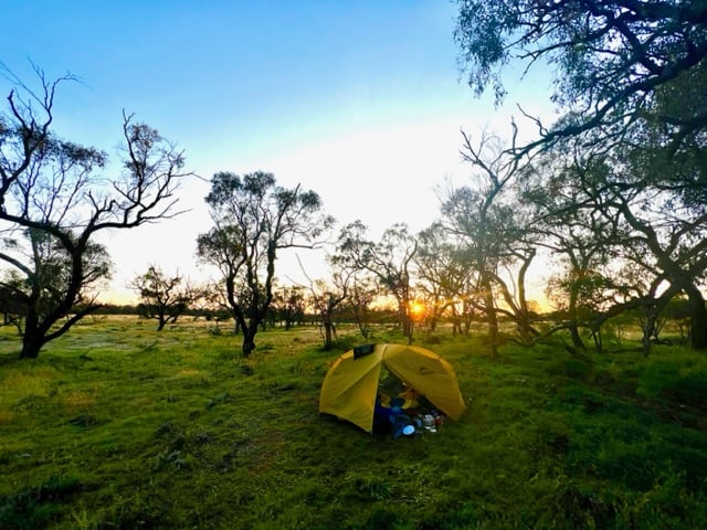
Rendezvous lake at sunrise

Looking down from a pass toward Edna and Vernon lakes

I don't remember which lake this was...

Little Spangle Lake

Day 3 was supposed to be a descent from Everly Lake down to Smith Falls and then back to Rendezvous lake or one of the other nearby lakes on the western side of the pass for a total of 12.5 miles and 2700’ of ascent. However, that didn’t happen due to bailing out early at Spangle lakes. Instead, we retraced our path from Spangle Lake. We intended to stop at Edith Lake or Farley lake that day, leaving us with 6-8 miles to hike out on the last day. That really seemed like it would happen given that my knee started getting pissed off on the descents again.

Big Spangle lake

One of the small lakes at one of the wide, flat passes

However, I decided to try something: ibuprofen and Tylonol together - I’d heard this was a pretty great painkiller combination. Heck yeah it is! It was amazing. My knee pain…disappeared. I think I was getting some nerve involvement along with the inflammation. I thought I would be able to hobble out to Edith or Farley lake, but it turns out… we hiked out the entire rest of the way, 16.3 miles, 2862’ ascent. We were motivated to get home back to our two dogs. Never have I ever been so glad to see the car!

Looking down towards Farley lake (near) and Yellow Belly lake (far), with the White Cloud mountains in the background and remaining snow in the foreground

I was afraid I’d have trashed my knee, but the pain meds and shifting my weight more forward for the descents gave me just general knee fatigue the next day. Success!

3


I day-hiked in to the Bighorn Crags area a couple of weeks ago. The Bighorn Crags are named for their bighorn sheep and really cool craggy granite mountains. They are quite old and eroded, with lots of cirques, crags, and towers. I would recommend getting to the trailhead and camping, then backpacking in for a few days.

Getting to the trailhead is a 2.5 hour drive from Salmon, Idaho through forest service roads. The first 1.5 hours are fine - well maintained dirt roads with easy grades. The last 18 miles takes an hour on a really crappy road deep into the mountains. Tire popper rocks abound, so be careful and be prepared! There is a campground at the trailhead.

The trail system is such that you hike along a ridge line for about six miles until you reach the major crags.

From the trailhead you almost immediately hit the Frank Church Wilderness boundary. You will pass some trails to go to a couple of lakes but they are some distance away and a hike down from the ridge line. The ridge line is dry, so bring water.

The first lakes you reach in the crags are Wilson Lake and Harbor Lake at about mile 7.1.

The trail bounces around between about 8500' and 9200' elevation. However, one way is about 1700' of ascent, meaning we had 3400' ascent and 3400' descent in 14 miles round trip.

4
5
submitted 11 months ago* (last edited 11 months ago) by [email protected] to c/[email protected]


Did a quick day hike last weekend to Goldbug Hot Springs in Elk Bend, ID. It's a little under 2 miles one way, and about 900' elevation gain - half of it in the last quarter-mile. You start at a trailhead next to private land and hike about a quarter-mile through private land (it's allowed but stay on trail, dogs on leash and keep your noise level down).

It was very hot in the afternoon and there is little cover, it improves as you approach the hot springs. The springs actually spring cold water and hot water, and some pools are hotter than others, so explore!

The map The map

The approach - the springs are up in the mountains

The vew from the springs back down

The hot springs

5


I took this out-and-back hike in August 2022. It was a 9.3 mile hike one way. You start in relatively populated national forest land and then as you rise through the mountains, reach the Wilderness area. The trail climbs through Bear Basin, switch backing up the bowl of the basin to the first pass, which is stunning. The descent down the pass is rough with lots of steep gravel. The trail splits and you take the high trail to the east, over the next pass to Summit Lake, which is nestled between two mountains, then over the lass tiny pass and down into the last, big basin. Hike along the meadow until you reach Thompson Lake at the foot of Gallatin peak. You can summit the peak, but I didn't. I surely didn't see a reasonable trail up it!

Elevation

Trail on quad chart

Looking into Bear Basin Looking into Bear Basin

Wildflowers Wildflowers

Looking down into Bear Basin from the pass Looking down into Bear Basin from the pass

Summit Lake Summit Lake

Towards Thompson Lake Towards Thompson Lake

Thompson Lake Thompson Lake

Sunrise at Thompson Lake Sunrise at Thompson Lake

6
 
 
7


I went for a quick out-and-back hike this weekend along the Alaska Basin Trail near Alta, WY, USA. Accessible by Teton Canyon trailhead, Alaska Basin trail is about 9 miles long and ends in Alaska Basin, approximately 9500' altitude. Alaska Basin is near the backside of the Teton mountains and the views are amazing.

I was unable to hike the whole thing because the snow is still melting after a heavy winter and cold spring. That's ok though, since I needed to take it easy as my right knee is still recovering from overuse the week previously.

I hiked four miles in and camped overnight, then hiked out in the morning. The first three miles are very gentle rise through Teton Canyon with gorgeous meadows, forest, Teton Creek, and views. Right now there are a ton of waterfalls, which is amazing! At mile 3 is the trail break for Devils Staircase, which was clear of snow by now, that rises to Teton Shelf. I continued on the left fork to stay on Alaska Basin trail and hiked another mile, which is rockier and steeper. There is an excellent campsite above Teton Creek right around mile 4 and an elevation of about 7800'. Patches of snow are still around and the trail is wet, but things should be excellent in the next few weeks.

It's so early in the season there that the greenery is just getting started, lots of tender shoots and leaves and no flowers yet. It felt like the Pacific Northwest in terms of temperature and humidity, which was a really nice different experience as the summers are hot and dry. Oh, and I saw black bear, deer, and moose tracks in the mud. Thankfully I did not encounter any of them.

8


I did a three-day, two-night backpacking trip for the Cirque of the Towers loop in the Wind River Range, WY USA. It was a 26.1 mile loop total, starting at about 9100' and maxing out at 11300' crossing over the Continental Divide on Texas Pass.

I don't recommend going over Labor Day weekend. Everyone comes out to do it, so it is quite busy. But it's a beautiful hike and quite challenging!

Trail map

Zoom in of the Cirque

Dad's Lake

Shadow Lake

Shadow Lake at sunset

Cirque of the Towers - Texas Pass

Hoo boy was that a scary pass. There is no official trail for the pass, but people have created one. It's incredibly steep and somewhat unstable, more of a scramble than a hike. But once over it, it's incredible!

Lonesome Lake

Jackass Pass

Jackass Pass is the second crossing of the Continental Divide on this loop.

Jackass Pass towards Arrowhead Lake

9


These are highlights from my last years 4 day hike from Bovec to Tolmin that covered 78km (48 miles) and 5200m (17000 ft) of elevation gain and 2 mountain peaks.

Krn lake

View from mount Krn

Clouds forming on mountain ridge due to warm costal air hitting the mountains and rising over the top

Remenants of WW1 trenches over 2000m (6500 ft) above sea level

Look back on Krn mountain range

Tolminski kuk

View on a mountain range i also visited last year but only for 2 days

River Soča and the end of my hike

If you liked this i can share more from hikes i have planed this year.

10
1
submitted 1 year ago* (last edited 1 year ago) by [email protected] to c/[email protected]


As promised, here is a trip report!

Trailhead: Palisades campground Path: hike past Lower Palisades lake (4 mi), Upper Palisades lake (7 mi) and into Waterfall Canyon (end at 11 miles).

The snow has melted and the Palisades are in full growth mode! Tons of flowers are blooming or preparing to bloom in the next couple of weeks. Patches of snow still exist in Waterfall Canyon starting at about 7400 ft elevation. There were two waterfalls flowing at the end of the canyon. We camped in some nice established campsites to the west of the trail by one of the lakes at the end of the canyon. It was a quiet day with no other people out past Upper Lake.

(Palisades creek is super fast this year!)

(Upper Palisades Lake is beautiful)

(The main waterfall)

(The other waterfall)

(Lake we camped by)

11


Super stoked for my first first hike of 2023. It's not exactly deep wilderness but it will be beautiful nonetheless. It's a hike in the Palisades in eastern Idaho up to Waterfall Canyon. Here's the Alltrails screenshots for it. I will post pictures upon return.