NASA's Curiosity Mars Rover

296 readers
10 users here now

A lemmy community for scientific discussion of the Curiosity Rover and Mars Science Laboratory.

founded 8 months ago
MODERATORS
1


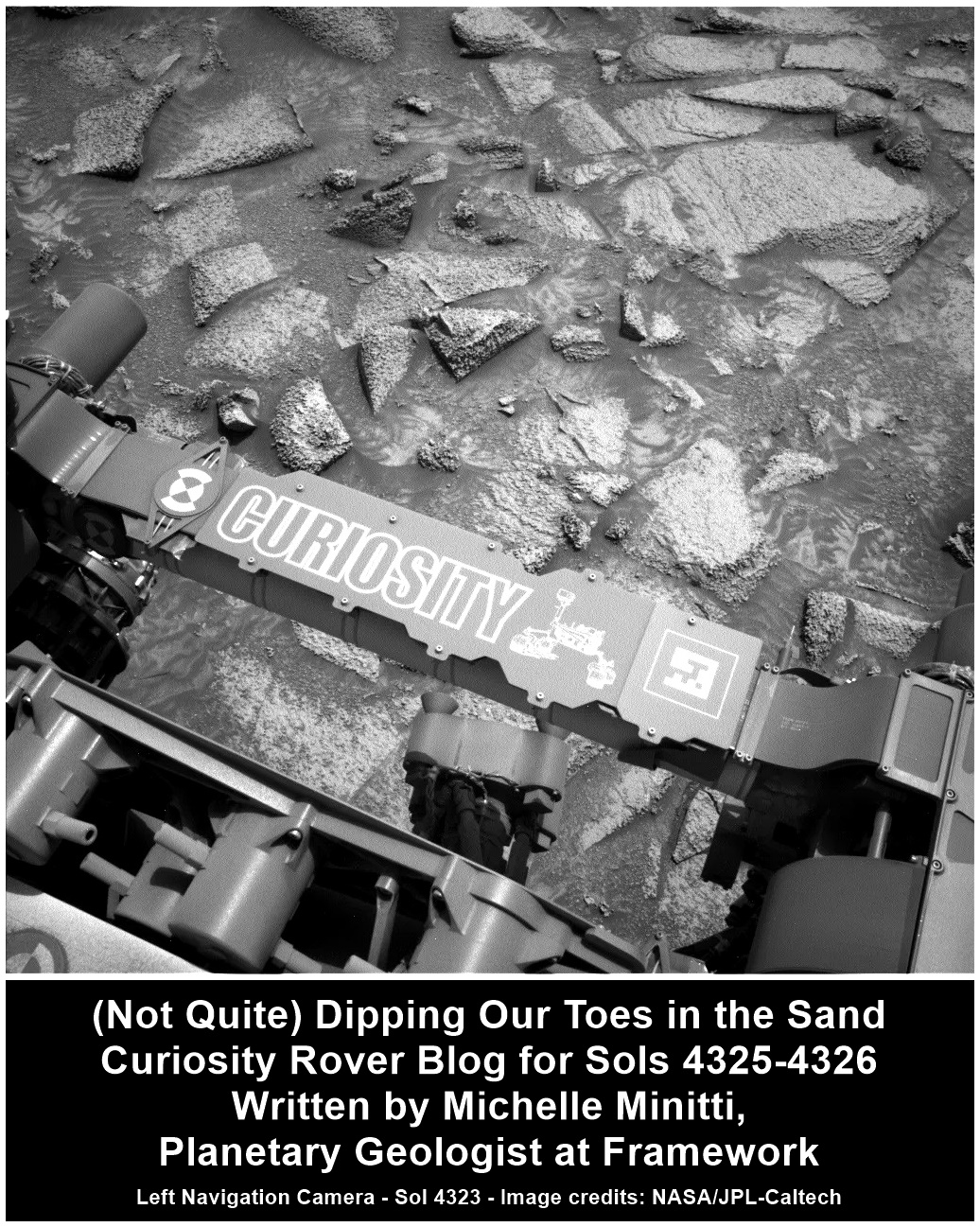
Planning with Popsicles - A Clipper Celebration! - Curiosity Rover Blog for Sols 4334-4335. Earth planning date: Monday October 14, 2024

Today was an unusually exciting day during tactical planning on the Curiosity mission because it intersected with a momentous event in space exploration: the launch of Europa Clipper from Kennedy Space Center. Even though the launch window occurred right in the middle of our morning planning meetings, at 9:06 a.m. PDT to be specific, today’s Tactical Uplink Lead and Science Operations Working Group Chair agreed it would be OK for the entire tactical team to take a 15-minute pause to turn on NASA TV and watch the launch together. Down the hall the Perseverance rover tactical team had decided the same, and for a few moments, the two teams paused their planning and watched together in anticipation as the countdown ticked down to T-0. Many of my close friends and co-workers had worked for years — some for decades — to make this mission a reality, and it was amazing to watch the enormous rocket carrying the Clipper spacecraft leap off the pad knowing how hard it was to get to this point. I cannot wait for the mission’s discoveries once it reaches Jupiter’s watery moon Europa!

In true JPL tradition, we of course had to commemorate the event with some sweet frozen treats on-lab. Back when Curiosity landed, we had a full fridge of ice cream that was kept stocked for the first 90 sols of the mission. (Eating ice cream cones at 2 in the morning is a core memory of mine from those early days in our mission.) Today, in a clever nod to Europa’s icy surface, we celebrated with some even icier sweets: fruit and coffee popsicles to anyone on-lab. I chose coffee of course; the caffeine was great to help me get through a busy day of planning for Curiosity!

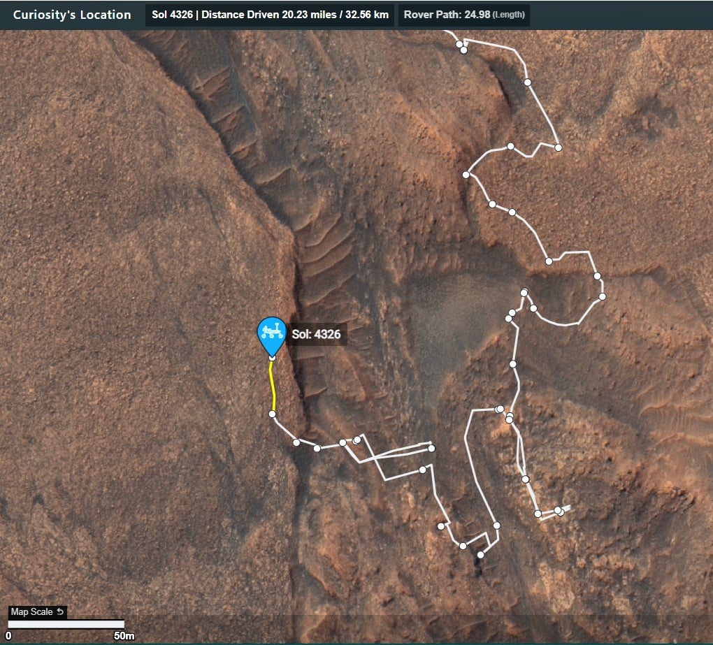
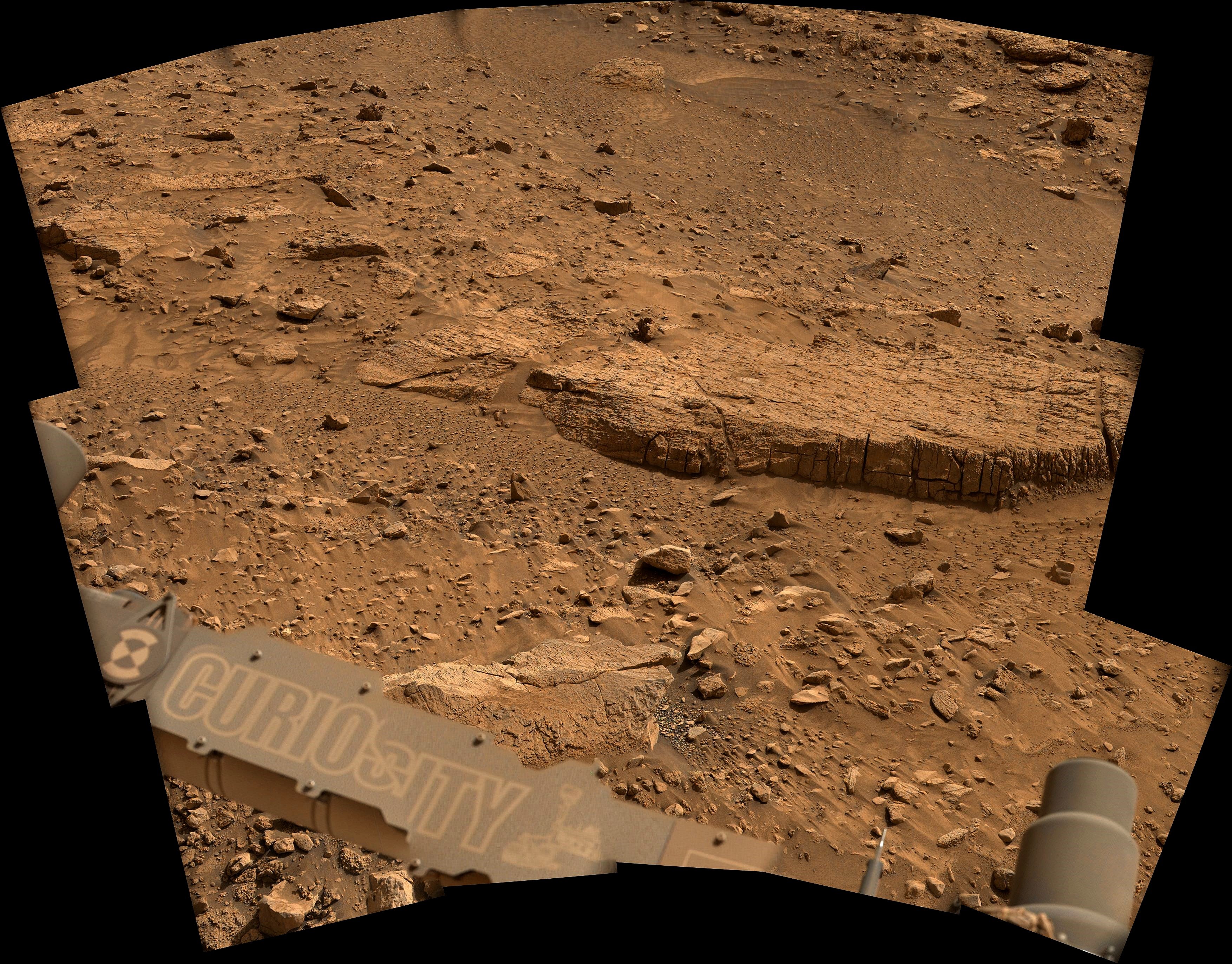
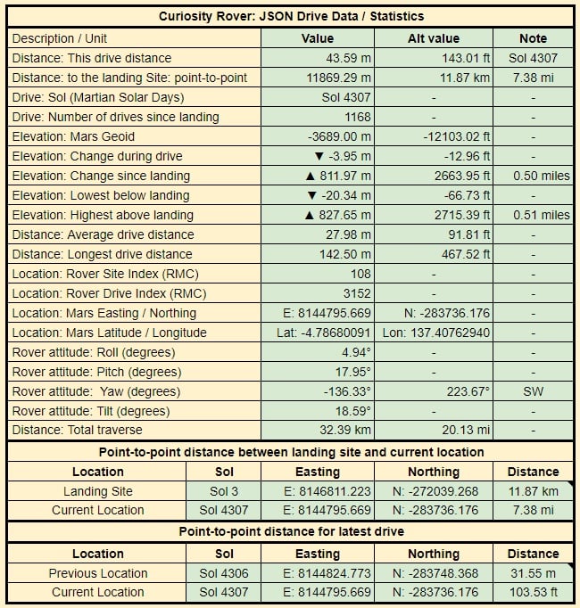
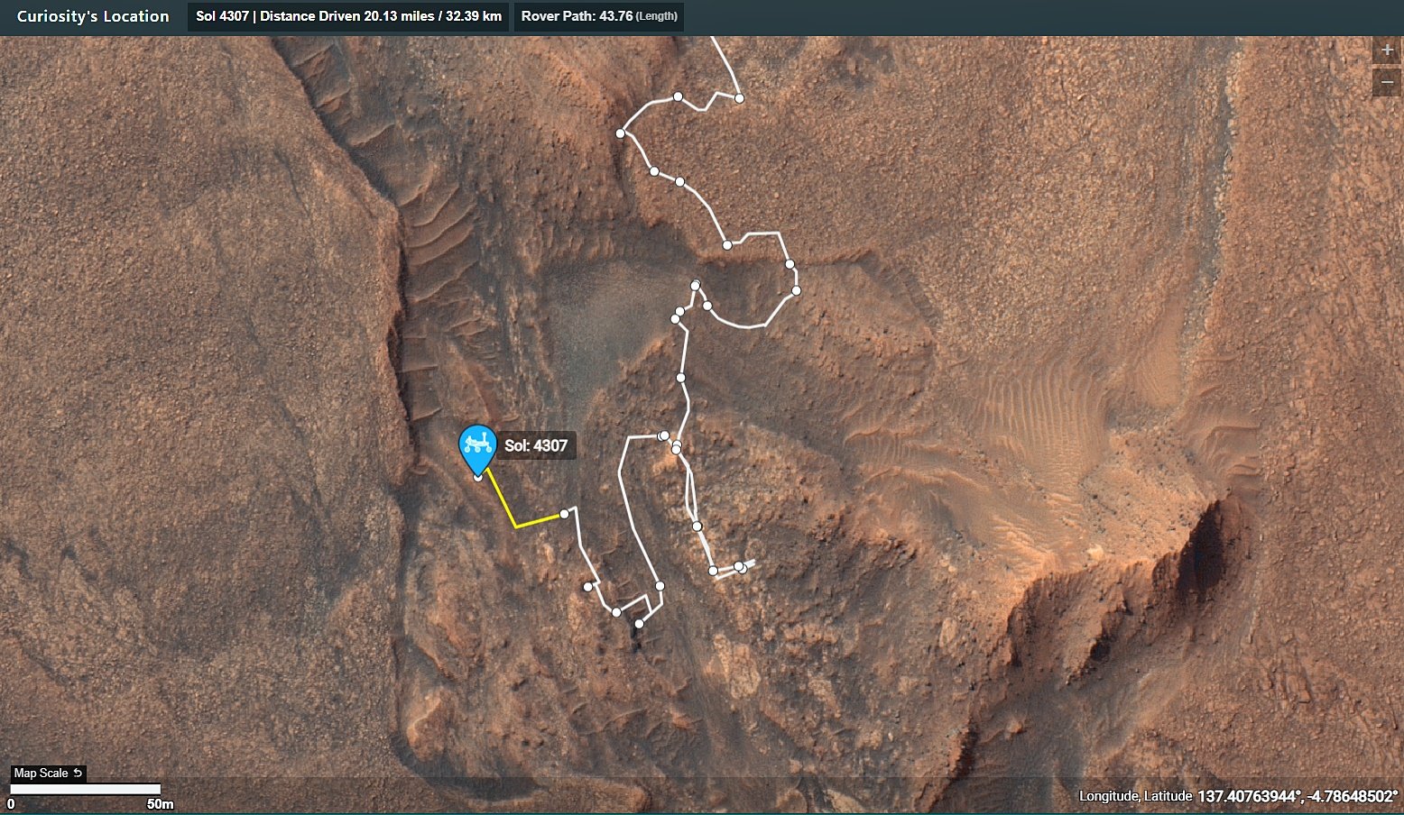
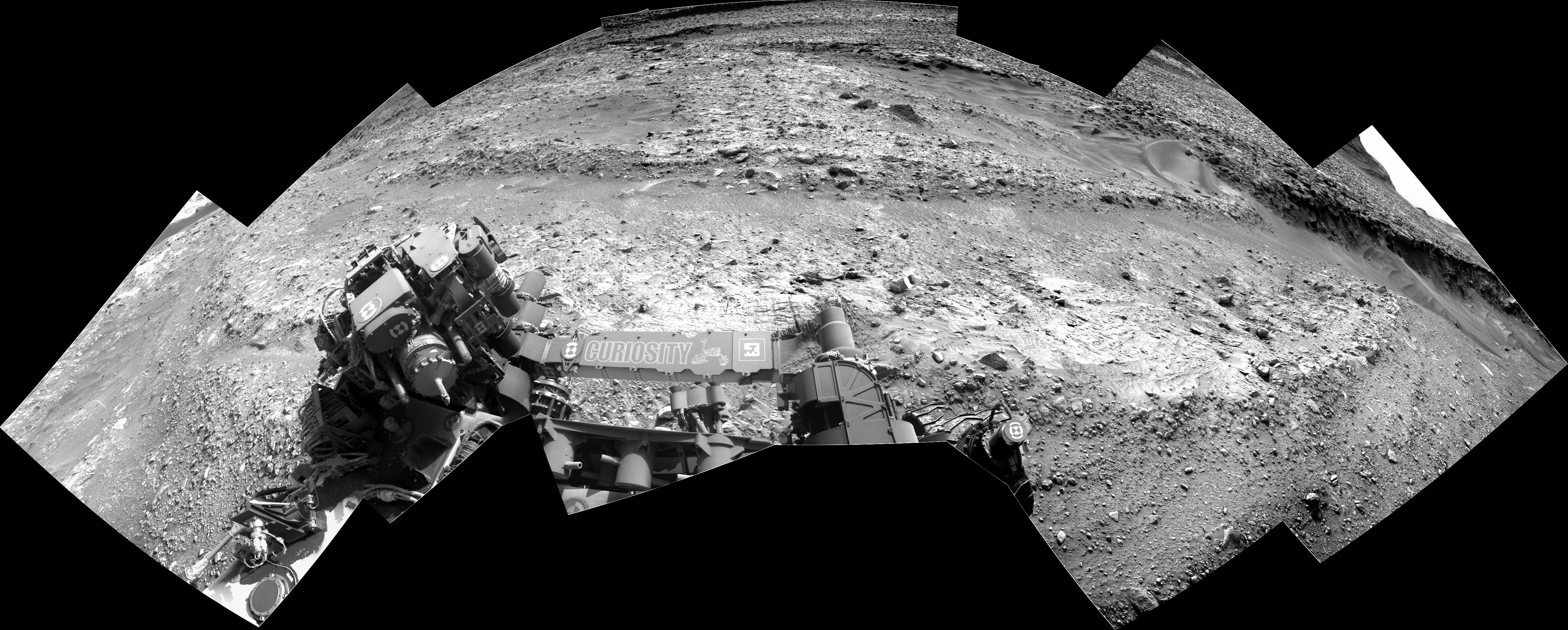
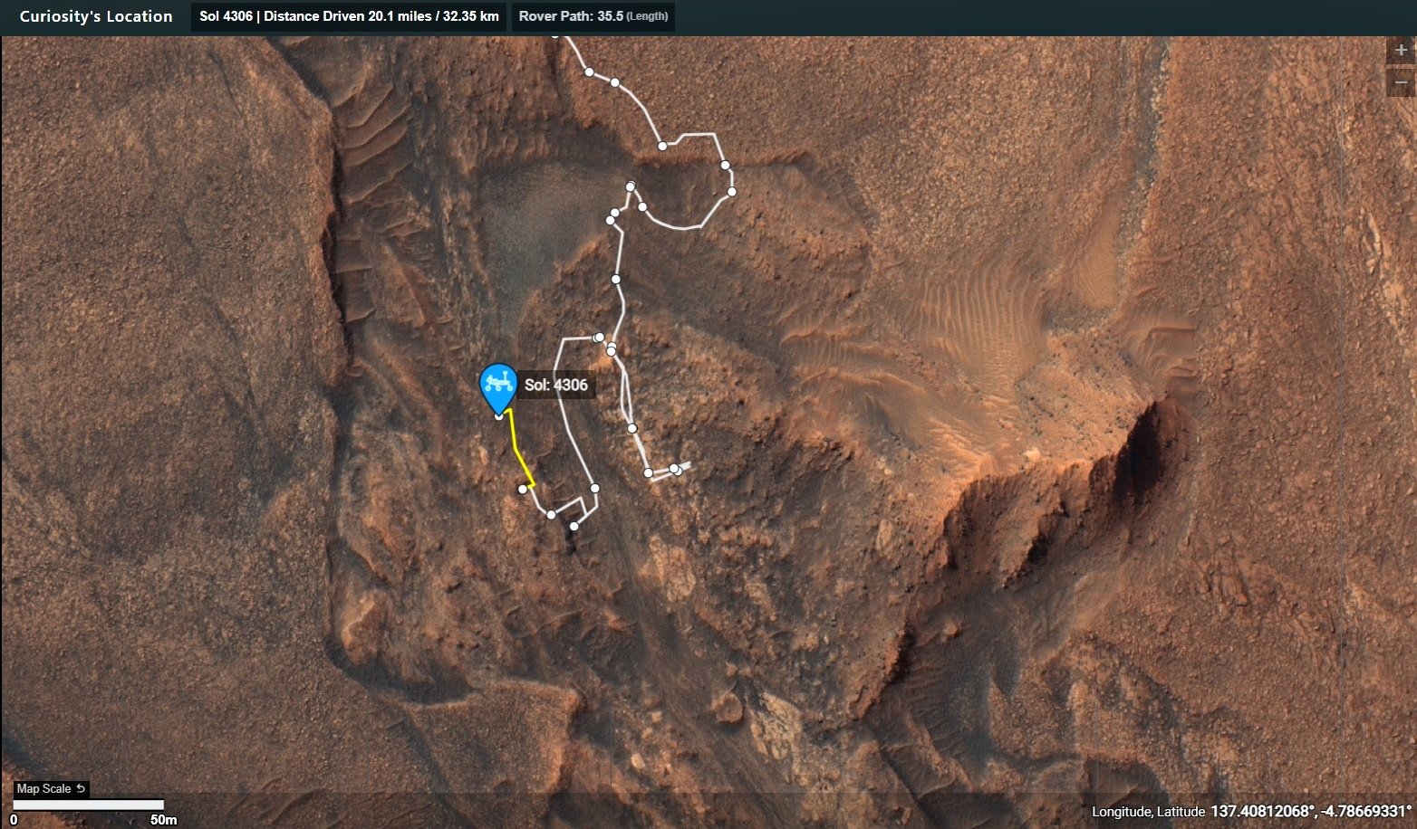
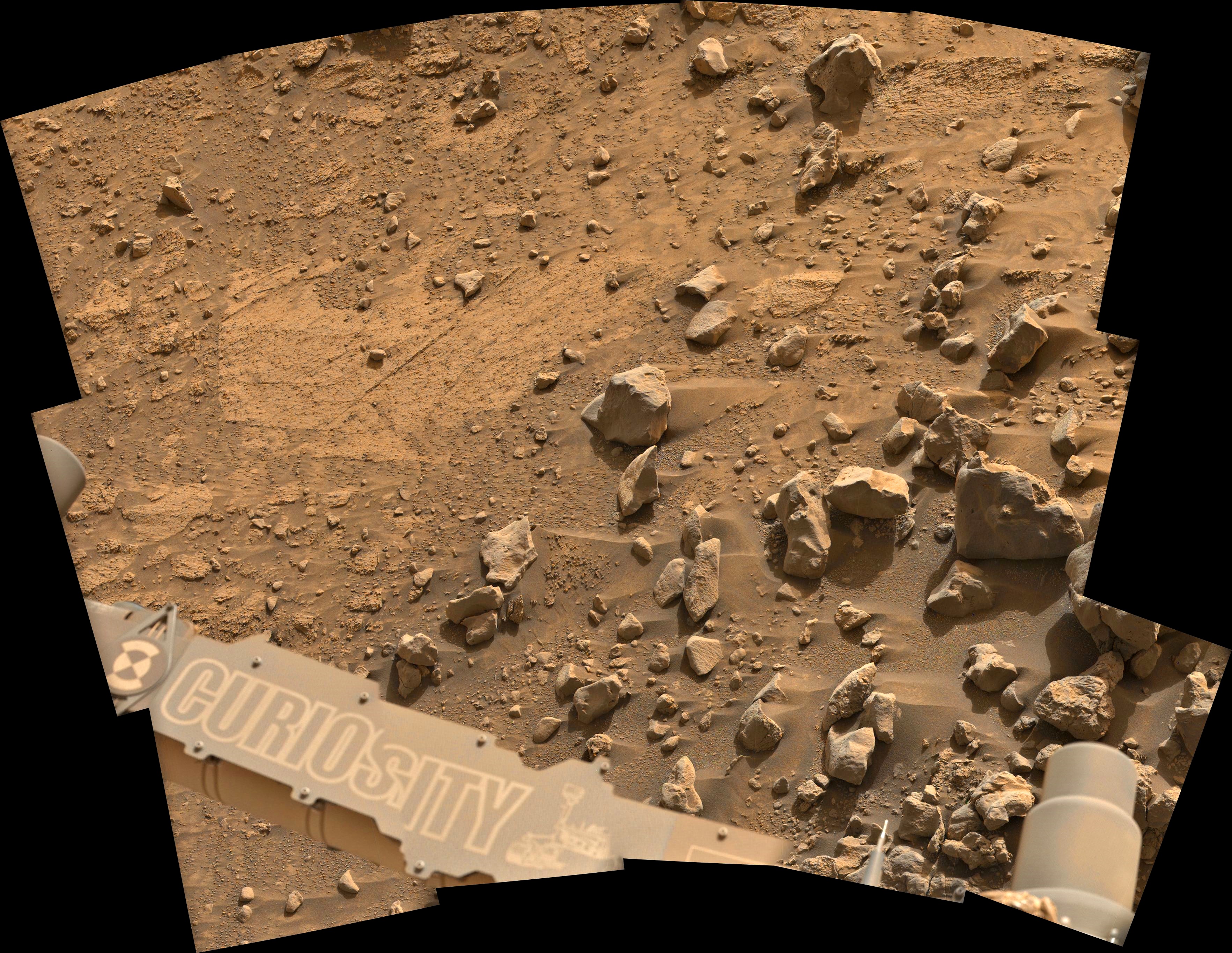
On Mars, things with our rover are going well. We completed our mega ~50-meter drive (about 164 feet) over the weekend, which took Curiosity further north along the western side of Gediz Vallis channel. Our plan today is a “touch and go,” which means we’ll do contact science with APXS and MAHLI on a block in front of us named “Dollar Lake,” some remote sensing, including ChemCam LIBS of a target named “Cape Horn” and a couple Mastcam mosaics, followed by a drive to the north. We’ll continue to follow the western side of Gediz Vallis channel as we descend slightly down Mount Sharp, until we reach a location where we are able to head west towards a more easily traversable valley, and then restart our ascent.

What a fun day of planning today. Congratulations to everyone involved helping Europa Clipper reach this incredible milestone, and go Clipper go!

Written by Abigail Fraeman, Planetary Geologist at NASA's Jet Propulsion Laboratory

Source for this blog and the archive of all blogs (with all the links and the original raw images etc) https://science.nasa.gov/blog/sols-4334-4335-planning-with-popsicles-a-clipper-celebration/

These blog updates are provided by self-selected Mars Science Laboratory mission team members who love to share what Curiosity is doing with the public.

Dates of planned rover activities described in these reports are subject to change due to a variety of factors related to the Martian environment, communication relays and rover status.

Image credits: NASA/JPL-Caltech

2


Today’s Rover ABC – Aurora, Backwards Driving, and Chemistry, with a Side of Images - Curiosity Rover Blog for Sols 4331-4333. Earth planning date: Friday October 11, 2024

This blogger is in the United Kingdom, just north of London, where we yesterday had beautiful night skies with a red aurora that was even visible with the unaided eye, and looked stunning on photographs. That reminded me of the solar storm that made it all the way to Mars earlier this year. Here is my colleague Deborah’s blog about it: “Aurora Watch on Mars.” And, of course, that was a great opportunity to do atmospheric science and prepare for future crewed missions, to assess radiation that future astronauts might encounter. You can read about it in the article, “NASA Watches Mars Light Up During Epic Solar Storm.” But now, back from shiny red night skies north of London, and auroras on Mars six months ago, to today’s planning!

Power — always a negotiation! Today, I was the Science Operations Working Group chair, the one who has to watch for the more technical side of things, such as the question if all the activities will fit into the plan. Today there were many imaging ideas to capture the stunning landscape in detail with Mastcam and very close close-ups with the long-distance imaging capability of ChemCam (RMI). Overall, we have two long-distance RMIs in the plan to capture the details of the ridge we are investigating. You can see in the accompanying image an example from last sol of just how many stunning details we can see. I so want to go and pick up that smooth white-ish looking rock to find out if it is just the light that makes it so bright, or if the surface is different from the underside… but that’s just me, a mineralogist by training, used to wandering around a field site! Do you notice the different patterns — textures as we call them in geology — on the rocks to the left of that white-ish rock and the right of it? So much stunning detail, and we are getting two more RMI observations of 10 frames each in today’s plan! In addition there are more than 80 Mastcam frames planned. Lots of images to learn from!

Chemistry is also featuring in the plan. The rover is stable on its wheels, which means we can get the arm out and do an APXS measurement on the target “Midnight Lake,” which MAHLI also images. The LIBS investigations are seconding the APXS investigation on Midnight Lake, and add another target to the plan, “Pyramidal Pinnacle.” On the third sol there is an AEGIS, the LIBS measurement where the rover picks its own target before we here on Earth even see where it is! Power was especially tight today, because the CheMin team does some housekeeping, in particular looking at empty cells in preparation for the next drill. The atmosphere team adds many investigations to look out for dust devils and the dustiness of the atmosphere, and APXS measures the argon content of the atmosphere. This is a measure for the seasonal changes of the atmosphere, as argon is an inert gas that does not react with other components of the atmosphere. It is only controlled by the temperature in various places of the planet — mainly the poles. DAN continues to monitor water in the subsurface, and RAD — prominently featured during the solar storm I was talking about earlier — continues to collect data on the radiation environment.

Let’s close with a fun fact from planning today: During one of the meetings, the rover drivers were asked, “Are you driving backwards again?” … and the answer was yes! The reason: We need to make sure that in this rugged terrain, with its many interesting walls (interesting for the geologists!), the antenna can still see Earth when we want to send the plan. So the drive on sol 4332 is all backwards. I am glad we have hazard cameras on the front and the back of the vehicle!

Written by Susanne Schwenzer, Planetary Geologist at The Open University

Source for this blog and the archive of all blogs (with all the links and the original raw images etc) https://science.nasa.gov/blog/sols-4331-4333-todays-rover-abc-aurora-backwards-driving-and-chemistry-with-a-side-of-images/

These blog updates are provided by self-selected Mars Science Laboratory mission team members who love to share what Curiosity is doing with the public.

Dates of planned rover activities described in these reports are subject to change due to a variety of factors related to the Martian environment, communication relays and rover status.

Image credits: NASA/JPL-Caltech/LANL

3


Continuing Downhill - Curiosity Rover Blog for Sols 4329-4330. Earth planning date: Wednesday, October 9, 2024

Curiosity is continuing to make good progress downhill along the western edge of the Gediz Vallis channel, allowing us to take another look from a different perspective at this area we've spent many months exploring. The drive from Monday's plan executed as expected, positioning us about 30 meters (about 98 feet) north of our last location. Unfortunately, the rover parked with its right front wheel atop an unstable-looking rock, so we decided to keep the arm stowed rather than risk having the wheel slip with the arm unstowed.

As a consequence, our plan today is all remote sensing, kicking off with a LIBS activity on a bedrock target “Sapphire Lake” and long distance RMI mosaics of “Pinnacle Ridge,” which avid readers may remember was a focus of an imaging campaign while we were still in the channel. Mastcam gets its turn on both Sapphire Lake and Pinnacle Ridge, as well as a Mastcam-exclusive target, “Wuksachi,” to document some rover-disturbed regolith and a wheel-scuffed rock surface. This plan's drive is also in the first sol, which will hopefully bring us nearly 40 meters (about 131 feet) further north, closer to our eventual exit from Gediz Vallis.

The first sol also sees a small collection of environmental science observations, including Navcam images to monitor dust and sand on the rover deck as well as a Navcam movie looking out over the northern horizon to look for clouds. We haven't been seeing many clouds lately, but we are rapidly approaching the end of the current Mars Year, and the end of the dusty season. (The new year, numbered 38, begins Nov. 12; a Martian year is much longer than one on Earth, taking 687 Earth days to orbit the Sun.) Though the cloudy season won't really pick up steam until February, the “noctilucent cloud season” will be taking place in December and January, which has produced some spectacular images in the past. Today's plan also features an “UltraSPENDI,” or “Shunt Prevention ENV Navcam Drop-In.” This activity takes 18 cloud movies and dust devil movies over three hours and serves to prevent the rover's batteries from remaining fully charged for an extended period of time, which would hurt their long-term health.

The second sol of this plan is pretty simple, featuring a Mastcam tau to measure the amount of dust in the atmosphere, a ChemCam AEGIS activity, some more Navcam deck monitoring, and a 360-degree Navcam survey for dust devils around the rover. As always, REMS, RAD, and DAN will be continuing with their usual activities.

Written by Conor Hayes, graduate student at York University

Source for this blog and the archive of all blogs (with all the links and the original raw images etc) https://science.nasa.gov/blog/sols-4329-4330-continuing-downhill/

These blog updates are provided by self-selected Mars Science Laboratory mission team members who love to share what Curiosity is doing with the public.

Dates of planned rover activities described in these reports are subject to change due to a variety of factors related to the Martian environment, communication relays and rover status.

Image credits: NASA/JPL-Caltech

4


On the Road Again - Curiosity Rover Blog for Sols 4327-4328. Earth planning date: Monday, October 7, 2024

After successfully completing investigations within Gediz Vallis, Curiosity is back on the road through the Mg-sulfate (magnesium sulfate) bearing unit. The terrain under our wheels is a familiar collection of broken up blocks, and we’re keeping our rover eyes on the more distant stratigraphy and the deposits within the Gediz Vallis channel (as seen in the above Navcam image). Our traverse along this side of the channel is a great chance to understand the erosional and depositional history of Gediz Vallis from a different perspective, and to characterize variations in the sulfate unit.

I was on shift as Long-Term Planner today, and it was a pretty straightforward two-sol plan, with contact science on the first sol and driving on the second sol. The team planned a great collection of measurements to characterize the rocks in our workspace and more distant features.

The plan starts with remote sensing, including ChemCam LIBS on a gray, smooth slab at “Paloma Meadows,” followed by two long-distance RMI mosaics to assess the thickness and distribution of white clasts in Gediz Vallis. Then Mastcam will document Paloma Meadows and a distant dark clast at “Sky Parlor Meadow” to understand the variety of rock types and where they might have come from. The remote sensing block also includes a Navcam observation to search for dust devils. Later in the afternoon Mastcam will acquire a mosaic looking back towards “Whitebark Pass” including the white clasts (some of which were previously tied to observations of high sulfur) and the distribution of deposits within “Pinnacle Ridge.” Then Curiosity will use the instruments on the arm to assess one of the blocks in our workspace at “Pincushion Peak.” We’ll use the DRT, MAHLI, and APXS to assess the grain size, textures, and composition of a nodular block of bedrock. On the second sol Curiosity will acquire ChemCam LIBS and Mastcam of Pincushion Peak, which will make for a nice set of coordinated observations. The second sol also includes a long-distance RMI mosaic of an interesting dark block to assess sedimentary structures, and two Navcam observations to characterize atmospheric opacity and the movement of fines on the rover deck. Then Curiosity will continue driving, and take post-drive imaging to prepare for a similar plan on Wednesday. Looking forward to continuing to explore what’s under our wheels and on the horizon!

Written by Lauren Edgar, Planetary Geologist at USGS Astrogeology Science Center.

Source for this blog and the archive of all blogs (with all the links and the original raw images etc) https://science.nasa.gov/blog/sols-4327-4328-on-the-road-again/

These blog updates are provided by self-selected Mars Science Laboratory mission team members who love to share what Curiosity is doing with the public.

Dates of planned rover activities described in these reports are subject to change due to a variety of factors related to the Martian environment, communication relays and rover status.

Image credits: NASA/JPL-Caltech

5


This is just a screen capture from the official map: https://mars.nasa.gov/maps/location/?mission=Curiosity

North is up on this map

6


Data from JPL's JSON URL that is updated after every drive

7


Curiosity's latest workspace imaged on mission sol 4326 (October 7, 2024) after a drive of 25 meters (82.5 feet). This composite image is assembled from 15 overlapping L-MastCam subframe images, that were Bayer reconstructed before assembly. The workspace covers an area about 2 meters (~6.5 feet) across, and shows details within the workspace accessible to the instruments and tools on the rover's 2 meter-long robotic arm. Image Credits: NASA/JPL-Caltech/MSSS/fredk

8


(Not Quite) Dipping Our Toes in the Sand - Curiosity Rover Blog for Sols 4325-4326. Earth planning date: Friday, Oct. 4, 2024

If you read this blog very often, you know that nearly every time the rover stops for science, MAHLI and APXS focus on interesting (and accessible!) rocks as targets. The rover science team is, after all, built with a lot of geologists. But geology is not all rocks, all the time — sand is former rock that if buried and pressurized long enough will become rock again. Today was time for sand to shine, as the workspace was cut by troughs of sand of different colors and brightnesses, and it had been nearly 500 sols since we acquired our last dedicated sand measurement with APXS and MAHLI. The “Pumice Flat” target was one of the brighter sand patches while “Kidney Lake” was one of the darker sand patches. APXS uses a special placement mode over sand targets so the instrument gets close, but not too close, to the loose material which could foul up the instrument. Not-rock was also the purview of our environmental observations. Navcam is scheduled for imaging seeking out clouds and dust devils, and changes in the sand and dust on top of the rover deck. Both Navcam and Mastcam will make observations to measure the amount of dust in the atmosphere. REMS will keep track of our weather with regular measurements, RAD will monitor our radiation environment, and DAN will look through rock for signs of water beneath our drive path.

Unsurprisingly, the rest of the rover could not ignore bedrock. We managed to squeeze in DRT cleaning of a nice bedrock slab, “Ribbon Fall,” for MAHLI-only imaging. In places, the bedrock slabs were cut by thin veins of darker gray material, similar to dark gray materials we saw in the bedrock on the other side of Gediz Vallis. ChemCam targeted one of these dark gray examples at “Black Divide,” and also rastered across some of the prominent layers visible in the vertical faces in the workspace at the aptly named “Profile View.”

Our imaging efforts could be roughly divided between looking back at our path through Gediz Vallis from our new and higher perspective, and looking ahead to what awaits us. ChemCam planned RMI mosaics back toward a field of the white stones we spent time studying in Gediz Vallis and toward a part of the edge of Gediz Vallis that we did not explore previously. Mastcam looked back at the part of the edge of Gediz Vallis we just traversed, “Pilot Peak,” for clues as to why it sits higher than the bedrock farther from the channel edge. They also targeted “Clyde Spires,” which was a gravel ridge in Gediz Vallis of interest as we drove by it initially. Looking ahead, Mastcam imaged a puzzling gray rock sitting atop the bedrock slabs south of us at target “Buena Vista Grove,” and further south still, they planned a large mosaic covering a very big rock — the spectacular “Texoli” butte that has loomed and will continue to loom over our path for months to come.

Written by Michelle Minitti, Planetary Geologist at Framework

Source for this blog and the archive of all blogs (with all the links and the original raw images etc) https://science.nasa.gov/blog/sols-4325-4326-not-quite-dipping-our-toes-in-the-sand/

These blog updates are provided by self-selected Mars Science Laboratory mission team members who love to share what Curiosity is doing with the public.

Dates of planned rover activities described in these reports are subject to change due to a variety of factors related to the Martian environment, communication relays and rover status.

Image credits: NASA/JPL-Caltech

9


Surfin’ Our Way out of the Channel - Curiosity Rover Blog for Sols 4323-4324.

Earth planning date: Wednesday, Oct. 2, 2024

As a member of the group tasked with organizing our campaign to investigate the Gediz Vallis channel and deposit (informally known as the Channel Surfers), I was a little sad this morning to see that our drive had successfully taken us out of the channel, back onto the magnesium sulfate-bearing unit, into which the channel is incised. Our long-anticipated investigation of the channel has proven fruitful: Curiosity made the first definitive detection of elemental sulfur on Mars, and we have examined a variety of intriguing lithologies and relationships within the deposit over the last 4.5 months. It has been an exciting time, and I have particularly enjoyed riding this wave with my fellow Channel Surfers — a great team! Now to make sense of all the fantastic data we have collected.

We are not completely done looking at the channel and deposits though. We will be driving parallel to the western margin for a while to facilitate comparisons with what we observed from the east. Tosol we will image two areas of interest within the Gediz Vallis channel from our current vantage point with Mastcam and ChemCam long-distance RMI. But back to the sulfate unit — the team planned a number of activities to document the return to the sulfate unit. These include APXS and MAHLI of the nodular bedrock immediately in front of the rover (“Sub Dome”), ChemCam LIBS and Mastcam of another bedrock block (“Vert Lost Grove”), and Mastcam of the resistant bedrock ridge immediately adjacent to the Gediz Vallis channel (“Muah Mountain”).

Once the drive of about 25 meters (about 82 feet) hopefully executes successfully, Curiosity will look down and image the terrain between her front wheels with MARDI, acquire ChemCam LIBS on an autonomously selected target in the workspace, and then perform a series of atmospheric and environmental observations. These include a Mastcam tau to measure dust in the atmosphere, Navcam dust devil and suprahorizon movies, and a Navcam line-of-sight observation. The plan is rounded out with DAN, RAD, and REMS activities.

Written by Lucy Thompson, Planetary Geologist at University of New Brunswick

Source for this blog and the archive of all blogs (with all the links and the original raw images etc) https://science.nasa.gov/blog/sols-4323-4324-surfin-our-way-out-of-the-channel/

These blog updates are provided by self-selected Mars Science Laboratory mission team members who love to share what Curiosity is doing with the public.

Dates of planned rover activities described in these reports are subject to change due to a variety of factors related to the Martian environment, communication relays and rover status.

Image credits: NASA/JPL-Caltech

10


Captured by Curiosity's MAHLI camera on September 29, 2024 (Sol 4318)

For scale the Lincoln Penny has a diameter of 0.75 inches (19.05 mm)

Fun fact: They used a 1909 Lincoln VDB penny for the calibration target as the rover was supposed to launch during 2009, 100 years after the coin was minted and 200 years after the birth of Abraham Lincoln. Technical issues delayed the launch, but the penny was already fitted to the calibration target.

Can anyone spot the Martian in the image? :)

11


It's had a tough journey, but it's still trucking

12


Pulled away from the workspace to provide better access to the fractured bedrock target with the rover's robotic arm

15 frame mosaic of deBayered L-MastCam images

NASA/JPL-Caltech/MSSS/fredk

13
 
 
14


Check out the online map using this link https://mars.nasa.gov/maps/location/?mission=Curiosity

15


Leaning Back, Driving Back - Curiosity Rover Blog for Sols 4309–4310

Earth planning date: Wednesday, September 18, 2024

The lengthy drive planned on Monday executed as expected, and we came in today to find our rover parked at a jaunty angle on a sloped ridge. There were some worries that the slope might limit our ability to use the arm for contact science in this plan (we don't want to do anything that might cause the rover to slide down the slope!), but after some careful consideration, we received the good news that all six of our wheels are holding on firmly to the ground, so there was no risk of slipping.

On Monday, two different options for today's plan were laid out. The first option, a "full contact science" plan where we don't drive, was to be executed if Monday's drive put us exactly where we hoped. The second, a "touch-and-go" plan where we do some light contact science before driving away, was to be executed if the drive didn't put us where we wanted to be. As it happened, the rover was a little too enthusiastic about driving, and actually put our desired workspace under its body rather than in front where the arm could reach it. There's always a little uncertainty in the final position after such a long drive! So, we decided to stick with a touch-and-go plan that includes a tiny backwards drive of less than a metre to reposition our desired target in front of the rover.

Although we need to re-position, we aren't slowing down on science for even a second. We are parked in front of a large fractured slab of bedrock, which can be seen in the above image. This slab became the contact science target for this plan with DRT and APXS activities on "The Minster." Mastcam is getting a workout today as well, with large mosaics of "North Channel," "Buckeye Ridge," "Quinn," and "Island Pass." These mosaics are all documenting various aspects of the ridge we're sat on and the edge of the Gediz Vallis Channel, including sedimentary rocks, white sulphate materials, and gravels and fine-grained materials. ChemCam is also taking a turn on the bedrock slab with a LIBS activity on "Grand Sentinel" and a mosaic of some exposed white stones off in the distance.

The second sol of the plan, after our short drive, is largely taken over by environmental science activities, though there is our usual post-drive ChemCam AEGIS. These activities include a Mastcam tau and Navcam line-of-sight to measure the amount of dust in the atmosphere around and above us, as well as a dust devil movie, suprahorizon cloud movie, and some Navcam deck monitoring to see if our driving or the wind is moving around any of the sand and dust on the rover deck. The team is also taking the usual set of REMS, RAD, and DAN observations.

Written by Conor Hayes, Graduate Student at York University

Source for this blog and the archive of all blogs (with all the links and the original raw images etc): https://science.nasa.gov/blog/sols-4309-4310-leaning-back-driving-back/

These blog updates are provided by self-selected Mars Science Laboratory mission team members who love to share what Curiosity is doing with the public.

Dates of planned rover activities described in these reports are subject to change due to a variety of factors related to the Martian environment, communication relays and rover status.

Image credits: NASA/JPL-Caltech

16


De-Bayered L-MastCam mosaic - Assembled in MS-ICE

NASA/JPL-Caltech/MSSS/fredk

17


Curiosity acquired this image using its Mars Hand Lens Imager (MAHLI), located on the turret at the end of the rover's robotic arm, during September 17, 2024 (Sol 4307). The camera focus motor count (returned with the image) can be used to calculate the camera standoff distance (camera lens to the target). In this case the standoff was close to 25 centimeters (~10 inches). This provides an image scale of ~95 micrometers per image pixel, or a scene width of ~15 centimeters (~6 inches). Image Credits: NASA/JPL-Caltech/MSSS.

18


Awaiting drive data and the location. While we're waiting for those details, I have assembled a selection of the post drive L-NavCam images into a small mosaic, clearly showing the low ridge in front of the rover that was discussed in the last mission update.

19


Bright Rocks Catch Our Eyes - Curiosity Rover Blog for Sols 4307-4308

Earth planning date: Monday, September 16, 2024

We made good progress through Gediz Vallis in the weekend drive, landing in a segment of the channel containing a mix of loose rubble and other channel-filling debris. Amongst the jumbled scene, though, particular objects of interest caught our eye: bright rocks. In past workspaces in Gediz Vallis, similar bright rocks have been associated with very high to almost pure sulfur contents. As all good geologists know, however, color is not diagnostic, so we cannot assume these are the same as sulfur-rich rocks we have encountered previously. The only way to know is to collect data, and that was a significant focus of today’s plan.

We planned multiple mosaics across the examples of bright rocks visible in the image above. Mastcam and ChemCam RMI will cover “Bright Dot Lake” and “Sheep Creek” both in the right midfield of the image. Mastcam imaged the example in the bottom right corner of the image at "Marble Falls,” and ChemCam LIBS targeted one of the small bright fragments along the bottom of the image at "Blanc Lake.” There was also a small bit of bright material in the workspace, but unfortunately, it was not reachable by APXS. APXS analyzed a spot near the bright material, at target “Frog Lake,” and MAHLI was able to tack on a few extra images around that target that should capture the bright material. MAHLI also imaged a vuggy target in the workspace at “Grasshopper Flat.” The wider context of the channel was also of interest for imaging, so we captured the full expanse of the channel with one Mastcam mosaic, and focused another on mounds distributed through the channel at target "Copper Creek."

Even with all this rock imaging, we did not miss a beat with our environmental monitoring. We planned regular RAD, REMS, and DAN measurements, mid and late day atmospheric dust observations, a cloud movie, and dust devil imaging.

Our drive is planned to take us up onto one of the ridges in the channel. Will we find more bright rocks there? Or something new and unexpected that was delivered down Gediz Vallis by some past Martian flood or debris flow? Only the channel knows!

Written by Michelle Minitti, Planetary Geologist at Framework

Source for this blog and the archive of all blogs (with all the links and the original raw images etc): https://science.nasa.gov/blog/sols-4307-4308-bright-rocks-catch-our-eyes/

These blog updates are provided by self-selected Mars Science Laboratory mission team members who love to share what Curiosity is doing with the public.

Dates of planned rover activities described in these reports are subject to change due to a variety of factors related to the Martian environment, communication relays and rover status.

Image credits: NASA/JPL-Caltech

20


The reasons for the drive on sol 4306 are detailed in this mission update https://science.nasa.gov/blog/sols-4304-4006-12-years-42-drill-holes-and-now-1-million-chemcam-shots/

21


This data is updated and released by JPL via it's JSON URL's after each drive.

I import the JSON data into this table to make it easier to digest

If anyone wants to check the JSON, you can find it on this URL. https://mars.nasa.gov/mmgis-maps/MSL/Layers/json/MSL_waypoints.json

22


This drive was downslope to site 108.2792. The new site is 4.31 meters (14.14 ft) lower than the previous site 108.2528. The rover is pointing towards the Southwest (228.34°) The end-of-drive image is from the rover left-side navigation camera. Credits: NASA/JPL-Caltech

23


L-MastCam de-Bayered mosaic, roughly assembled in MS-ICE using 15 overlapping frames. It features the terrain accessible to the rover's robotic arm

credits: NASA/JPL-Caltech/fredk

24
25


West Side of Upper Gediz Vallis, From Tungsten Hills to the Next Rocky Waypoint - Curiosity Rover Blog for Sols 4302-4303

Earth planning date: Wednesday, Sept. 11, 2024

The rover is on its way from the Tungsten Hills site to the next priority site for Gediz Vallis channel exploration, in which we plan to get in close enough for arm science to one of the numerous large dark-toned "float" blocks in the channel and also to one of the light-toned slabs. We have seen some dark blocks in the channel that seem to be related to the Stimson formation material that the rover encountered earlier in the mission, but some seem like they could be something different. We don't think any of them originated in the channel so they have to come from somewhere higher up that the rover hasn't been, and we're interested in how they were transported down into the channel.

We aren't there yet, but the 4302-4303 plan's activities include some important longer-range characterization of the dark-toned and light-toned materials via imaging. Context for the future close-up science on the dark-toned blocks will be provided by the Mastcam mosaics named "Bakeoven Meadow" and "Balloon Dome." The broad Balloon Dome mosaic also covers a low dome-like structure formed by the light-toned slab-like rocks (pictured). Smaller mosaics will cover a pair of targets that include contacts where other types of light-toned and dark-toned material occur next to each other in the same block: "Rattlesnake Creek" which appears to be in place, and "Casa Diablo Hot Springs," which is a float.

The rover's arm workspace provided an opportunity for present-day aeolian science on the sandy-looking ripple, Sandy Meadow. Mastcam stereo imaging will document the shape of the ripple, while a suite of high-resolution MAHLI images will tell us something about the particle size of the grains in it. The modern environment will also be monitored via a suprahorizon observation, a dust devil survey, and imaging of the rover deck to look for dust movement.

The workspace included small examples of the dark float blocks, so the composition of one of them will be measured by both APXS and ChemCam LIBS as targets "Lucy's Foot Pass" and "Colt Lake" respectively.

In the meantime, the Mastcam Boneyard Meadow mosaic will provide a look back at the Tungsten Hills dark rippled block along its bedding plane to try to narrow down the origin of the ripples and the potential roles of water vs. wind in their formation.

Communication remains a challenge for the rover in this location. During planning, the rover's drive was shifted from the second sol to the first sol in order to increase the downlink data volume available for the post-drive imaging, thereby enabling better planning at the science waypoint we expect to reach in the weekend plan. However, maintaining communications will require the rover to end its drive in a narrow range of orientations, which could make approaching our next science target a bit tricky. We'll find out on Friday!

Written by: Lucy Lim, Planetary Scientist at NASA Goddard Space Flight Center Edited by: Abigail Fraeman, Planetary Geologist at NASA-JPL

Source for this blog and the archive of all blogs (with all the links and the original raw images etc): https://science.nasa.gov/blog/sols-4302-4303-west-side-of-upper-gediz-vallis-from-tungsten-hills-to-the-next-rocky-waypoint/

These blog updates are provided by self-selected Mars Science Laboratory mission team members who love to share what Curiosity is doing with the public.

Dates of planned rover activities described in these reports are subject to change due to a variety of factors related to the Martian environment, communication relays and rover status.

Image credits: NASA/JPL-Caltech

view more: next ›