this post was submitted on 18 Apr 2024
125 points (96.3% liked)
MapPorn
3299 readers
1 users here now
Discover Cartographic Marvels and Navigate New Worlds!
Rules
- Be respectful and inclusive.
- No harassment, hate speech, or trolling.
- Engage in constructive discussions.
- Share relevant content.
- Follow guidelines and moderators' instructions.
- Use appropriate language and tone.
- Report violations.
- Foster a continuous learning environment.
founded 2 years ago
MODERATORS
you are viewing a single comment's thread
view the rest of the comments
view the rest of the comments

Comments like these remind me that so many maps are super unfriendly to the color blind, which has to be annoying to so many people
Edit:
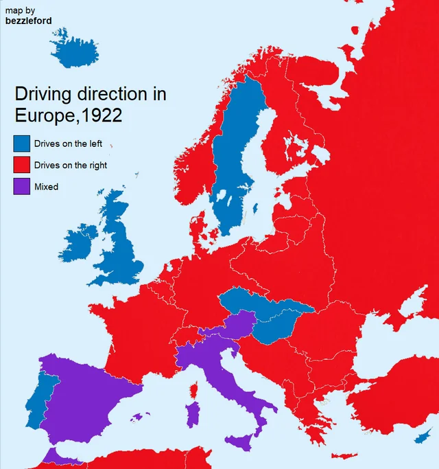
Didn't realize this was specifically in 1922, so it looks like it is probably due to a combination of war/control and legal changes.
Austria was apparently split based on which part of the country was controlled by Napoleon, and this lasted for quite awhile, though a few sources cite different lengths of time for the mixed driving laws. I wanted to use a local source here but it was paywalled.
Also, apparently Italy and Spain (and Canada?) changed from left side to right side drive in the 1920s, so this probably reflects that change in Europe.
This is a 1922 map though, not current
Yeah i totally missed that, edited my edits. Thanks!