1
ultralight
831 readers
1 users here now
Overnight backcountry backpacking/hiking in the spirit of taking less and doing more. Ask yourself: do I really need that?
Rules:
- Be decent.
- Stay on topic.
Resources:
founded 1 year ago
MODERATORS
2
3
4
5
6
8
9

11
12
13
14
cross-posted from: https://iusearchlinux.fyi/post/1294232
So we did the trip! Winter gear shakedown in place of a Wind River trip that got weather'd out. We did 8 miles in to Alaska Basin (9500', trailhead at 7100') in the rain/snow on Friday. Stayed up in the basin overnight, temperature dipped to 30 F (at least - maybe was colder overnight, but I moved the thermometer into the tent). Weather was overcast but no precipitation on Saturday for the hike back out.
Lower elevations still have autumn
Beautiful weather
Fresh black bear tracks (I think)
Basin lake
More Alaska Basin
Good morning snow
Some kind of pawed critter (coyote?)
Gorgeous day back out
Things I learned for backpacking in the rain/slush/snow: hell yeah dry bags kept the gear from getting damp from a day's worth of rain and snow. I need a better fleece solution. I also need a better puffy solution and a better camp shoe situation. My boots were waterlogged (which was fine while hiking, they are not waterproof, but no way am I going to wear them around camp) and the Crocs flats I brought did Not provide any protection from cold/wind/snow. My random Columbia Sherpa fleece is way overkill for hiking and doesn't dry quickly. My (non technical) down jacket got soaked in the back when I put it over the fleece. My wool gloves also got wet and became useless. Yikes.
Other things I learned: it was really nice being out there in different weather, in a different season, with no one else (except my husband) around. I loved it. Would do again. Also I am glad we nixed the Winds trip, the weather would have been worse and we would have had a much harder time of it. Getting this experience was good, before we got hit with it on the trail unexpectedly.


15
16
cross-posted from: https://iusearchlinux.fyi/post/1047974
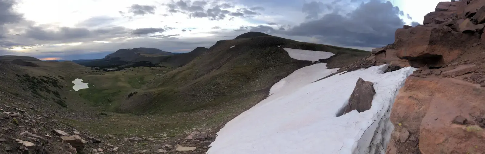
In late July, I took what was intended to be a four-day, three-night hike in the Sawtooth Wilderness area in Idaho, USA. We intended to take the trip in early July, but the snow over Sand Mountain pass was still quite bad according to the ranger.
The trip was to start from the west Yellow Belly Lake trailhead (7076’), pass by Farley lake (7745’), go up the pass by Edith lake (8720’), past that knot of passes and by Sand Mountain and down the pass (9219’) to Rendezvous lake (8861’) for Day 1, with a total of 8.6 miles and about 2950’ climbing elevation. Day 1 started late, around 2 pm (yay driving) and we hiked in the hottest part of the day; but we did it! Unfortunately we had to tack on 2 more miles hiking because Google was not reliable in getting us to the intended trail access point and sent us to the farther one. Live and learn… Total mileage, 10.6 mi.
Edith lake
Rendezvous lake from the pass
Sand mountain (it's not sand, but it's super eroded and looks like it), with the final knife-edge pass
Day 2 was to be the lake tour! Starting from Rendezvous lake, pass by Edna lake (8404’), Vernon lake (8460’), Ardeth lake (8288’), Spangle lake (8585’), Rock slide lake, Benedict Lake, and finally camp at Everly lake, in the shadow of Mount Everly. This involved a ton of up-and-down bouncing us between about 8050’ and 8700’, and would have entailed 3 full passes and a final climb up to Everly lake over 11.2 miles total. However, my knee was starting to complain about the repetitive stress injury I’d sustained earlier in the season. In the interest of safety, DrBohr and I decided to stop at Spangle Lake and chill out for the day, explore the area, and enjoy the quiet. Total distance: 6.3 mi, 1449’ climbing elevation.
Rendezvous lake at sunrise
Looking down from a pass toward Edna and Vernon lakes
I don't remember which lake this was...
Little Spangle Lake
Day 3 was supposed to be a descent from Everly Lake down to Smith Falls and then back to Rendezvous lake or one of the other nearby lakes on the western side of the pass for a total of 12.5 miles and 2700’ of ascent. However, that didn’t happen due to bailing out early at Spangle lakes. Instead, we retraced our path from Spangle Lake. We intended to stop at Edith Lake or Farley lake that day, leaving us with 6-8 miles to hike out on the last day. That really seemed like it would happen given that my knee started getting pissed off on the descents again.
Big Spangle lake
One of the small lakes at one of the wide, flat passes
However, I decided to try something: ibuprofen and Tylonol together - I’d heard this was a pretty great painkiller combination. Heck yeah it is! It was amazing. My knee pain…disappeared. I think I was getting some nerve involvement along with the inflammation. I thought I would be able to hobble out to Edith or Farley lake, but it turns out… we hiked out the entire rest of the way, 16.3 miles, 2862’ ascent. We were motivated to get home back to our two dogs. Never have I ever been so glad to see the car!
Looking down towards Farley lake (near) and Yellow Belly lake (far), with the White Cloud mountains in the background and remaining snow in the foreground
I was afraid I’d have trashed my knee, but the pain meds and shifting my weight more forward for the descents gave me just general knee fatigue the next day. Success!


17
Day 0 (mile 0-5) New York-Denver-Vernal-East Park Reservoir - Walk. Train. Walk. Bus. Walk. Plane. Walk. Plane. Hope to walk a lot more on the 105 mile Uinta Highline Trail. This trip is an effort to moderate my life. To hold a job, be there for my partner yet still have hiker dreams that occasionally become reality. I’ve never been very good at moderation but maybe it’ll work this time. Walk past the terminals in Denver Airport, think I should study this place in more detail. DEN is a portal to many places in the America west I would like to go. Not much of a view outside, inside I’m rocking secondhand clown shoes and MYOG backpack, sun hoody and shiny 2 oz windpants. “Most people call months in advance” says Vernal taxi driver Brad, as I repackage my haul from Walmart in the backseat on the way to McKee Draw. 4 days of food, water bottle and Ozark Trail trekking poles. I examine the plastic flick locks and frown. We talk winter weather, passport bros and Ley lines. I laugh and nod. Half a mile in, Vince from West Virginia sits astride a four wheeler smiling. He reminds me of my dad. Vince has cancer and is selling his houses and seeing as many wild places and animals as he can with the time he has left. The sky is clear and the sun hangs low in the thin, cool air. The silent pines surround me in this alpine oasis above the harsh desert below. 5 miles in I hit the reservoir, get water and make camp, anchor my tarp to a pine tree and recline on the duff. I eat, massage my sore feet and lay peacefully listening to the nothingness. Making it all the way here in one day was my best case scenario and I drift off delighted.
UHT Day 1 (mile 5-27) East Park Reservoir, Leidy TH, Gabbro Pass - As I walk down to East Park Reservoir at dawn to fetch water, 3 large birds take off from the lake, bellowing like dinosaurs as they rise. Their calls reverberate off the surrounding hills. 19 miles to Leidy, long water carry. Camel up freezing cold water. Ice cream headache. Head hazy from the altitude. Right hip gives me trouble all day, must’ve slept on it weird. Slower going than expected due to altitude, blowdowns, navigating the sometimes-disappearing trail and rocky terrain. Meet Alder from Colorado Springs, habitual sectionhiker on day 4 of his eastbound thru-hike. He’s going about my speed in the opposite direction. Says he’s had good weather and seen 2-3 westbounders and a handful of section hikers per day. Why go eastbound? “2,000 ft less elevation gain.” 😆 At Leidy TH meet Walt from SLC, on his annual pilgrimage to Leidy Peak, this year recovering from knee surgery. Still made it all the way up. Slept last night in a jacket in his truck. Around Leidy to Gabbro the wind is relentless and the trail rocky and elusive. Wind so strong you can’t even stop and take a break, reminds me of the PCT. Must keep going. Tough end of day. Want to climb Gabbro to Deadman but it’s 5 miles and I lose light and willpower. Camp at marginal site nestled amongst wind-beaten shrubbery.
UHT Day 2 (mile 27-41?) Gabbro Pass, Deadman Lake, Chepeta Lake, North Pole Pass - Wind howled all night and brought scattered showers. Tarp pitched storm mode. Wake with clear head and fresh legs. Today I get to “the good stuff”. Go over Gabbro, lovely breakfast at Deadman Lake. Reflected ripples of sunlight dance in the trees. Feel distinct sense of gratitude during pleasant morning hike to Chepeta Trailhead where I meet thru-hiker Justin trying to bail out due to altitude sickness. On the way to North Pole Pass meet local Randall who says next 3 days will rain, with snow likely above 10k. Shit. Meet father and son bow-hunting who repeat forecast. Shit. Start going through scenarios. Walk in intermittent rain until I can see North Pole, socked in at 12:04pm, way too early. Shit. Shit. North Pole is 4 miles long and totally exposed. I am prepared for rain and waiting out thunderstorms but not 3 days of cold rain and snow. If I go forward I will walk for 2 hours through a rainstorm, and bailing out becomes significantly harder from Painters Basin on the other side. Nothing to do but bail out now. Turn around, walk back to Chepeta. It’s windy, cool and overcast. Find Justin and wife Jen trying to stay warm sitting on a log wrapped in foam pads and tyvek. Rains off and on, start getting cold about 2pm. Move to more sheltered location, still near the road so we can flag down cars. Start boiling water to stay warm. Only a few cars at trailhead, hope someone stops. Check map to see how far the walk out is — it’s far. Randall stops by at 3pm and drives us down. We talk fishing, cars and tribal politics. Drops us in Roosevelt, eat pizza and try and fail to rent a car within a 30 mile radius. Justin’s dad Grandpa Jerry drives 3 hours from SLC to pick us up. Talks nonstop on the ride back, lovely man and crystal clear at 80. Watch dark stormclouds wrap the Uintas as we drive west on 40. Get into SLC around 10pm. Shower. Borrow clothes. Cotton feels good, feet do not. Pet dogs. Sleep in camper van. What a day. Still a bit in shock and saddened to have picked such a rotten weather window. Hope everyone still up there is OK.
Utah Day 3 Salt Lake City - Wake up in camper van in driveway, knock on house door at the polite time of 8am. Like me Justin and Jen are frugal but occasionally invest in something nice if it’s worth it — I start my day with an amazing cup of gourmet coffee from their prosumer-level coffee machine and proceed to cook up the cheap remains of my food bag: summer sausage, cheddar cheese and tortillas. Just pop tarts, tuna, ramen, sweets and trail mix left; this might be the first time I didn’t overpack food. I play with friendly cat Blackie and dogs Boots and Odin. Boots manically craves attention while Odin is a happy-go-lucky pup stuck in the body of a direwolf from Game of Thrones. We drive up to Hayden Pass to pick up J&J’s car and go from warm, sunny SLC to socked in, cool, all-day drizzle. Hypothermia weather. On the drive back Justin runs an errand a few blocks from his house, then hands me his car keys in the parking lot, tells me to be back by dark and then walks off. I try to figure out what hikes I can do in the Wasatch in a few hours and realize that everything is really high and really steep. The larger peaks are out of the question. I just want to get a decent view of the city so I settle on modest Ferguson Canyon and after the guys with beer bellies and families with little kids I scramble up as high as I can in search of a place that I can sit comfortably with a decent view, which is surprisingly hard to find amongst the steep, jagged, crumbly terrain. I drive back by dark and sit on the front porch with J&J. They’ve never even heard of the trail even though it’s 20 minutes away 😆 we debate dinner but Justin has been feeling off all day and turns in early. Jen and I eat pizza and share our life stories. I’m not really used to talking about myself much but I do my best. She has had things harder than I have. We talk and pet the animals for a few hours while we watch the neighborhood in the dark.


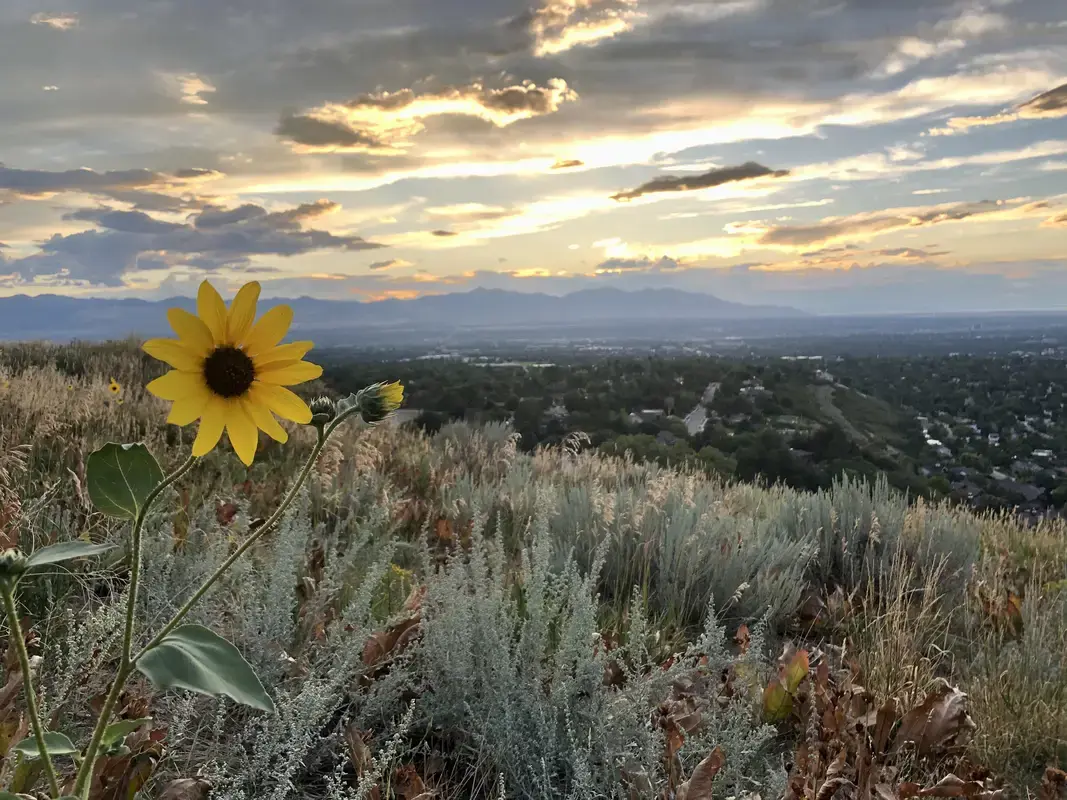
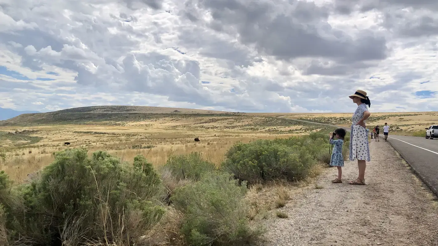
Utah Day 4 SLC, Antelope Island, Frary Peak - Eat breakfast out of my food bag, then at J&J’s suggestion head to Frary Peak Trail on Antelope Island, a rugged chunk of land an hour away in the Great Salt Lake, connected by causeway and host to its own herd of bison(!) Hit up Walmart for some sunscreen and an Arnold Palmer, pay the entrance fee and head up. First climb is through a sea of the unprepared who are walking up a steep, exposed trail in full Utah sun in t-shirts, no hat and some carrying no water. Crowd thins rapidly and only see a handful of the prepared afterwards. Trail is solid, the climb steady and the views expansive throughout, fantastic. Some fun twists and turns along the way with an absolutely banger view from the top. Make it up in time for a late lunch. The most scenic and enjoyable couple of miles this whole trip, Uintas included. Loved everything about it, except forgetting my lunch in the car. Whoops! Drink celebratory beverage, walk down, drive back, home-cooked pasta dinner, then figure out how to AirPlay photos to the TV and spend the night sharing pictures and telling stories. Supposed to rain tomorrow… considering Mt. Olympus but we’ll see what happens. Fall asleep to the pitter-patter of raindrops on the van roof.

Utah Day 5 SLC - Fly out tomorrow morning, on my trip’s downslope now. Rainy morning. Freezing rain in the Wasatch. Won’t clear up in time for any side trips today. Uintas have gone from bad to worse over Labor Day weekend with snow at Mirror Lake; the NWS describes “winter-like conditions” above 10k feet. Warm up with cappuccino. Jus still recovering from altitude sickness. We talk Grand Staircase and I try to soak it all in. Down the rabbit hole we go with trip photos, then YouTube videos, then Steve Allen guidebooks. Watch a documentary on legendary dirtbag climber Fred Beckey. Jen shares an Instagram story on Swiss via ferrata, I send her a link to via ferrata in Utah. “$109 to walk on some metal pegs? No thanks.” ❤️ eat some great Indian food and spend the night in the living room with the tv off, talking and occasionally sitting in silence, listening to the nothingness. Nice to find others completely comfortable doing so. Sort out morning plans, fall asleep reading Grand Obsession.
18
19
20
21
22
23
Getting soaked is the absolute worst. How much condensation do you get and what do you do about it?
Image from Ultralight Backpackin' Tips by Mike Clelland

24
25
view more: next ›